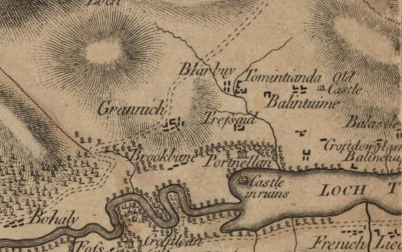
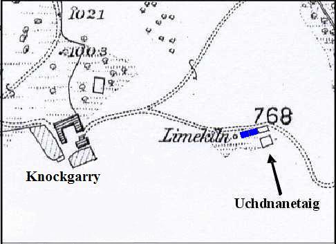
Uchdnanetaig is the smallest homestead in Borenich yet one of the most interesting, if only for its enormous limekiln. James Stobie's map of Borenich (1783) gives its name as Ouchinentach, and shows its location between Balintochich (Balinloch) and Balnald (Balinauld) of Borenich, but the number and shape of the dwellings are simply diagrammatic licence.
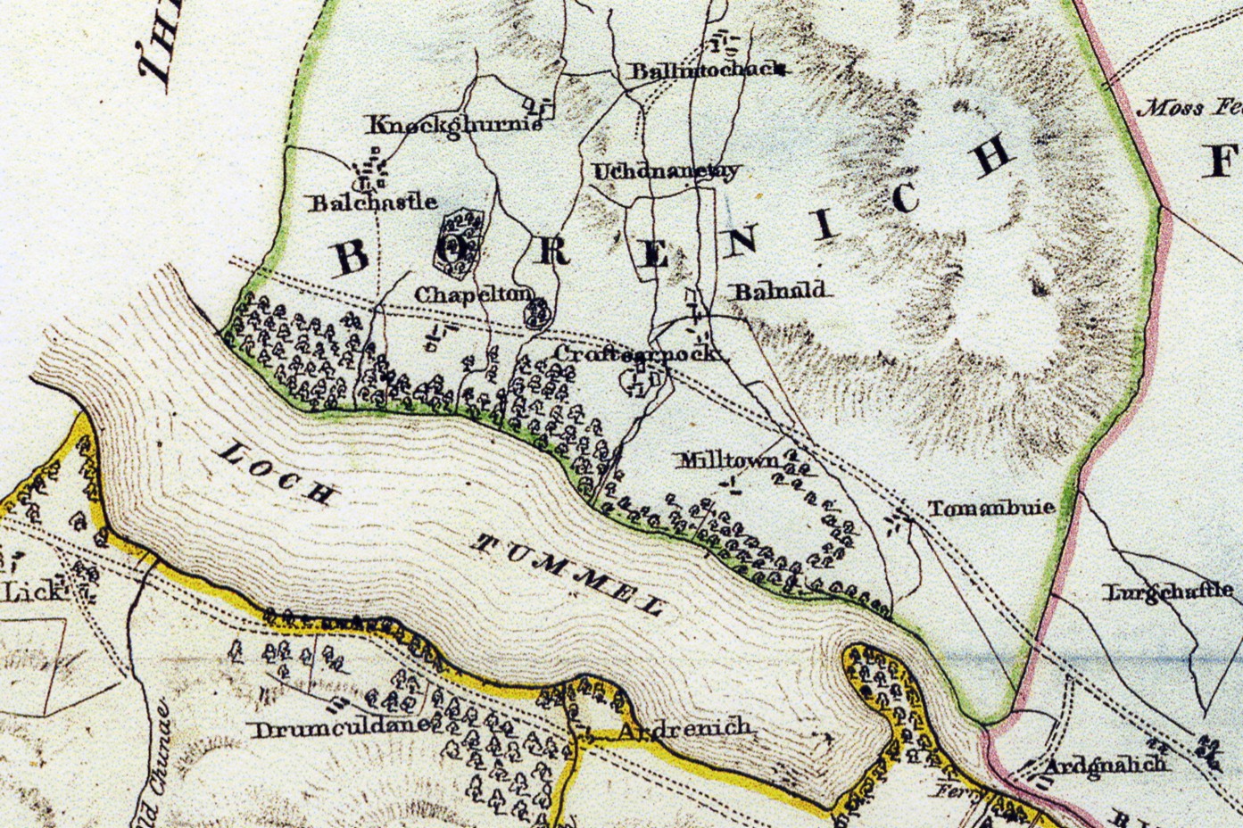
John Waterstons 1832 map of 'The Estates of Fincastle (Borenich), Lick and Duntaulich' has the name Uchdnanetuy in the same position, but for some reason does not indicate the exact location of the homestead.
Even the the 1st edition of the Ordnance Survey 6-inch map (Perthshire 1867, sheet 30), is rather dismissive of Uchdnanetaig. It shows a single deserted building with a small enclosure and a limekiln, but does not name the settlement.
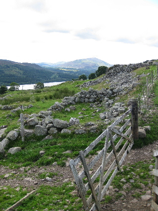
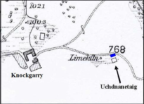
The remains of the dwelling shown on the O.S. map consists of the unmortared footing of a cruck-framed house built into the hillside which gently slopes southwards. The old cart track between Knockgarry and Balintochich runs along the back and east side of the dwelling.
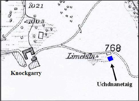
In front of the dwelling house was a small rectangular enclosure separated from the house by a trackway. The stones of the enclosure are of no great height and the walls may have been a mixture of rock and turf. The ground inside the enclosure is fairly level and drains well compared to the area downhill from it.
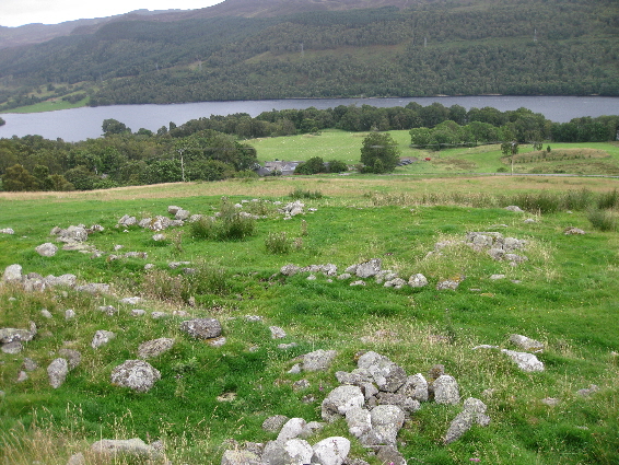
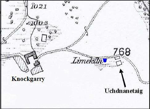
Although the 1st edition of the Ordnance Survey 6-inch map (Perthshire 1867) only shows a single dwelling, the Royal Commission on the Ancient and Historial Monuments of Scotland (RCAHMS) identifies a substantial range of four compartments, with the single roofless building as the most easterly of the four compartments. This is supported by two pieces of evidence.
Firstly there is a distinct line of large stones, along the area between the single dwelling and the limekiln, in exactly the place that any footings would have been. Unfortunately the site has been used as a stone dump for field clearance, and thus it is difficult to see if footings exist on the upper side.
The second piece of evidence comes from baptisms in the Old Parish Records. George McDonald, alias Caldal or Caldel, and his wife Ann Stewart were living at Uchdnanetaig between the birth of their son George in October 1777 and the birth of their daughter Jean in May 1780. At the same time Donald Stewart and Margaret Robertson were also living at Uchdnanetaig with their family of six children. Likewise John Stewart and his wife Margaret Stewart in uchdnanetaig had their daughter Elspeth baptised in August 1778. This shows that there must have been at least three dwellings at Uchdnanetaig.
In addition to the dwellings there must have been a store or workroom, as it is known that Donald Stewart was a handloom weaver and Uchdnanetaig was being used as a small farm.
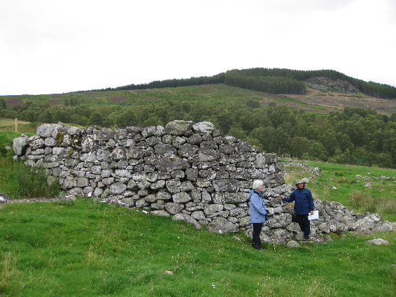
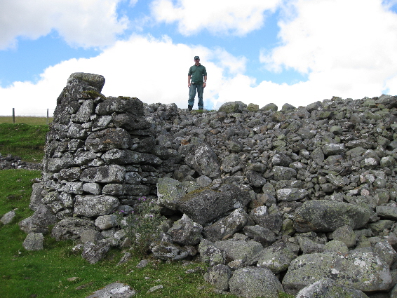
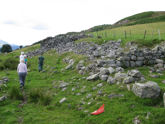
Standing at the end of the settlement, and overlying the most westerly compartment of the dwelling range, is a substantial limekiln built into the hillside. Although the front has partially collapsed and the bowl has been used as a stone dump for field clearance, it is still an imposing structure. The central bowl measures 4 metres in diameter, is surrounded by walls over 2 metres thick and is well over 4 metres in height. When in production it could have yielded an enormous amount of lime to improve the fertility of the surrounding pastures, or to make mortar for construction.
The age of the limekiln is hard to gauge. As it was built over one of the original buildings, and as the stones from most of the range seem to have been used in its construction, it was probably built after 1805: the last date when there is evidence of more than one family living here. It was certainly built by 1867 as it appears on the O.S. map, but to be more accurate than this is difficult. Possibly estate papers could help. There are two nearby courtyard farms which were built in the early 1800s: Borenich farm and Knockgarry. The difference between them is that Borenich farm was constructed of mortared stone, whereas Knockgarry is un-mortared. So the dates of these two buildings could indicate the age of the limekiln.
Slightly to the west of the limekiln there is a depression in the ground orientated in a north to south direction, and running up a steep slope. The steepness of the slope precludes this from being a dwelling. At the top of the slope the shape appears to be slightly rounded, with a few stones breaking through the grass, and this suggests that the structure is the remains of a corn-drying kiln and its barn.
| Details of Borenich Homesteads | Stewart Births at Uchdnanetaig | Blair Atholl Marriages | Return to Home Page |
|---|