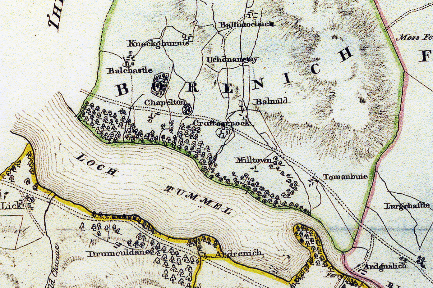
In the Blair Atholl area there are three dwellings bearing this name. Firstly there is Tombue (Tombuie) on the north side of the River Tummel, not far from the Queen's View and, like Glen Fincastle, is within Dull Parish. Secondly, there is Tomanbuidhe which is on the Kinloch Rannoch Road from Strathtummel, not far from Dalno and the turn off to Trinafour. Lastly, there is Tomanbuie of Borenich (Tom Buidhe) on the edge of Loch Tummel, below the present-day Borenich Farm.
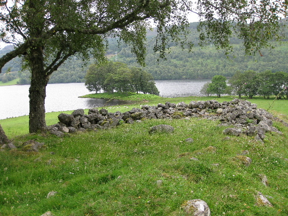
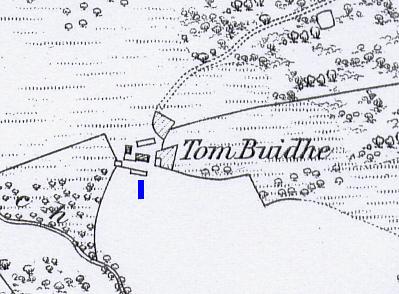
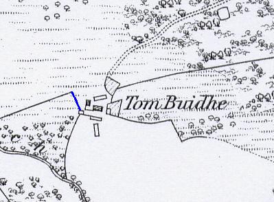
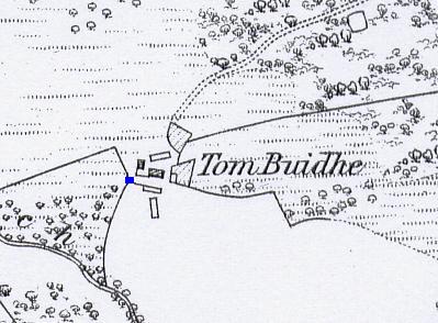
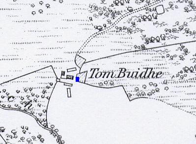
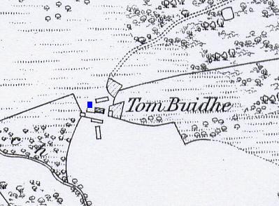
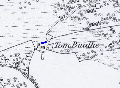
Today, Tomanbuie of Borenich is hidden away in an isolated, but idyllic, spot overlooking grassy meadows which gently slope down to the edge of Loch Tummel. However, John Waterston's map (1832) shows that before the present road along the north side of Loch Tummel was built, the original cart-track passed right beside Tomanbuie.
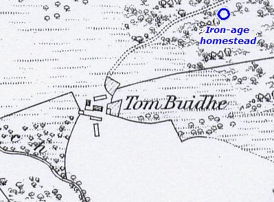
Even by 1867, when the 1st edition of the Ordnance Survey 6-inch map for Perthshire was published, there was still a cart track down to Tomanbuie from the new road which passed the ruins of the iron-age homestead (right).
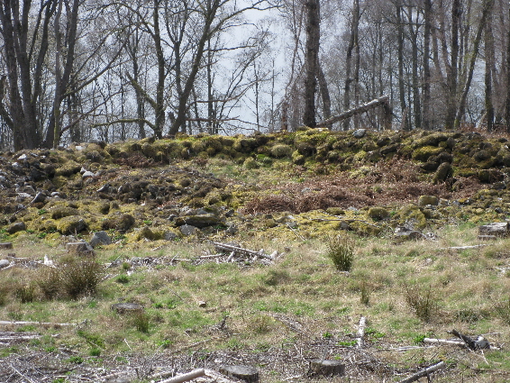
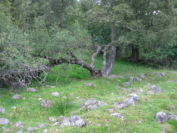
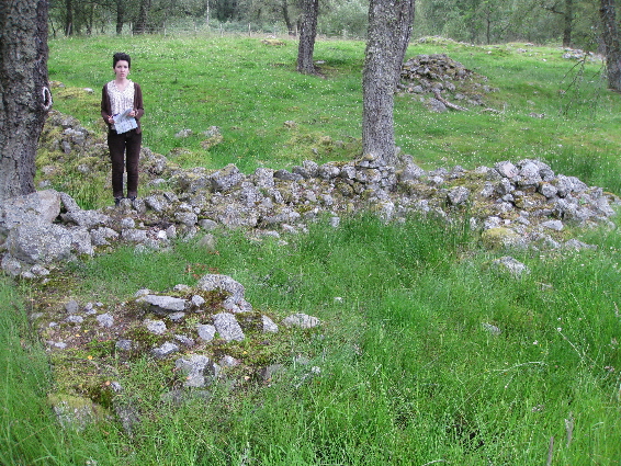
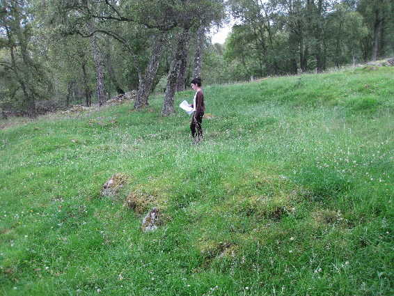
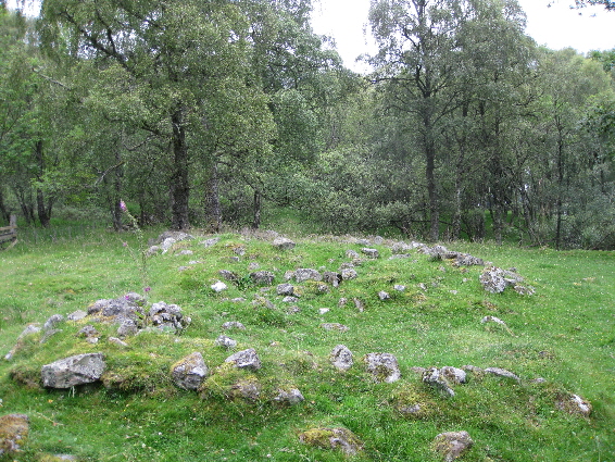
The most southerly dwelling sits on a small ridge overlooking the pasture leading down to the lochside. The footings of a cruck-frame house remain fairly intact at the south end, but gradually disappear at the north end. The house must have been about 15 metres in length by 5 metres in width, and although it is in a fairly exposed position it would have been quite dry compared to some of the other dwellings which are close to a marsh.
Behind the Ridge House, and nearly at right-angles to it, are the remains of another house of a similar size. About 3 metres in from the west end of the ruins, an internal row of stones suggests that there was an attached outhouse for tools or livestock. Both the dwelling and the outhouse appear to have doorways on the south side.
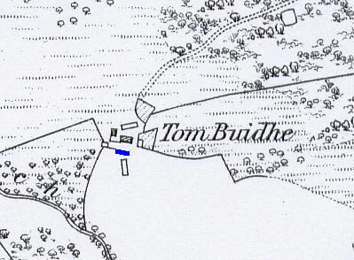
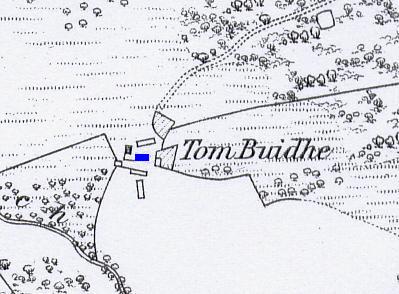
A small wall ran from the Southern Dwelling to the Boundary Wall which separated the homestead from the marsh on the west side. On the O.S. map it is quite noticeable that the dwellings occupy a key position in the centre of the gap between the east and west boundary walls. Perhaps this was to keep the livestock from wandering out of the pasture to the south of the settlement. Alternatively it could have kept animals out, if the land had been sown with crops.
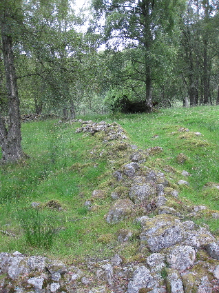
Built into the boundary wall are the remains of a small building measuring 6.5 metres in length by 4 metres in width. The stones on the west side, next to the marsh, form a regular corner and appear to be much larger and straighter than the rest of the structure. At the east end, the stones are piled up in a small mound. Whether this is on purpose is difficult to say, but it is rather odd that the structure forms part of the boundary wall, unless the boundary wall was built at a later date.
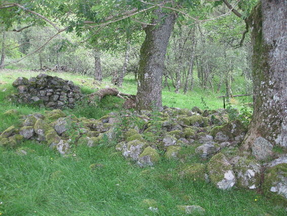
There is also an outhouse built into the eastern boundary wall, measuring 7 metres in length and 4.5 metres in width. Although it is quite tumbled down now, the amount of stone and the presence of a partially intact, unmortared, northern wall suggest that this was a stone walled outhouse rather than a cruck-framed structure.
This is one of those rare occasions when it is possible to state who was living in a particular dwelling. The evidence comes from the 1861 census which shows that widow Christian Fraser was living with her neice and grand-daughter in the only occupied dwelling, while the Ordnance Survey map shows that the only roofed dwellings in 1867 were a single house and an out-house. Additionally, it is also known that the Frasers were running a grocery store. This information comes from the 1841 census returns, and from anecdotal evidence. An old lady, who lived in Strathtummel, told Mr Scott of Tressait that she recalled buying sweets at the shop just down from Borenich Farm, when she was a child.
The grocer was Alexander Fraser who was married to Christian McIntosh of Dalmarnock, Little Dunkeld. Alexander's parents were James Fraser and Margaret Stewart who farmed Balnald of Borenich, while Alexander's uncle, John Fraser, farmed Tomanbuie. Some of the family have a memorial stone in the Borenich Burial Ground.
For more information about the Frasers see 'The Genealogy of the Fraser Family of Strathtummel'.
Despite this being the last house that was lived in, it is in a worse state than any of the others. Except for one corner where there are a few visible stones, there are only grassy ridges and a central depression to show that a dwelling once stood here. As a rough estimate, the house was about 14 metres in length and 5 metres in width, and from the slope of the land, the entrance would have been on the south side.
Like the Fraser's house this building, measuring 5.5 metres by 3.5 metres, was in use in 1861. Its small size suggests that it was a storehouse, either for the grocer's shop, or for tools to cultivate the two enclosures which were still being tended at that time.
The most northerly of the buildings was roughly 19 metres in length and 5 metres in width, and seems to have had a cruck-frame design. An internal line of stone shows that it was divided into two sections of 7 metres and 12 metres. Perhaps a loom house?
| Details of Borenich Homesteads | Stewart Births at Tomanbuie | Blair Atholl Marriages | Return to Home Page |
|---|