Riechappel is situated in Glen Banvie opposite the old Comyn's Road which linked Comyn's Tower (forerunner of Blair Castle) with the Comyn stronghold
of Ruthven in Badenoch. It has been known by a varieties of names - Riechappel, Chappel, Chapeltown and Bail an t' Sepail - but there is no evidence
for a chapel, except in the names of the nearby hill and stream. (It is worth mentioning that there is a second Chapeltown in Blair Atholl parish,
in Strathtummel, next to the Borenich Burial Ground. It is easy to confuse the two, but the Strathtummel one was usually called Balinteapail,
Balchapel or Chapeltown and is mentioned in the 1841 census, whereas Riechappel was uninhabited by that time).
Before 1713 there was no permanent settlement, and it was known as the 'Shealling of Rienchapel in Glen Bruar'. So the link to a chapel pre-dates
the settlements and may go back to the time of the Covenanters, when religious intolerance forced some people to hold open-air services in the
relative safety of the hills.
In 1713 Lauchlan McIntosh from Dowbank of Badenoch obtained a tack (lease) for the Shealling of Rienchapel in Glen Bruar, and was given an allowance
(reduction) of £10 Scots in his first year 'for putting up the biggings'. By 1724 the tenancy was equally split between Alexander McDonald and
Donald Stewart, each paying £12 Scots and one wedder (a castrated male sheep) with its fleece at Beltane (the first of May). Each was also
obliged to grass 25 of the Duke's sheep at the township.
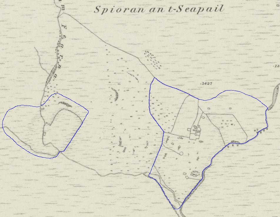
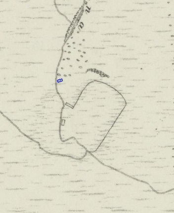
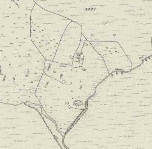
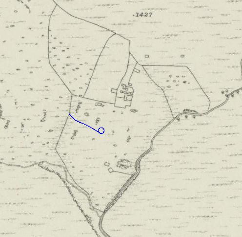
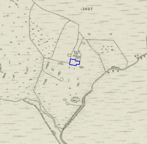
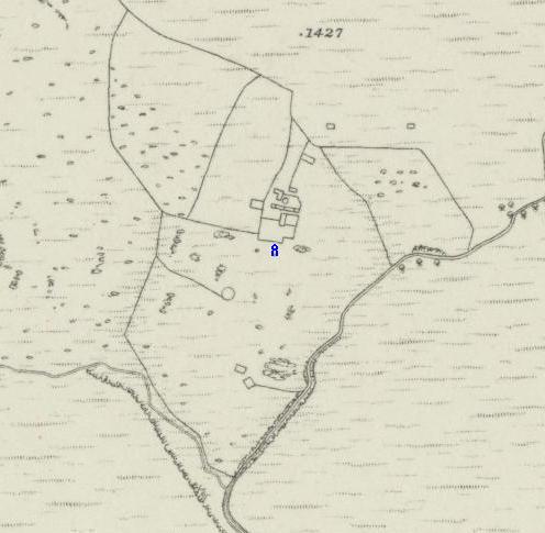
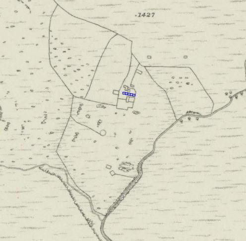
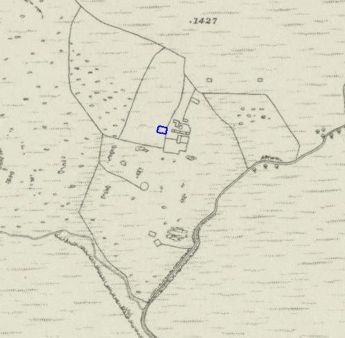
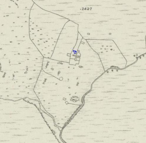
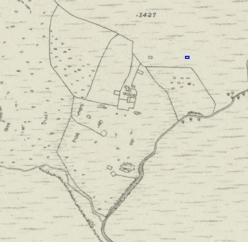
Although James Stobie, the Atholl Estate Factor, drew an estate map in 1780 showing that Riechappel consisted of two parts, it is unknown whether
Alexander McDonald and Donald Stewart farmed separate sections or worked together. It is noticeable that there are fewer ruins on the western part
compared to the eastern part. Possibly the smaller western part was the site of the original summer sheilings, or perhaps it was used to house the
Duke's 50 sheep, keeping them separate from the rest of the flock.
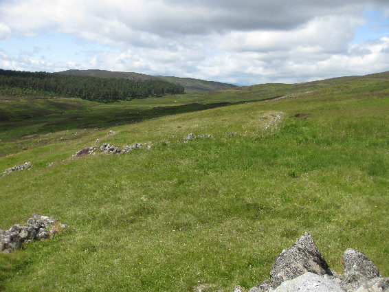
It is also worth noting that although the estate map shows two small separate pieces of ground, a head dyke was built right across the hillside
from the Allt Feith nam Fearna to the Allt an t-Seapail, suggesting that all of the hillside down to the Banvie was being farmed.

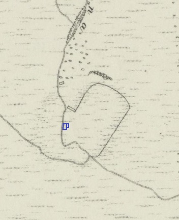
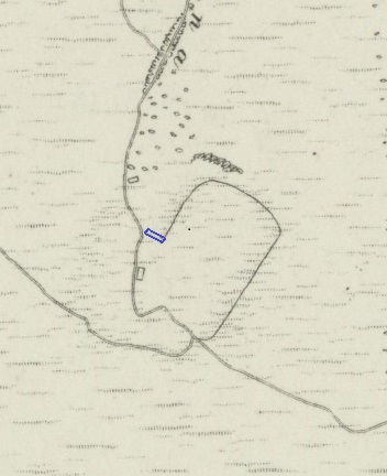
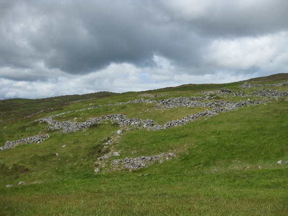
Although the First Edition of O.S. map for Perthshire (1867) shows just a single ruined dwelling, there is an enclosure built between the Allt Feith nam Fearna and the west side of the lower house, with the doorway of the house facing eastwards.
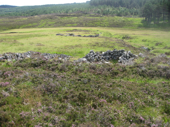
The main building seems to be a house with an ajoining outhouse. The doorway of the house was facing south, but the outhouse appears to have had a doorway facing west. The end of the outhouse is close to the river and virtually completes the enclosure.
Slightly up-hill from the enclosure there is a rectangular building by the side of the stream. The building is in two parts set at different levels. The lower, western part is quite easy to see but the higher, eastern part is covered by a thick layer of heather making it difficult to ascertain the purpose of the structure. It might be a kiln, but the heather obscures the top of the higher section, and there is no obvious sign of a fire-place amongst the fallen stones of the dividing wall. If it is a kiln, this would suggest that the two tenants of Riechappel were farming independently of each other.
The last building up the slope, which appears to be a house, is not shown on any of the O.S. maps. Like the other structures, it is constructed of un-mortared rough stone from the field suggesting that it was built at the same period of habitation. Why this obvious feature was not mapped is open to conjecture, but it is known that the surveyors were being urge to complete Perthshire as quickly as possible. There are similar ruins, for example Balcastle, where some of the house footings that must have existed were not included by the map-makers.
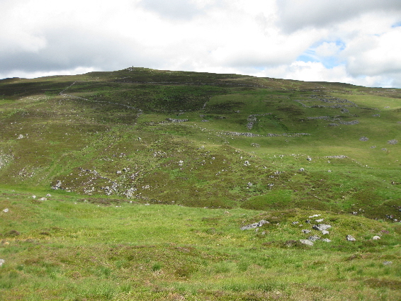
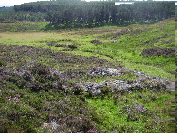
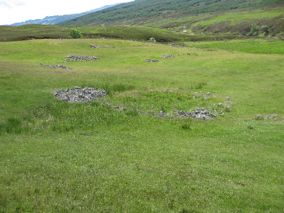
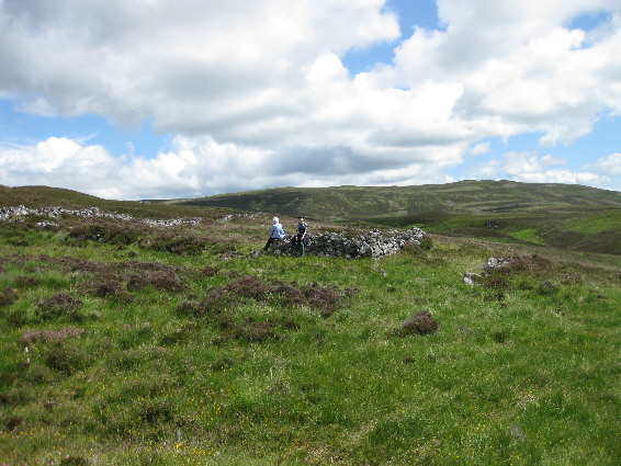
The eastern section of Riechappel is unusual as the settlement is on a steep slope, but even today this grassy area stands out from the surrounding heather suggesting that a limestone-rich bed-rock would have made this a fertile area for agriculture. In addition the steep sided gorge carved by the Allt an t-Seapail to the east, and the steep-sided Banvie burn to the south, meant that stone enclosure walls were only needed to the west and north. The southern wall shown on the O.S. map is little more than an earth embankment, possibly built to prevent flooding of the flat land beside the burn.
At the bottom of the grassy slope, leading up to the main buildings, there are the remains of two rectangular dry-stone enclosures. The more easterly
one has a wall built between it and the Allt an t-Seapail gorge. The purpose of this wall is unclear but it may have been for herding livestock into
the enclosures.
The other stones further up the hillside are accumulation of rocks from field clearance. This suggests that large parts of this grassy area were
being ploughed and planted with crops.
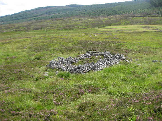
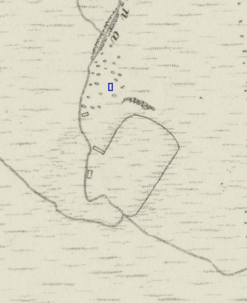
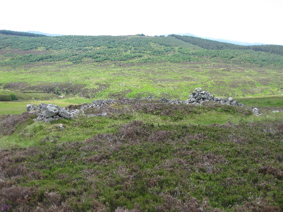
Halfway up the hillside there is a third enclosure with a wall joining it to the western perimeter. Although the O.S. map shows this as a circular
structure, it is more of a rectangular shape with a large pile of rocks from field clearance at one end. The other rock piles beyond it are,
likewise, the results of field clearance.
The slope of the hill is such that, although the enclosure is at ground level at the top end, the lower end of the enclosure and the ajoining wall
form an embankment above the lower slope. If a wooden fence had once existed between the third enclosure and the wall further up the slope, it is
possible that this area was used as a pasture for livestock.
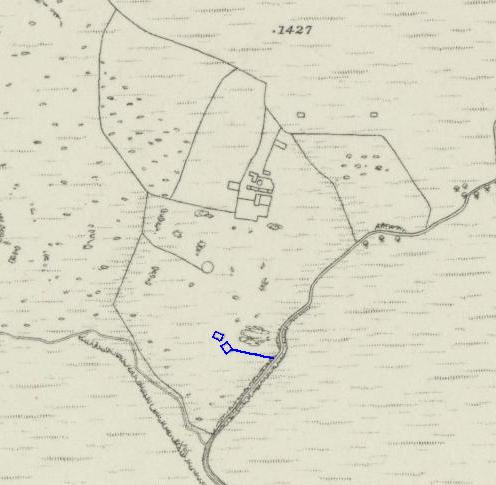
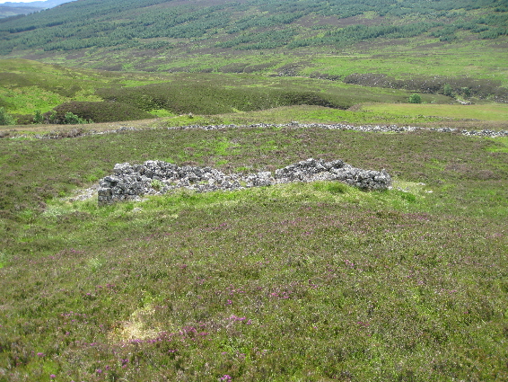
Just below the houses of the homestead there is a large enclosure which is nearly rectangular except at the south east corner. The reason for this irregular shape is unclear, but there is a rocky outcrop at that corner, and perhaps the missing corner allowed easier access up and down the hillside.
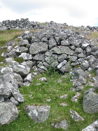
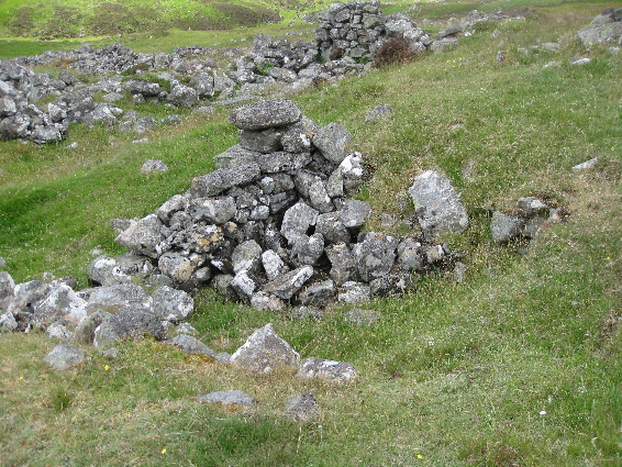
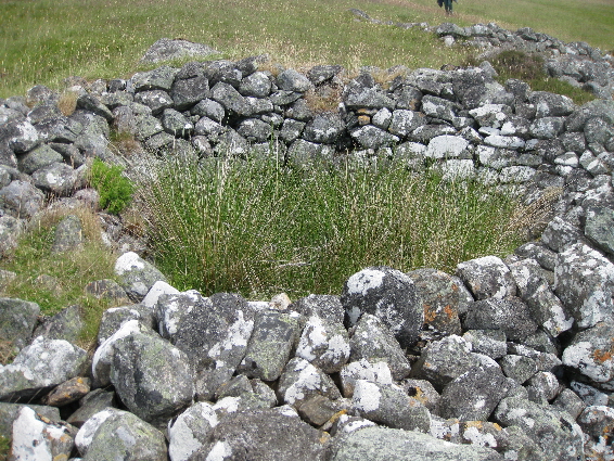
Just below the homestead enclosure are the remains of a kiln which is not shown on the O.S. map. The kiln is quite small and the walls of the bowl
are fallen in, but the stone arch of the flue is still intact and clearly visible, as are the two outer walls of the building.
It is difficult to say whether this was a lime-kiln or a small corn-drying kiln without excavating the bowl to see the state of the stones inside.
A gentle heat is required for corn-drying, but an intense heat which tends to crack the stones of the bowl is required for turning limestone rock
into lime.
There is a large corn-drying kiln further up the hillside (discussed later), which might suggest that this is a lime kiln, but the two walls at the
front are very typical of a corn-drying kiln, and as Riechappel already has a natural supply of lime from the bedrock, would additional lime be
needed? Of course, the people here could have been producing and selling their lime, or perhaps the ground was so fertile that there was a need for
more than one corn-drying kiln.
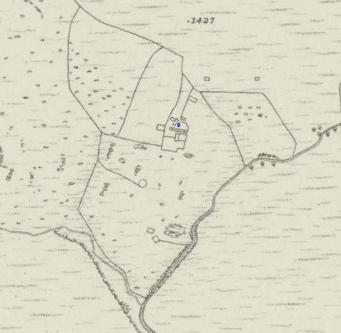
Above the homestead enclosure there appears to be a courtyard with a long building, orientated down the slope of the hill, at the far end. The suggestion that this is a courtyard, rather than another enclosure, is based on the large gateway on the east side.
The courtyard building is perculiar as it forms part of the courtyard wall, and has been built down the slope rather than across it. This suggest
that the building was not a house, but either a barn or a workshop. The exposed position of the building would have made it suitable as a threshing
barn. Threshing barns were built with a door on the windward side and a window opposite it. If the door and window were wedged open on a windy day,
the threshed grain could be tossed into the air and the draught of wind would separate the lighter chaff from the heavier seed.
There is a grassy passageway between the courtyard and the row of houses, which gave access to the houses, and also led to the far side of the
settlement.
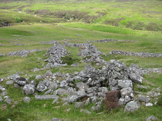
The main building at Riechappel is built into the hillside. At other settlements only the stone footings of cruck-framed houses remain, but here there are the remains of gable-ends and internal walls which separated the building into five sections. The builders used rocks from field clearance, and no mortar was used in their construction. Considering that there has been no habitation at Riechappel for over 150 years, the remains are in fairly good condition. The purpose of this building is unclear. It is unlikely to be a dwelling and seems too extensive for mere storage. Perhaps it was housing for livestock, which might be quite important considering that originally it had been just a summer sheiling.
At the far side of the houses there is a rectagular structure which, from the O.S. map, appears to be another enclosure. However if the rectangle of stones was built as a wall, then the centre of the enclosure was subsequently filled with soil and levelled to form a raised platform. The purpose of such a structure is unknown, but there are several possibilities. It may have been used as a drying area for sheaves of grain or for hay-stacks, but on other settlement sites the drying areas have been covered with a fairly thick layer of small stones.
Just behind the houses is a small (2m x 2m) rectangular ruin built into the slope of the hill. It may have been a small store, or possibly a pig
house.
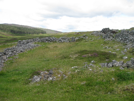
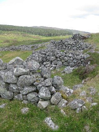
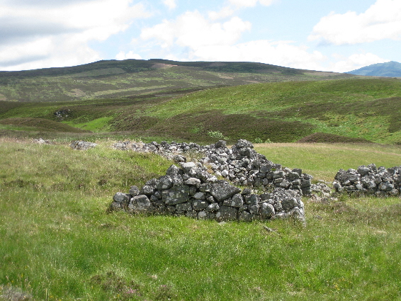
The O.S. map shows the next ruins as being an L-shaped building, but in fact there are two structures: a corn-drying kiln, and a small building at
right-angles to it.
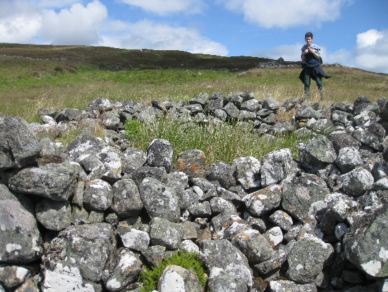
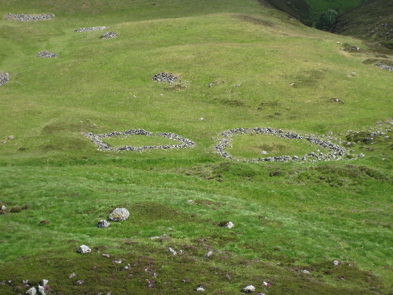
This corn-drying kiln is much larger than the kiln at the bottom of the settlement, and would have been able to dry a substantial quantity of grain. The kiln bowl is quite shallow, but is extremely well made and is still in very good condition. The kiln was enclosed at the top end of the kiln barn, the sides of which still remain and there is a doorway leading out to the adjacent store with gable ends, which can be seen in the photograph below. This would suggest that the store was being used to house the grain after it had been dried. Grain had to be dried as, in many parts of the Highlands, the weather did not allow cereals to be sown until much later than in the Lowlands. Consequently the crop was sometimes not harvested until October and could not be dried in the open air.
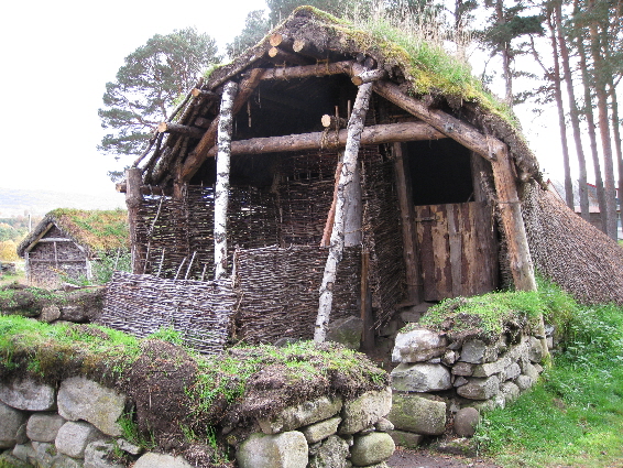
Kilns were used to dry grain so that it could be stored or ground to make meal (flour). A small peat fire smoldered in the fire box and the hot air moved along the flue to the bottom of the kiln bowl. Halfway up the kiln bowl there was a wickerwork floor on which the grain lay while the warm air rose up through it. A typical corn-drying kiln has been reconstructed at The Highland Folk Park at Newtonmore in Scotland, which is well worth a visit. Alternatively why not watch the short video produced by The Highland Folk Park and The Forestry Commission (Scotland).
Hyperlink to the video of the corn-drying kiln

Further up the hill, halfway between the main part of the settlement and the head-dyke which separated the pasture from the moorland, there are the remains of another large building. From its size and having been built on the level, this could have been a large house and byre.

Beyond the head-dyke there are two buildings in the heather moorland, both built on little rises of the ground and both level on the slope. The ruins indicate that both buildings were quite large and might have been houses, but usually houses would have been situated below the head-dyke, not above it. Another possibility is that these were byres for cattle. Riechappel is so far up Glen Banvie, that it is unlikely that there were shielings where the livestock was taken in summer. As the next habitation is at the head of Glen Bruar, there would have been plenty of space for sheep, cattle and horses to roam free.
| Blair Atholl Marriages | Return to Home Page |
|---|