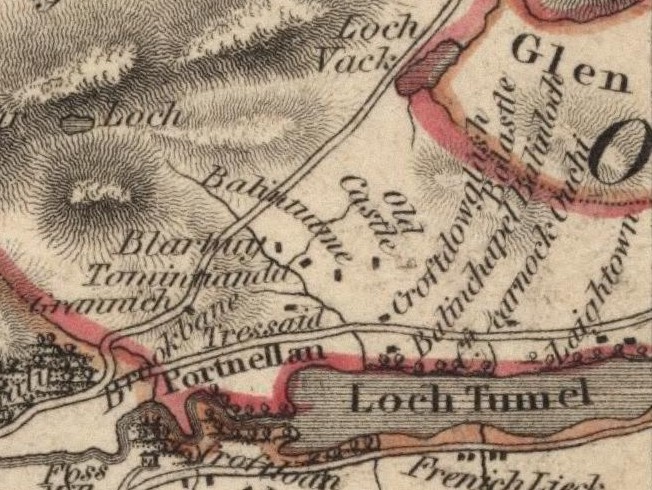
When James Stobie produced the first reliable map of the Borenich area in 1783, he did not mention Milltown of Borenich. However, there were dwellings to the south of Croftcarnoch which Stobie named as "Laightown", and this is probably the same site.
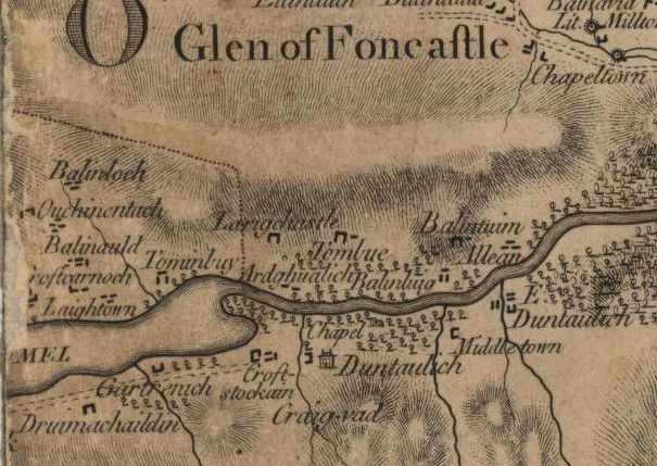
John Thomson's map of Borenich produced in 1827 relies heavily upon James Stobie's work. In some cases too heavily. Although the road along the north side of Loch tummel is now shown, some of the townships are misplaced. Croftcarnoch and Laightown have migrated westwards, but there is no mention of Milltown of Borenich which is rather strange as 'Milntown of Borenich' is mentioned in the Blair Atholl parish records as early as 1790.
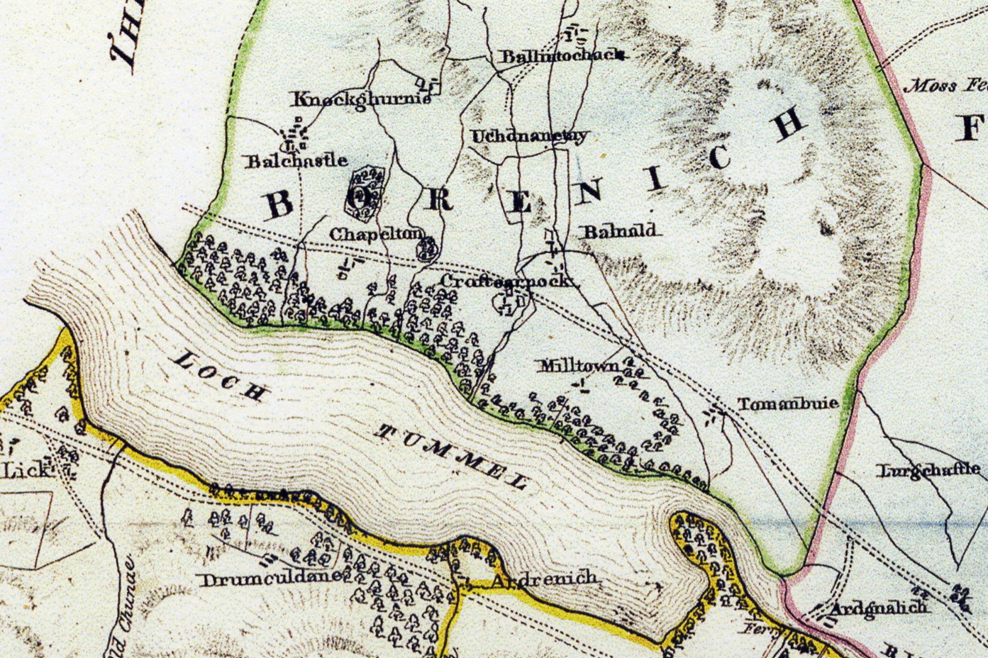
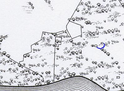
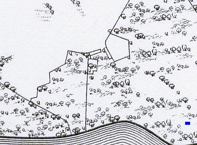
The third map of Borenich is John Waterston's Reduced Plan of the Estates of Fincastle (Borenich), Lick and Duntaulich (1832). In this map only the eastern end of Loch Tummel is shown, as the western part was owned by the Duke of Atholl. All of the homesteads appear in their correct locations, but Laightown is now called Milltown. Waterston shows each homesteads as a group of dwellings, but this is more for effect than for an accuracate record of each building. Not until the publication of the first edition of the Ordnance Survey for Perthshire in 1867, can the position of individual buildings be matched to existing structures.
It is thought that the mill was built between 1785 and 1790, and the evidence for this comes from the Old Parish Records. In 1776 Patrick Stewart of Balcastle married Jean Stewart of Struan, and between 1776 and 1796 they had nine children. The first two children were born at Balcastle, and tantalisingly the birthplace of the next two is just given as Borenich, but by May 1785 the family are at Nethertown of Borenich when their daughter Margaret was born. Laightown and Nethertown appear to be the same place, but the use of the name 'Laightown' is unusual as 'Laight' or 'Leigh' come from the Saxon word 'Leah' meaning a meadow or pasture. Nethertown on the other hand means a lower township, as it would have been relative to Croftcarnoch.
Just before midnight on the 14th March 1790, Jean Stewart gave birth to twins: a daughter just before midnight; and a son just afterwards. Their father stated that the births took place at Milntown of Borenich, and this is the first time that the name Milltown of Borenich is recorded.
The mill was used to process flax for the production of linen, but it is unclear as to how long the lint-mill was in production. The name 'Milltown of Borenich' was still in use when Janet Stewart, the daughter of James 'Ban' Stewart was born in 1830, but this does not prove that the lint-mill was still working. However it may have been working right up until the 1840s, as Isabella Robertson and her daughter, Ann Kennedy, in nearby Tomanbuie were recorded as lint-spinners in the 1841 census, although the Frasers living at Milltown were just described as farmers and wrights.
The first edition of the 6-inch Ordnance Survey map for Perthshire (1867) shows two long buildings at right-angles to each other and two enclosures, but by that date the buildings had long since been abandoned. From the sizes of the buildings, these could have been two dwellings.
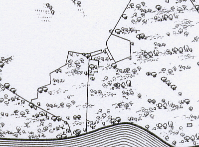
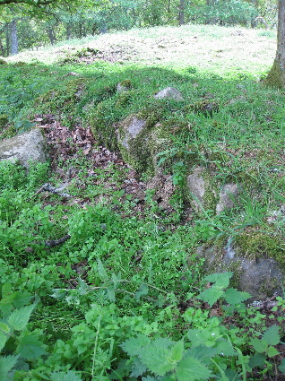
The only visible remains are of the stone footings of two cruck-framed dwellings and the remnants of the enclosure walls. The whole site is in poor condition with fallen trees, bracken and stinging nettles, making it virtually impossible to investigate during the summer months.
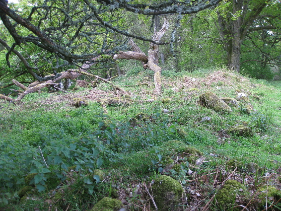
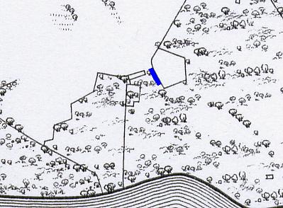
Dwelling A is situated at the edge of the wood bordering the open pasture. It measures 18 by 5.5 metres, with a rough east to west orientation. There is a stone partition at the west end of the building suggesting that a 5 by 5.5 metres outhouse was attached to the living quarters. The ruins are so tumbled down that it is difficult to say where the entrance to the dwelling might have been.
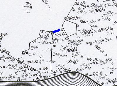
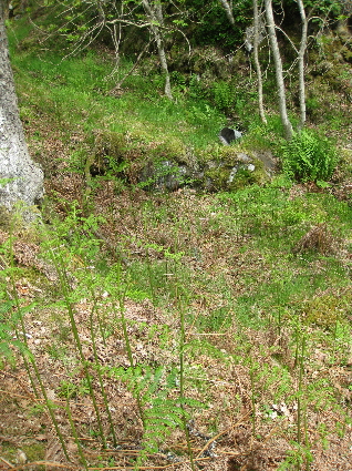
Dwelling B was built at right angles to dwelling A. It measures 21 by 5 metres, and once again has a small outhouse 4 by 5 metres attached to the living quarters at the southern end. Once again the ruins are very tumbled down and difficult to make out, but the stinging nettles in the centre of the photograph above, fill the centre of what was the building. The three trees on the right-hand side are growing on the footings of the dwellings which were abandoned between 1841 and 1851.
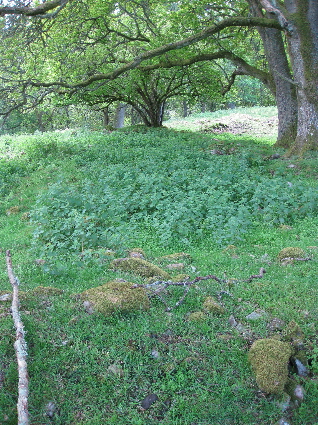
In some places the footings are quite visible as the ground is lower inside the ruins than outside. It is only an assumption that this is a second dwelling. The Old Parish Records seem to indicate that Nethertown was only occupied by single families. After John Douglas of Easter Duntanlich married Isobel Stewart of Balcastle in 1764, the couple farmed Nethertown until the mid-1770s when they moved to Balnald and then to Croftcarnoch. Nethertown was then occupied by Patrick Stewart and his family, as already mentioned. Two of Patrick's sons married in Blair Atholl, but both couples emigrated to Canada soon after marriage. However in 1819, a Patrick Stewart of Milntown of Borenich married Margaret Cameron of Pitcastle, in the parish of Logierait. This cannot be Patrick Stewart jnr. as he had emigrated to Nova Scotia with his brother in 1801, and it is assumed that this is the son of Charles Stewart, the brother of Patrick Stewart senior. If this is the case then it would suggest the presence of two houses.
For more information about this Stewart family see 'The Descendants of Patrick Stewart of Milltown of Borenich'.
Alternatively, the second building could have been used to store the flax before it was processed. To separate the flax fibres from the rest of the stalk it was first placed in a shallow pool of water and left for several days until the flax bundles felt soft and slimy. This form of 'retting' produced an unpleasant odour, so it is not surprising that the retting pool at Milltown is some way down-wind of the dwellings.
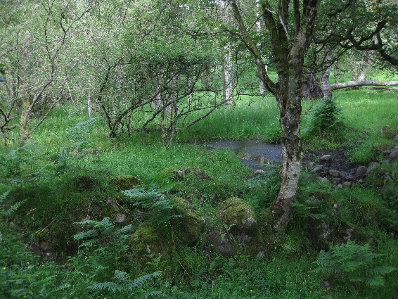
The retting pool was constructed on a gentle slope by building a semicircular boulders and earth embankment. This can be seen in the centre of the above photograph. The pool was on the left-hand side, where the willow is now growing. The ground is naturally very boggy, and perhaps the pool filled by natural seepage from the fields higher up, but more likely a conduit was used to take water from the Allt Borenich which runs to the east of the site.
After the flax stalk had been softened there were taken to the flax mill where they were broken by being hammered. Scrutching was carried out to remove some of the straw from the fibres. This was achieved by passing the crushed flax stalks though a set of rollers. After this the fibres would be heckled by passing the fibres through metal combs of different sizes, firstly to remove the remaining straw and secondly to polish the fibres. It is assumed that the Borenich flax mill had both a hammer and rollers, but nothing remains of any of the wooden mechanisms which have long since rotted away.
The flax mill was situated some distance below the retting pool, and although only the stone footings remain, the sluice is clearly visible on the west side of the building. This suggests that the mill had an over-shoot water wheel to power it. The source of the water for the mill is not obvious as there is no lade stream from the Allt Borenich, but perhaps the water was taken to the mill by a wooden aquaduct.
Lastly, flax was not the only thing in production here. To the west of Milltown there is a small stream draining water from the pasture land into Loch Tummel. Just before the stream enters the loch it runs through a deep but narrow gorge, and hidden away at the bottom of the gorge is a small stone structure beside the flowing water (NN 8378 5970).
Considering the small size of the site, the difficulty of access, its hidden location and the supply of running water, it is fairly certain that this place was being used for the production of illicit whisky - a trade which was widespread in this area and continued well into the late 1800s.
| Details of Borenich Homesteads | Stewart Births at Milltown | Blair Atholl Marriages | Return to Home Page |
|---|