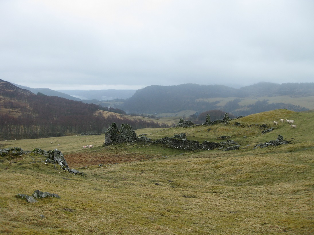
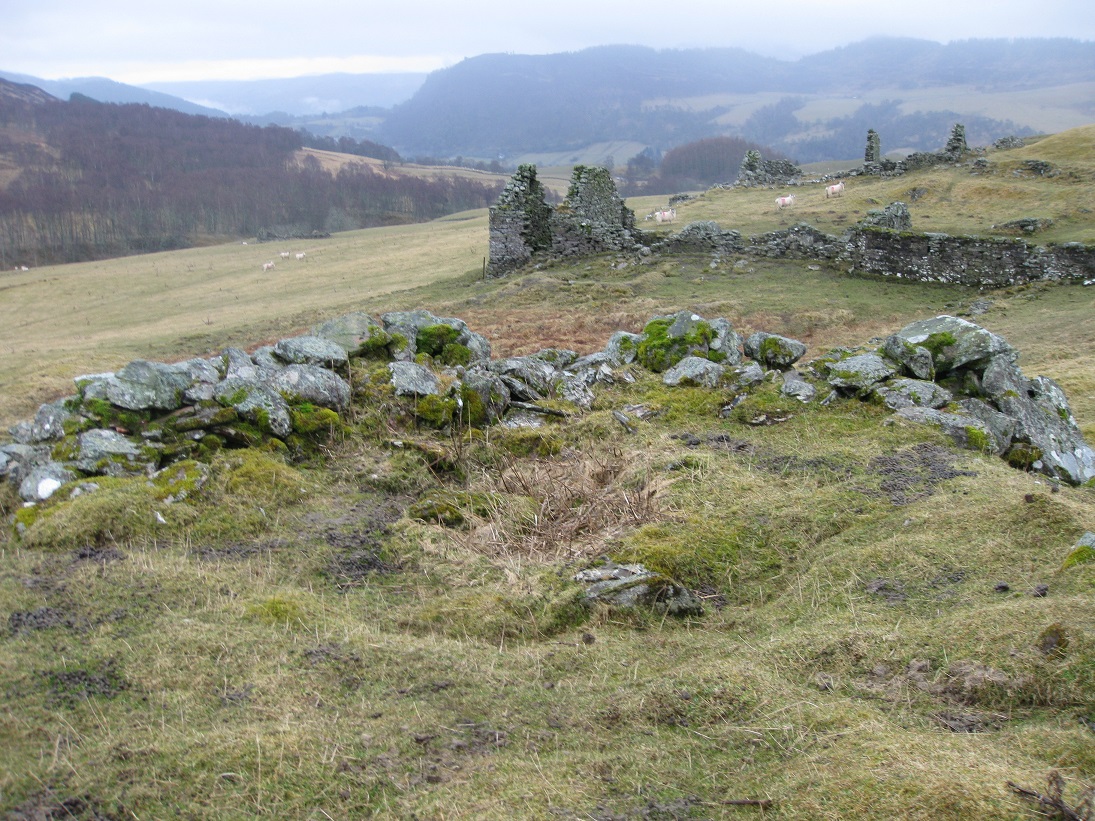
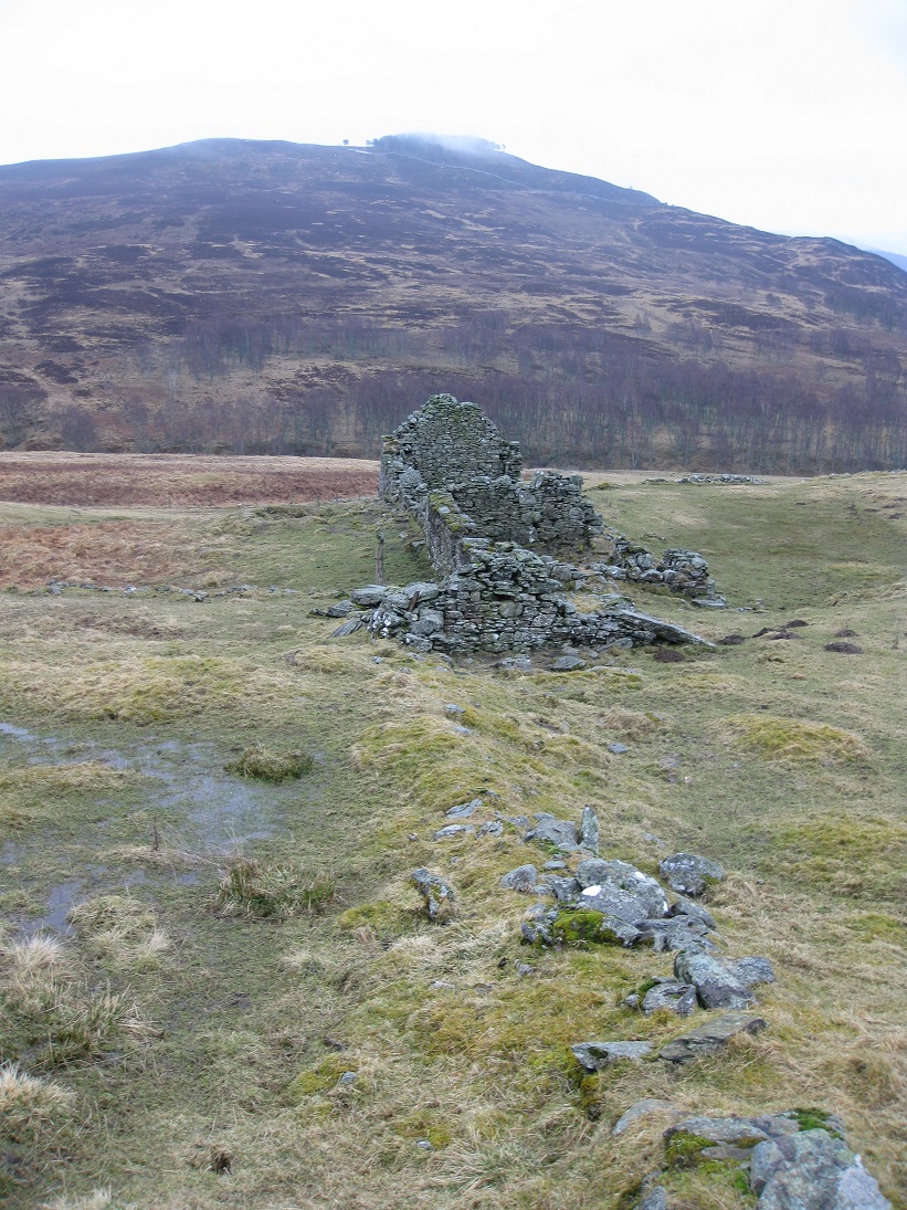
The ruins at Markdou of Clune are quite substantial. This is not surprising as this strip of land on the west side of the Allt Chluain was good farming ground and most of the properties were still in habitation until the 1870s. The land slopes gently down to the river and is grassy with rocky outcrops in some places. Markdou was the uppermost farm before Loch Moraig and the track between Aldclune and the peat moss at Loch Moraig passed just to the west.
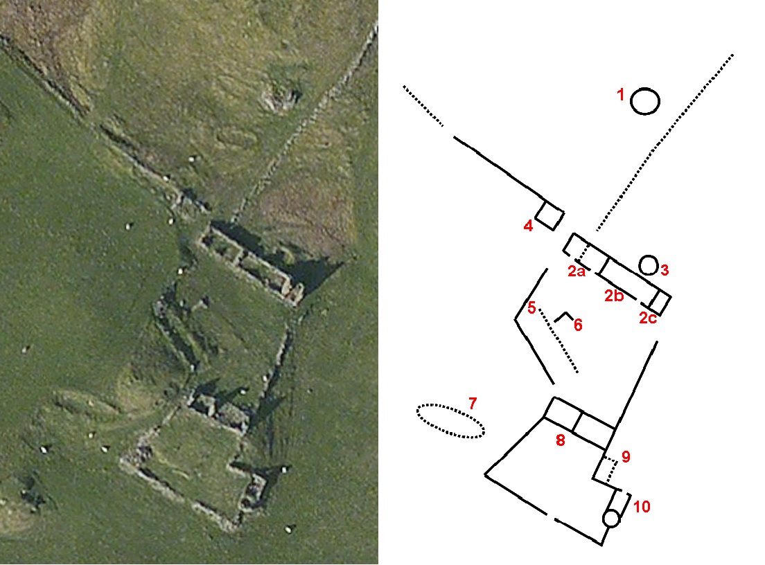
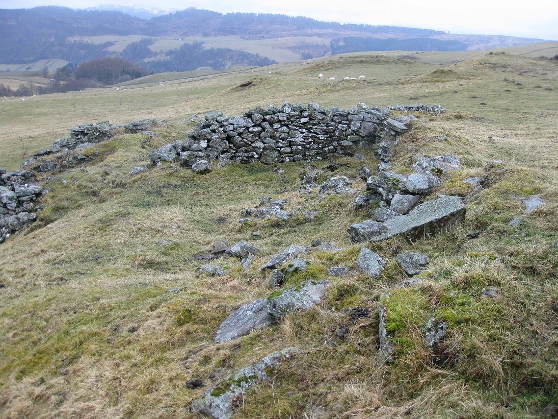
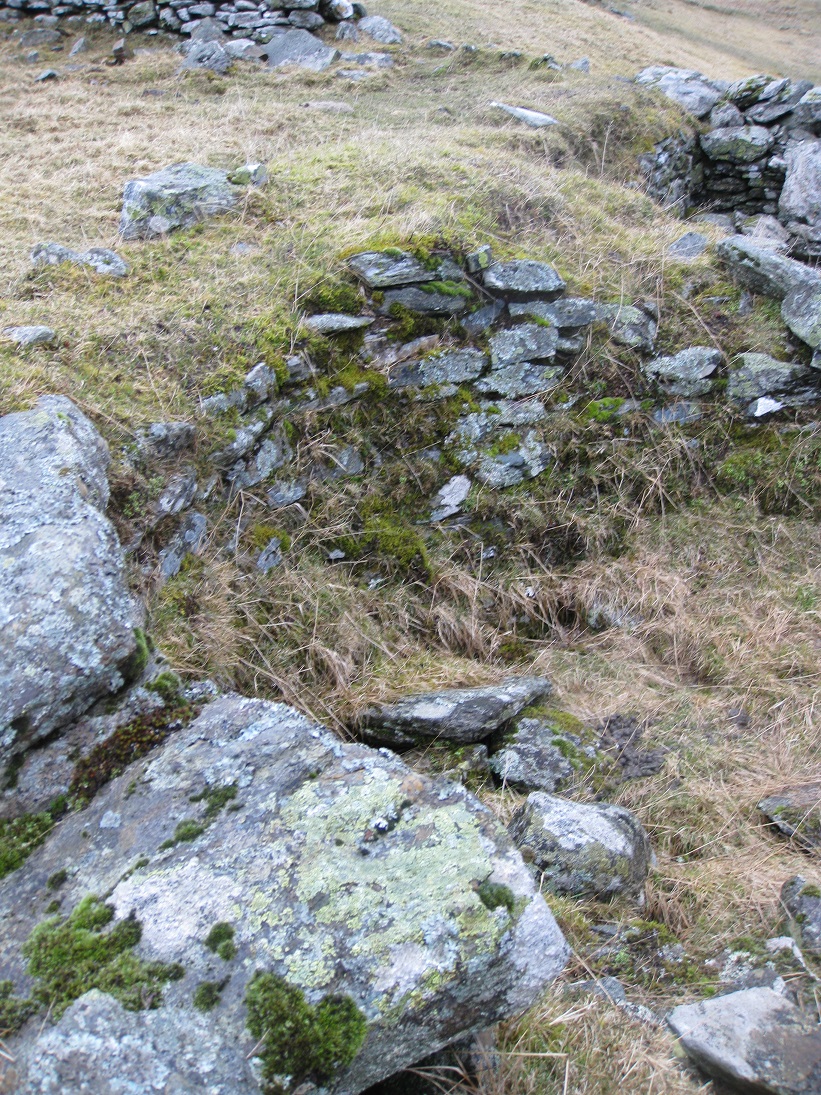
The 1st edition of the Ordnance Survey map (1867) shows an "Old Limekiln" to the north of the main ruins (1). However old limekilns were normally not much more than fire-pits for roasting limestone and this one is much more sophisticated.
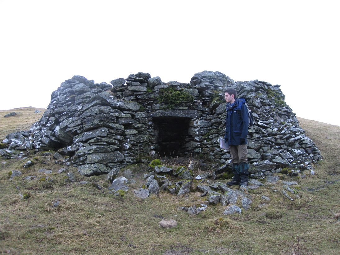
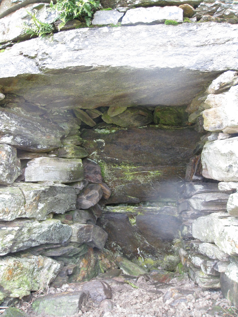
The limekiln was built into the slope of the hill using stratified stone, which may have come from the river-bed, and the roof was constructed using a single slab. Stone 'wings' on both sides of the hearth may have helped to improve the through draft, and increased the temperature of the fire. Some of the stones making up the hearth are cracked, but whether this is from intense heat or natural erosion is difficult to tell. The back of the hearth was constructed using two sloping slabs set at the same angle as the pile of burning wood and lime. Above the two slabs a gap has been filled with loose rocks and earth.
The top of the kiln is now grassed over, but a small depression in the middle suggests that originally there had been access to the top of the kiln. It would have been possible to roast limestone as a continuous process, instead of a batch process, by adding more wood and limestone at the top whilst the lime and wood ash were removed from the front of the hearth.
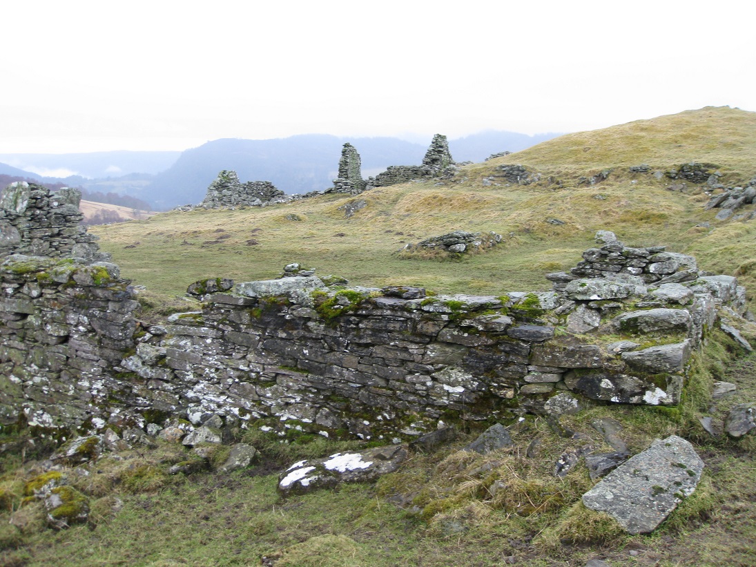
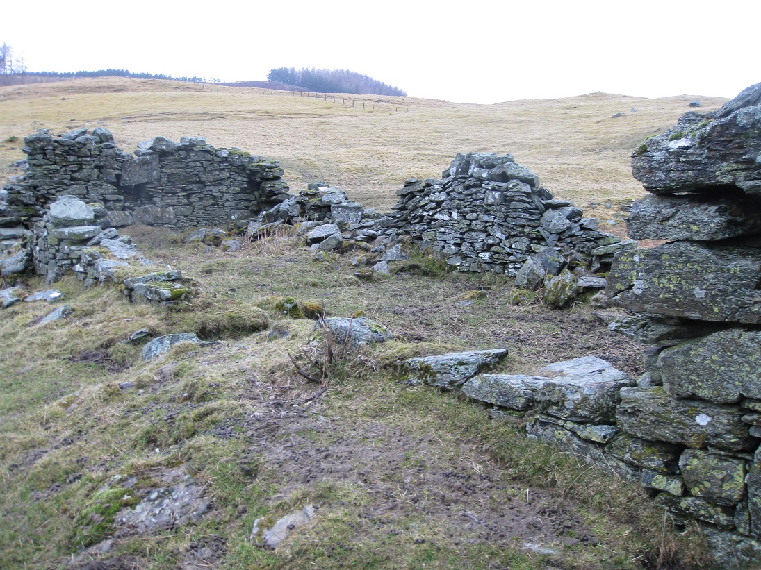
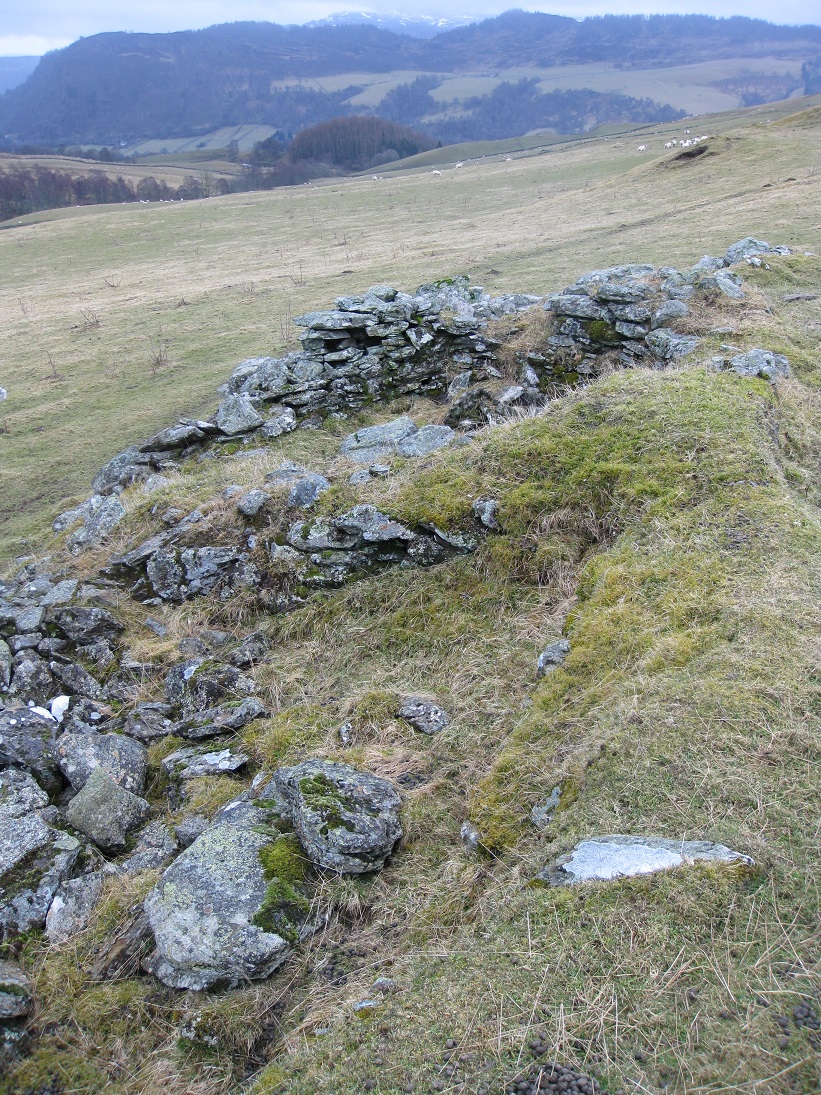
The main ruins of Markdou form two ranges of buildings (2 and 8) on either side of a stockyard. The Old Parish Registers show that Markdou of Clune was being farmed in the early 1700s, but the large gable ends suggest that the present ruins are of more recent construction, probably built over the footprint of the previous buildings.
The north range comprises three buildings (2a, 2b and 2c), orientated roughly east-west, as expected for dwellings. The most westerly (2a) was built next to the track which passed through the farm and probably was a store or workshop. It was roughly 5 metres wide by 11 metres long and there is evidence of a partition dividing it into two sections, one 5 metres long and the other 6 metres long. Each section had a window in the north side.
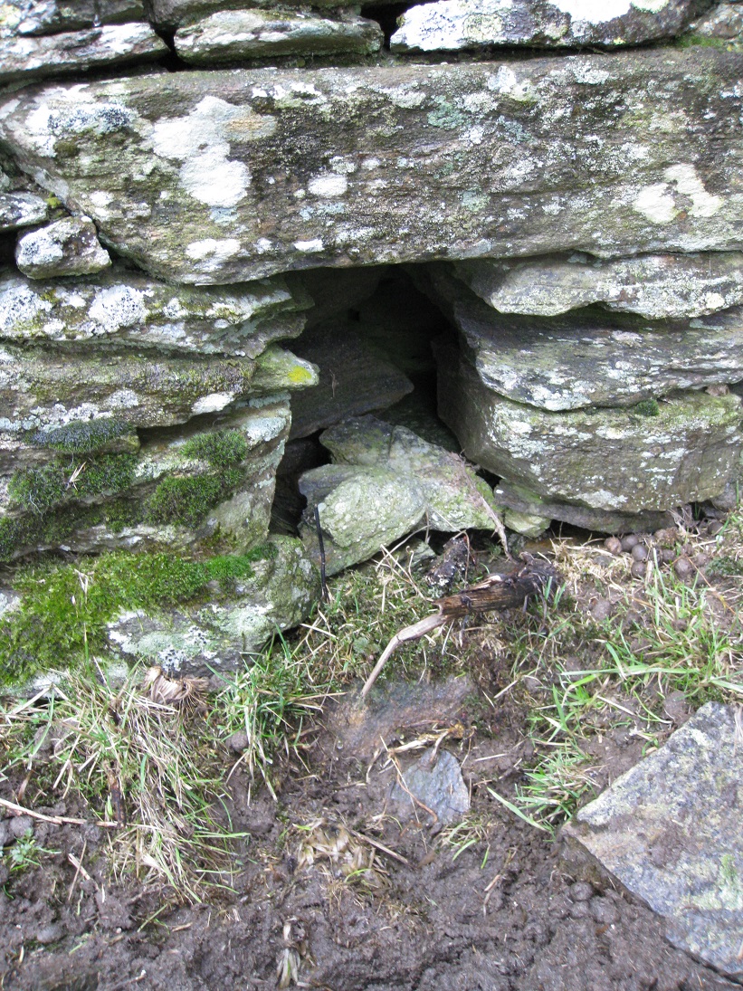
One of the windows still has the stone lintel, but the window itself has deliberately been closed up with stones at some time in the past. This may have been done to prevent livestock from escaping. Alternatively, the original window may have fallen out and the gap was just filled in.
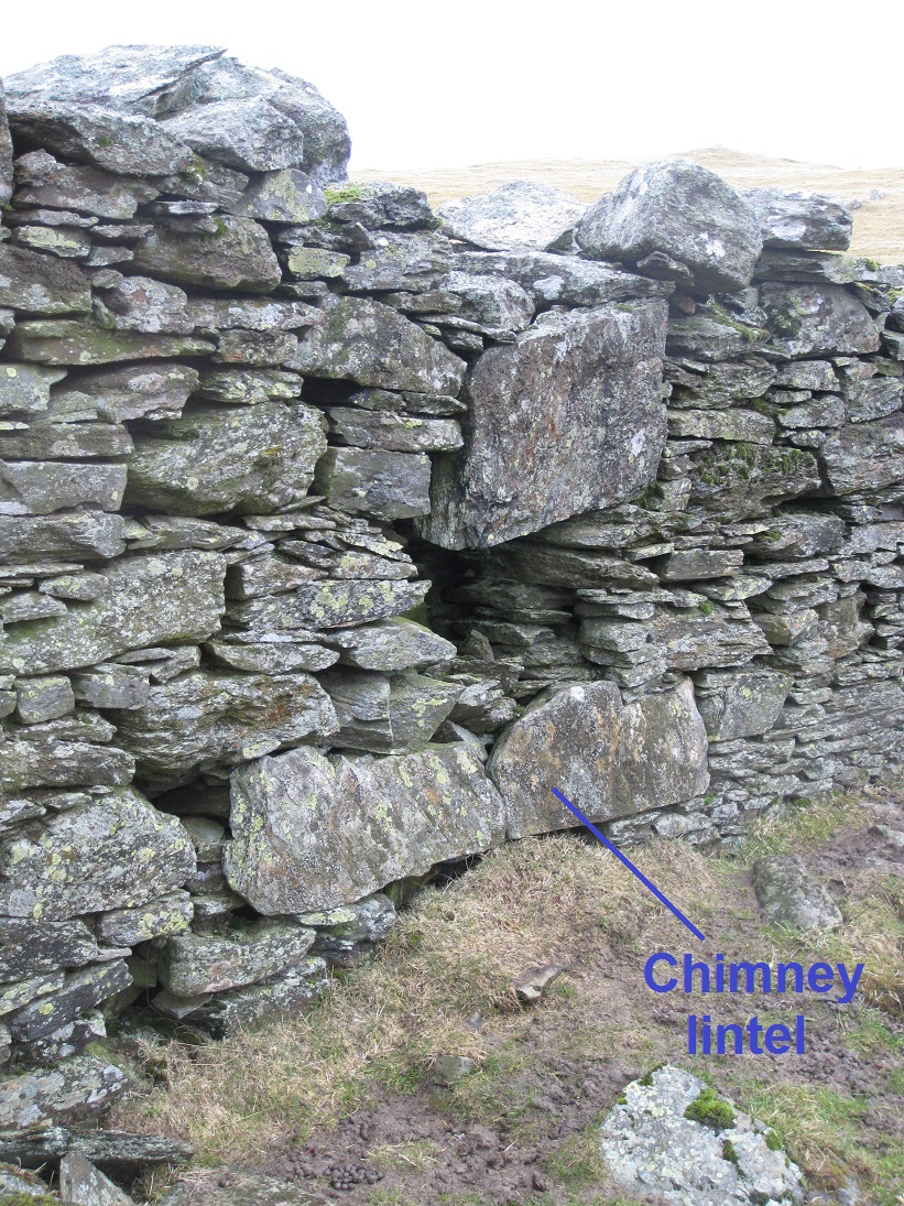
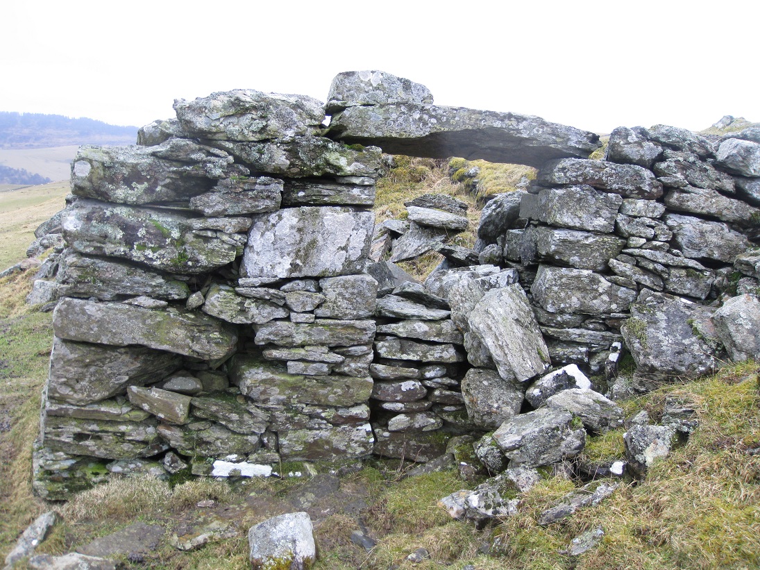
Building 2b was the farm house which is shown by the fireplace in the west gable. A rectangular flue has been built within the gable wall, whereas most fireplaces still relied upon a 'hanging lum' attached to the gable wall. An accumulation of earth has built up so that the chimney lintel is virtually at ground level. The house measured roughly 5 metres in width by 14 metres in length.
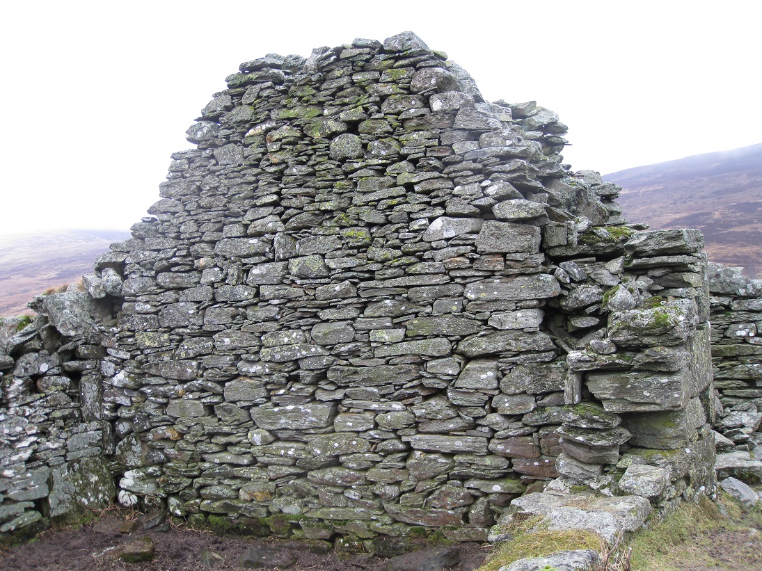
It is possible that house 2b also contained a stall for animals on the eastern side as there is some evidence for a central partition, and what appears to be a drainage hole set into the back wall. The eastern gable end is in remarkably good condition which is a testament to the builders. There are not traces of broken slates so the roof would have been thatched, but both the thatch and any roofing timbers have long since rotted away.
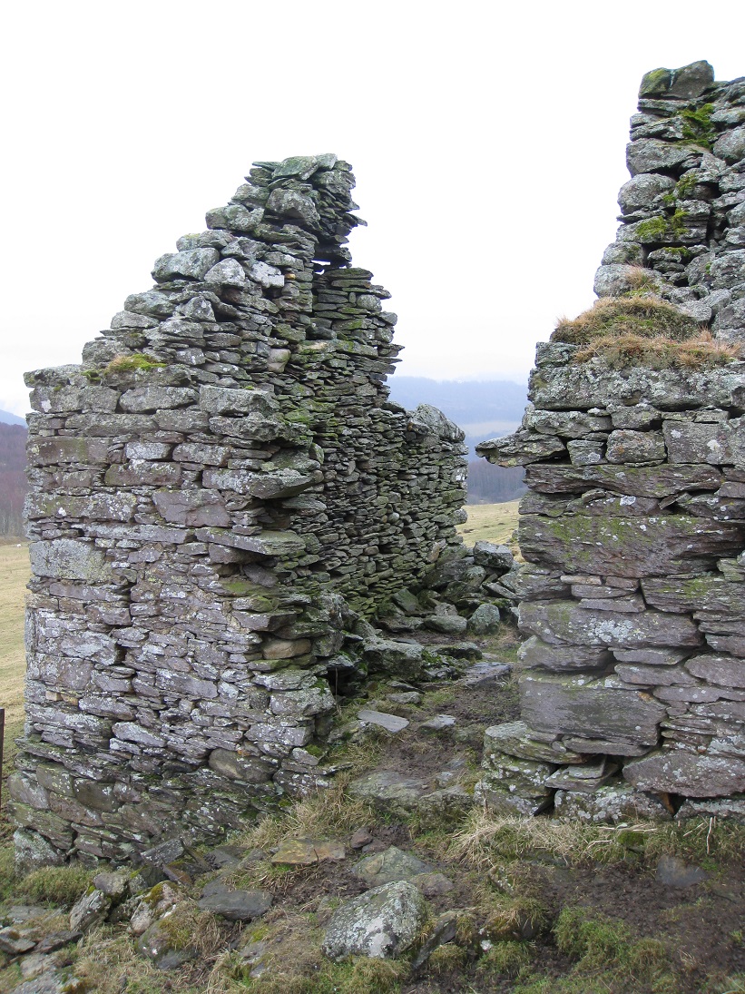
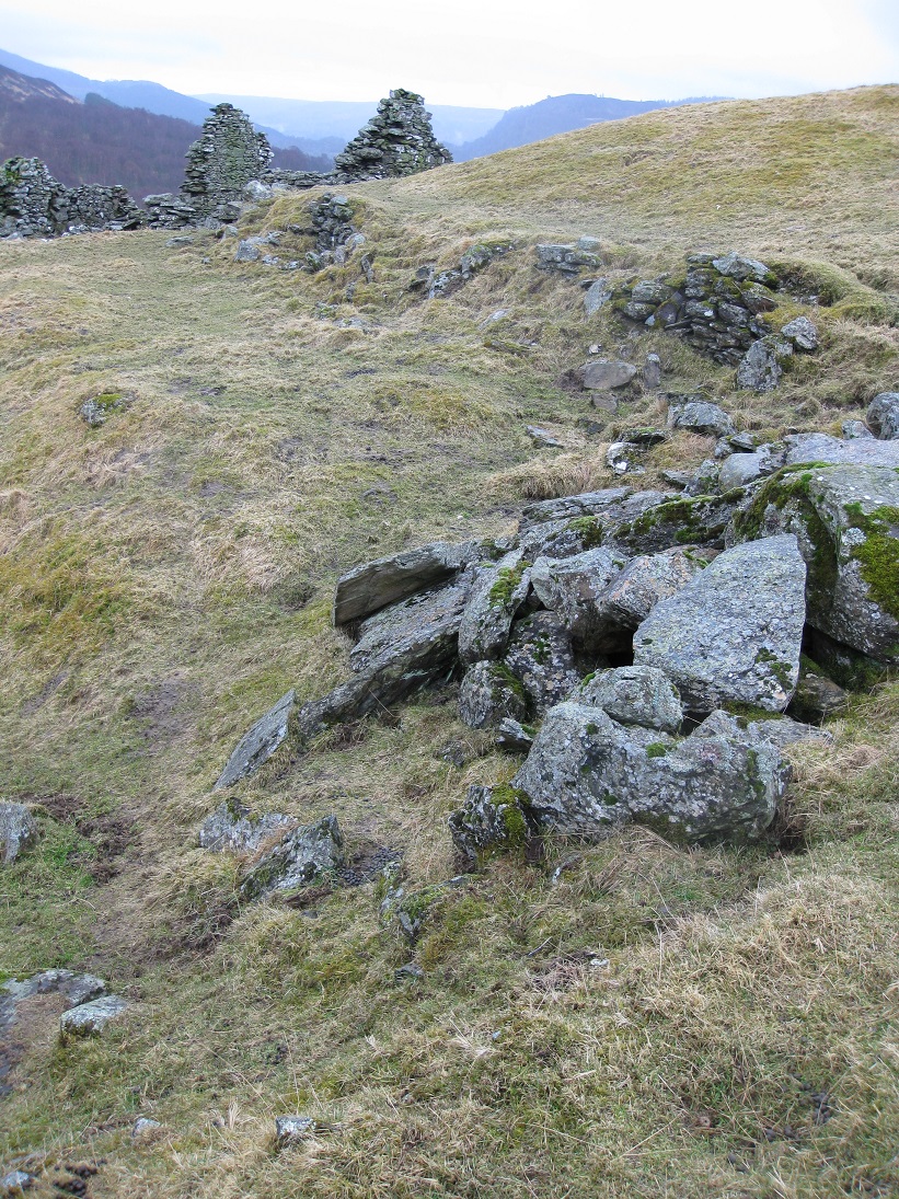
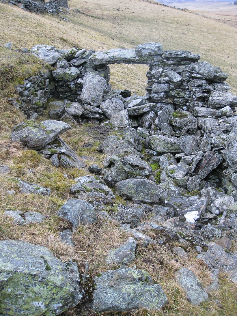
The last part of the north range (2c) is only 3.5 metres wide with matching gable ends on either side. From the north, the straight edge of the stonework on the right gable and protruding stone give the appearance that this was part of a continuous wall containing a doorway. However, from the south side, the construction of the external stonework of the two gable ends suggests that this was an open-ended byre or shed, which may have been added onto the house at a later date.
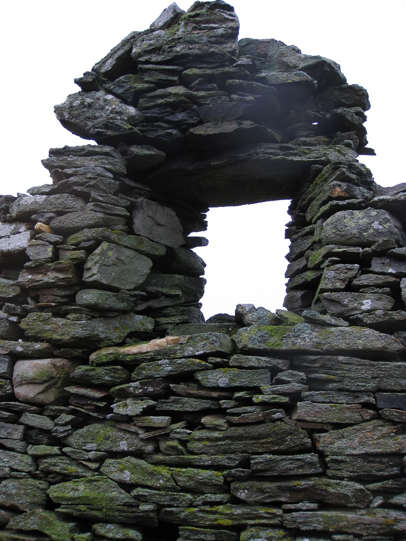
As the ground is sloping down towards the river, the gable end reaches a considerable height and the window is at loft level. The right hand side of the gable is virtually intact and clearly shows the ledge which helped to support the thick thatched roof. The window space is wider on the inside than on the outside, which would have maximised the amount of light entering. Beneath the window there is evidence of sockets where the joist of the loft would have hung, but there are none on the opposite side. If one side of the loft had to supported by upright timbers it would be further evidence that this part of the range was a later extension.
Behind the north range is a stone-lined shallow depression which is probably a retting pool (3). In the process of making linen yarn, the stems of flax were left to soak in water (retting) to break down the tough outer layer and release the soft flax fibres. Tenants were prohibited from using streams for retting as it fouled the drinking water, so retting pools were constructed for this purpose. At Markdou a steady trickle of water, from the marsh to the west, runs alongside a stone dyke to the back of the north range and could have passed through the retting pool.
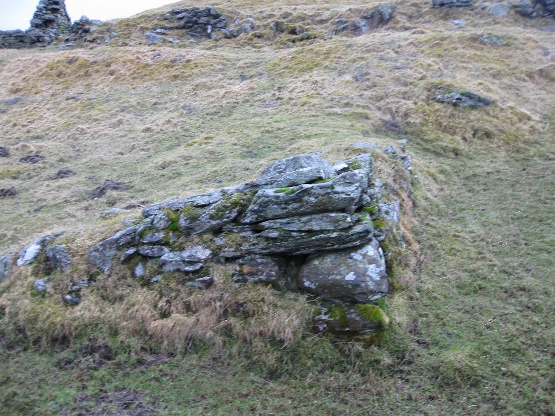
On the opposite side of the track from the north range are the remains of a small building (4), possibly a store, built at the end of a stone dyke.
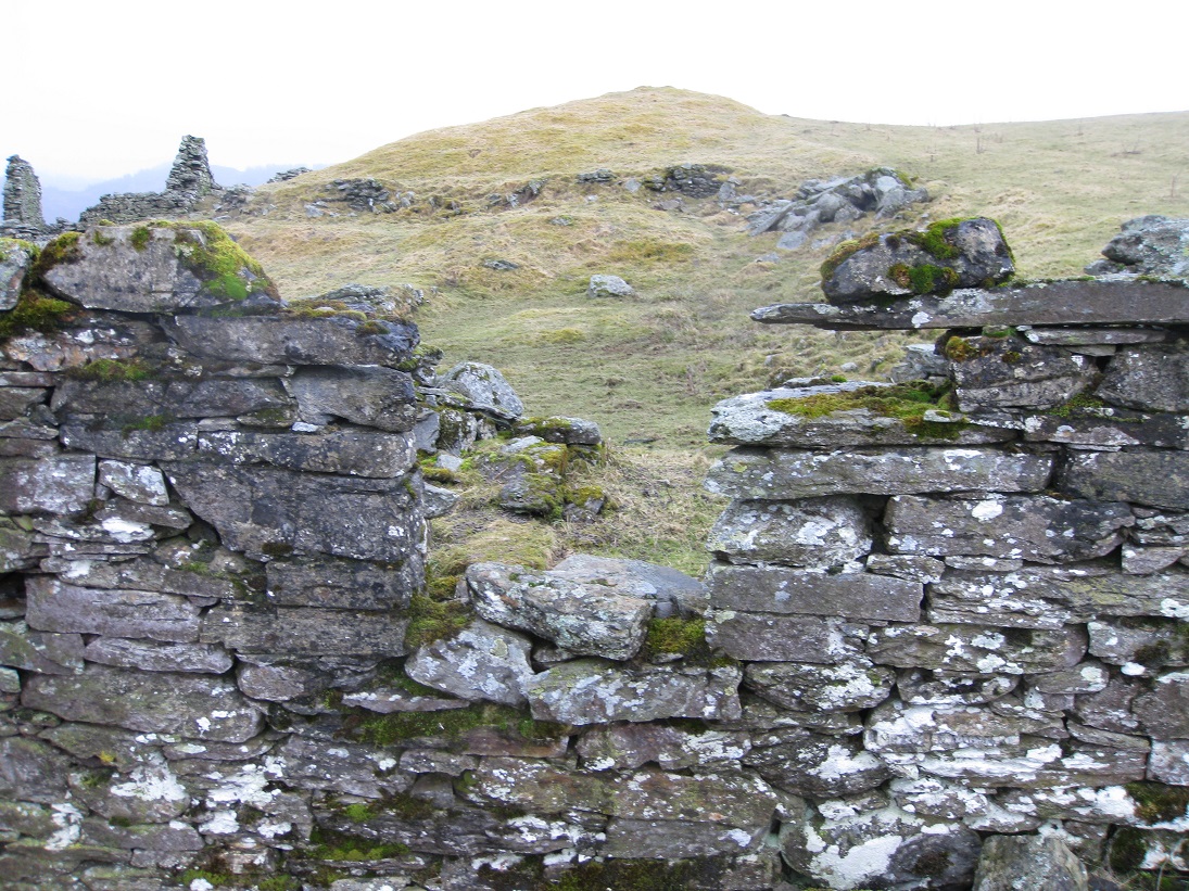
Between the north range and the south range is a large stockyard surrounded by dykes built of rough stone. At the south-west side there is a small
grassy mound and two retaining walls have been built to form a terrace (5). The purpose of this terrace is not obvious, but it may have been used
for stacking oats and barley, before winnowing.
Below the terrace, in the stockyard, there is a stone structure built at a tilt which appears to have been a ramp (6) for loading carts.
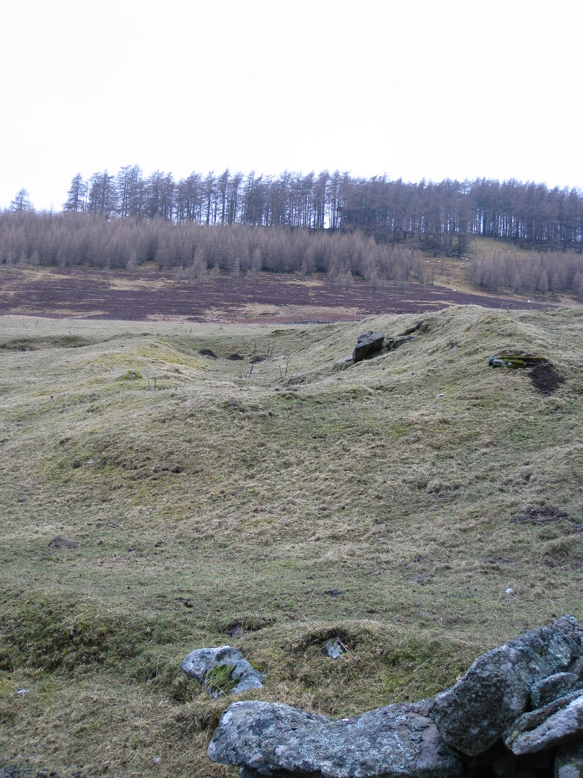
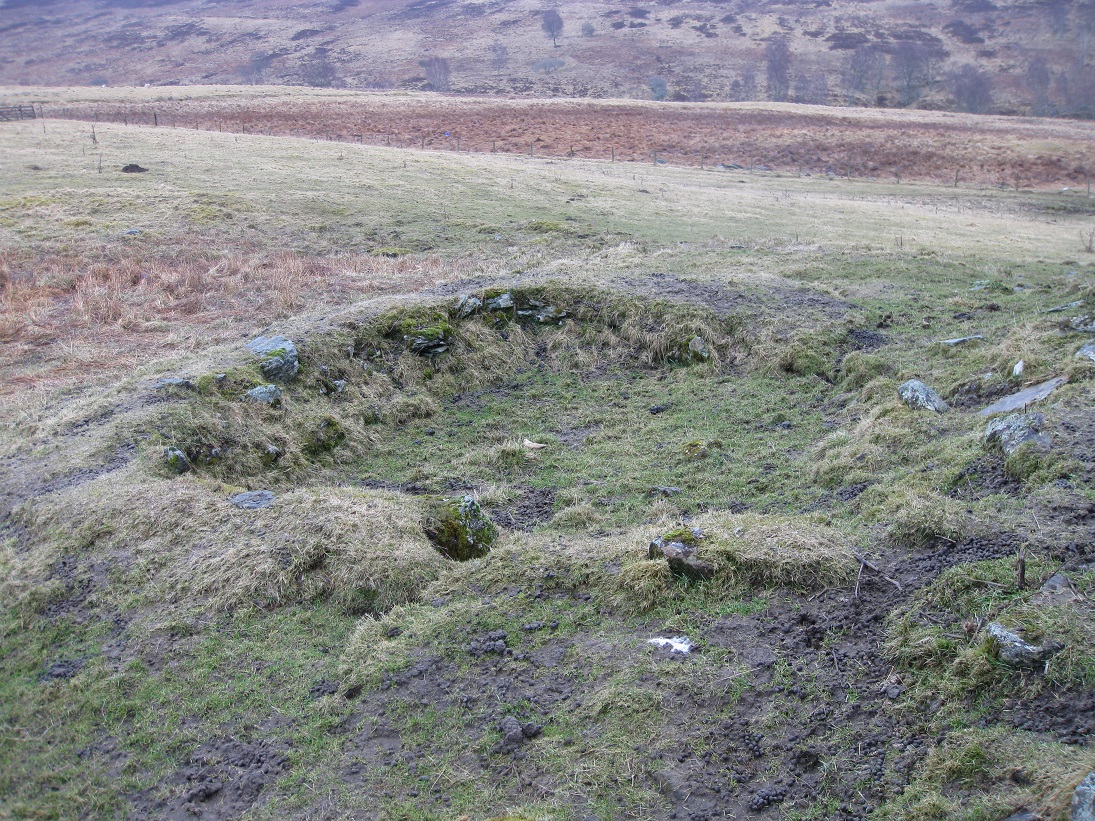
On the other side of the mound there is a large, grassy, oval depression which appears to be man-made. Its purpose in unclear. It may just be a watering hole for livestock which has dried up.
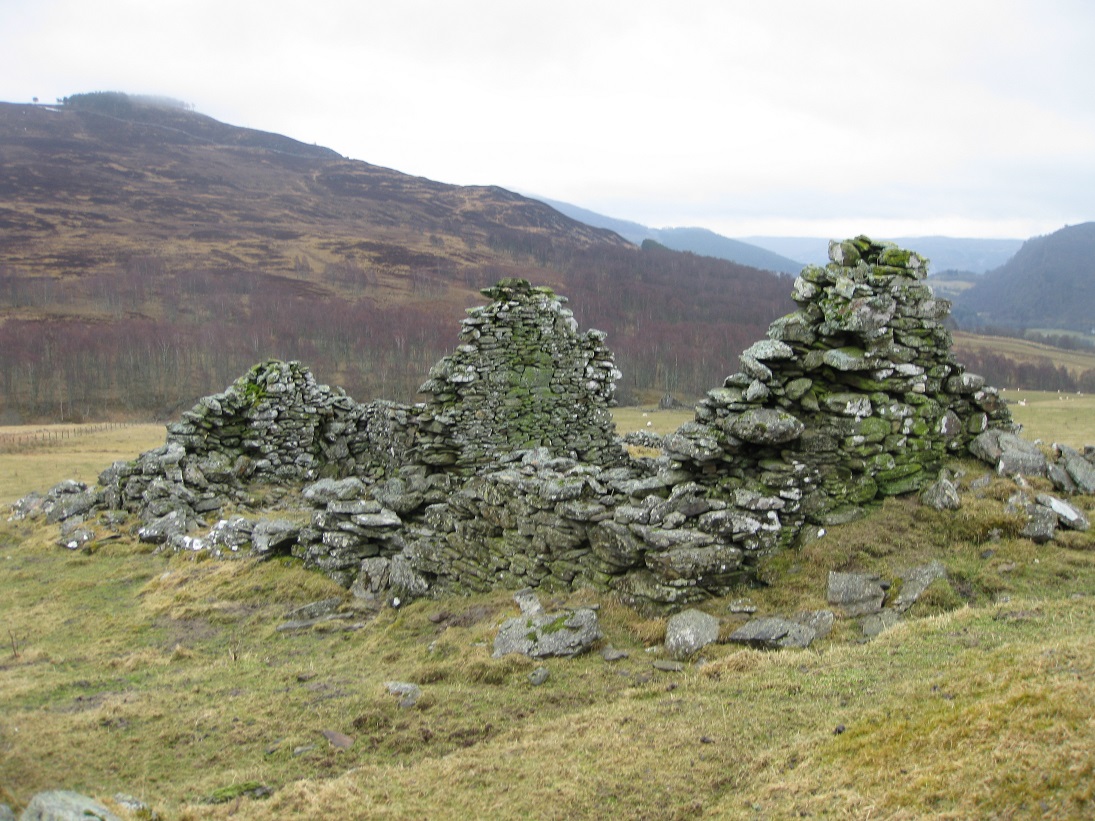
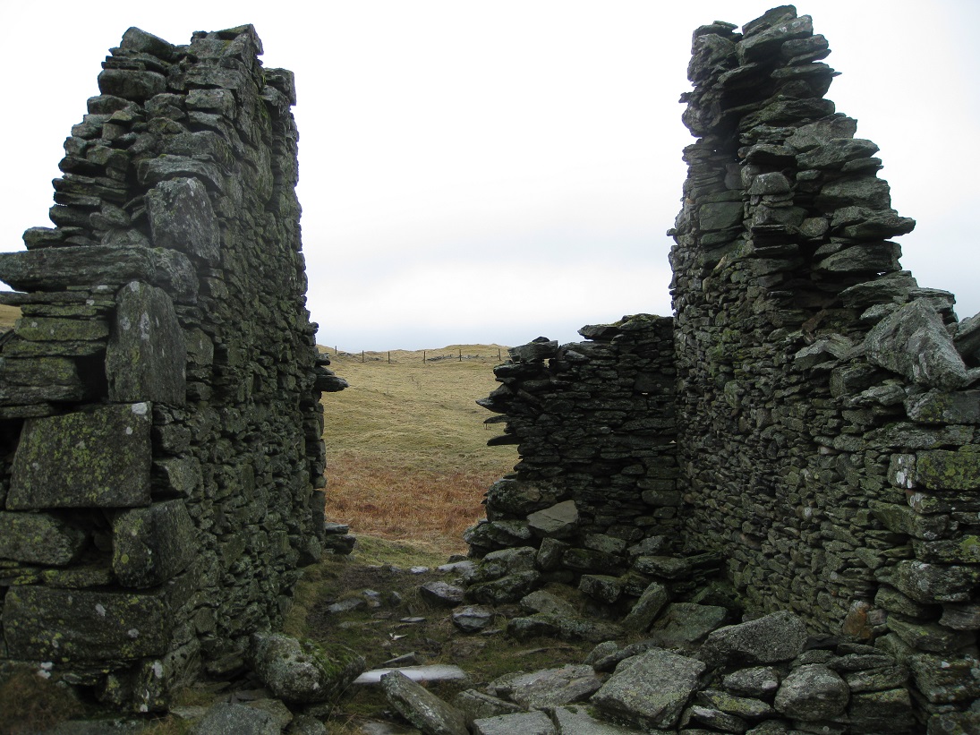
The south range (8) comprises of two joined buildings with an 'L' shaped walled garden or kailyard behind them. The doorways seem to have opened out into the stockyard, suggesting that these were byres or stores, rather than dwellings. Probably, the south range was built around the same time as the north range as the construction is very similar.
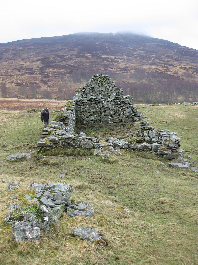
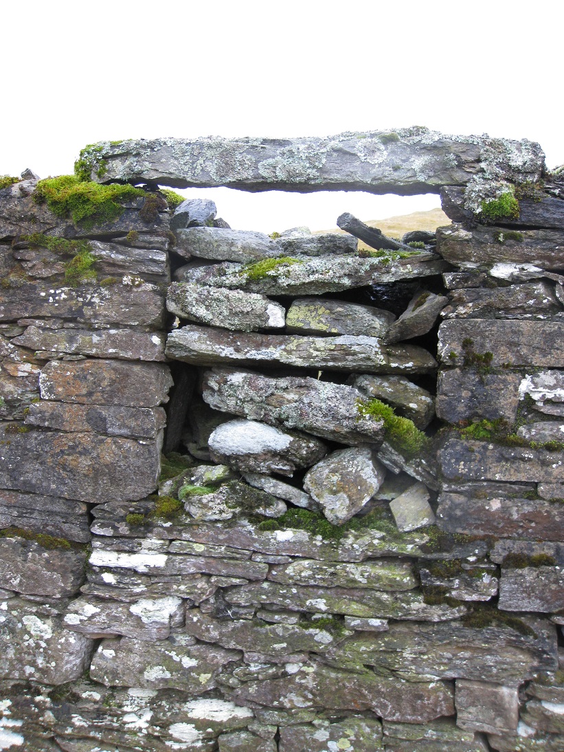
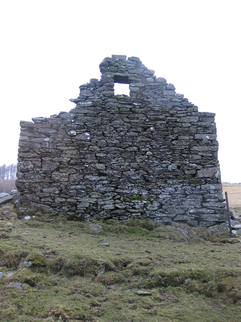
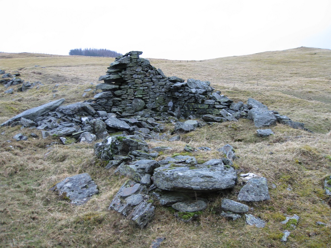
The ground slopes off steeply below the east wall of the stockyard and in one corner there remains the outline of where a turf walled structure (9) might have once existed. Further down the slope is a small stone building which, at first glance seems to have a window in the north side.
Upon closer inspection it is a small doorway which has been partially sealed with stone slabs, some of which have since slid out. Why this was done remains a mystery, as this would have been the only entrance when the barn had a roof.
The blocked door leads to a kiln barn which was used to dry grain. Grain had to be dried as, in many parts of the Highlands, the weather did not allow cereals to be sown until much later than in the Lowlands. Consequently the crop was sometimes not harvested until October and could not be dried in the open air. The kiln barn could be used to store sacks of winnowed grain. At the end of the kiln barn there was a fire box which led to the botton of the kiln bowl. A small peat fire smouldered in the fire box and the hot air moved along the flue to the bottom of the kiln bowl. Inside the kiln bowl there was a wicker-work frame, with a sheet covering it, on which the grain was spread. The grain, or sometimes sheaves, had to be turned regularly while the warm air rose up through it, otherwise the grain could become singed or even catch alight.
| Blair Atholl Marriages | Return to Home Page |
|---|