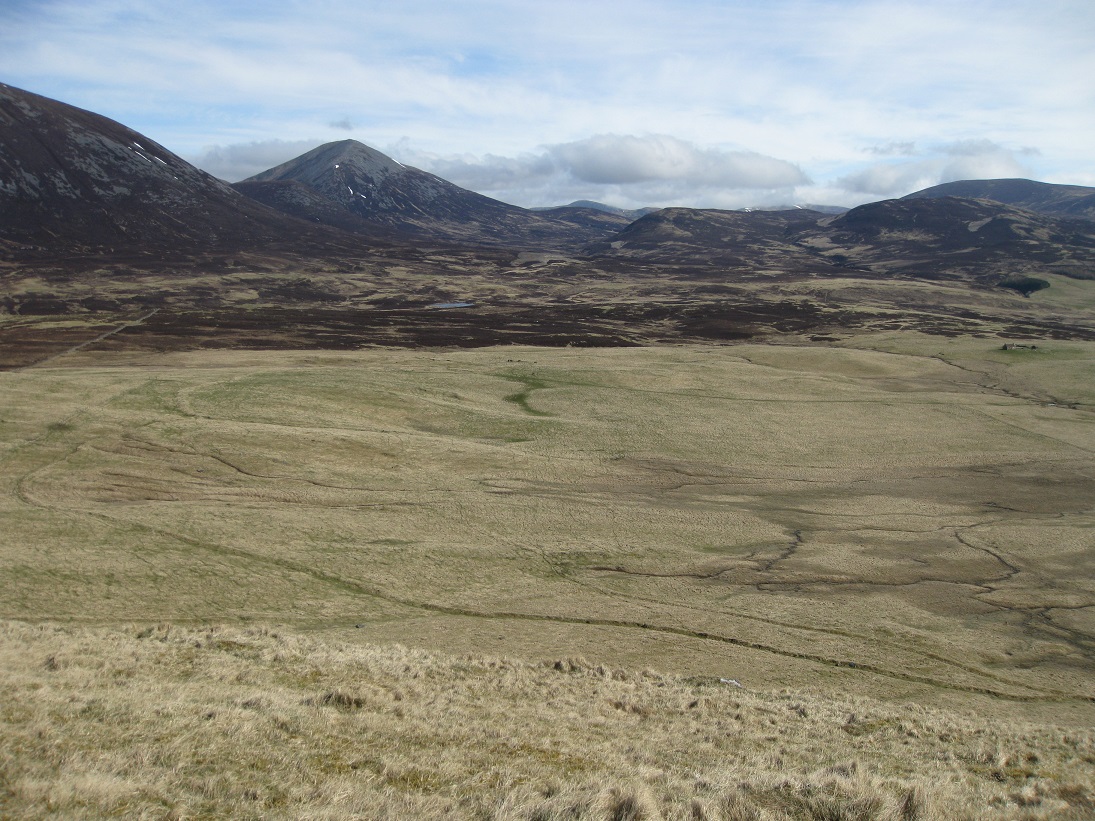
The site of Breakach of Glen Girnaig is on an upland plateau at a height of about 420m, north of Meall Mor and west of the Allt Girnaig.
On 5th December 1722 John Robertson of Lude, heritable proprietor, made an agreement with Donald Farquarson in Little Sinigaig and Donald Fraser in Luin Choalich (Loin Conlach), setting in tack (leasing) conjunctly and severaly, a parcel of new ground called Rynastron (Renestrone). At the same time John Robertson of Lude gave a lifetime tack (or 19 years) to Donald Gow for the adjacent new ground called Riefichet (Riephicair).
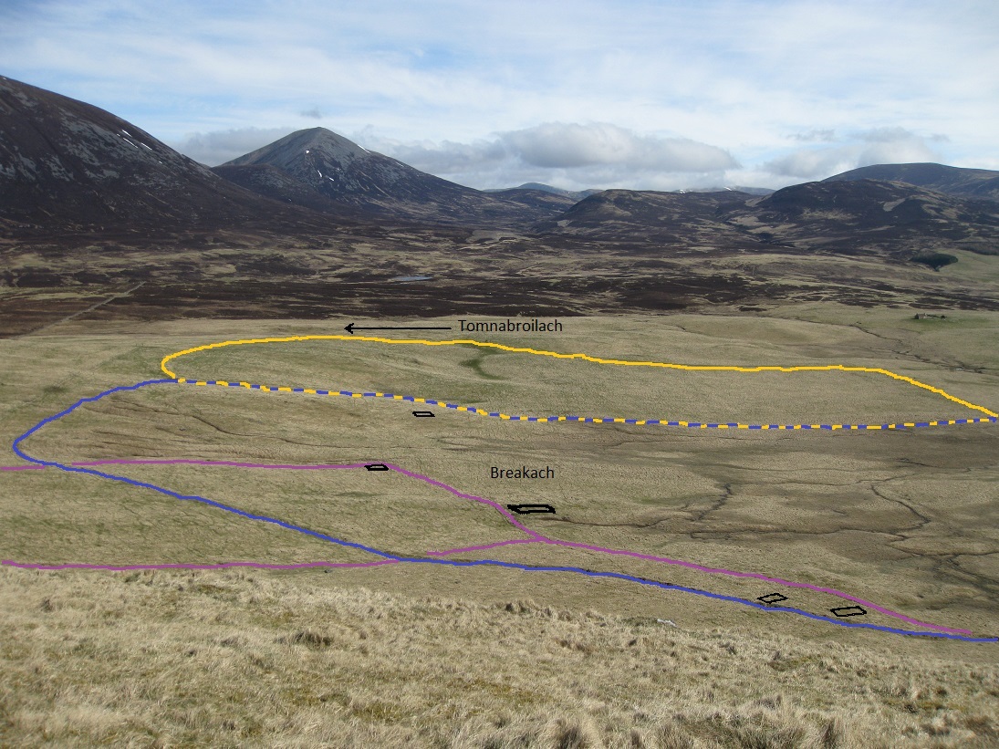
The tack defined Renestrone as extending to the Breakach boundary dyke, and it is quite likely that the dyke surrounding the enclosure, which takes up most of the plateau between Breakach and Tomnabroilach, was built at around the same time. Although the outline of the enclosure is clearly visible by aerial photography, little remains of the dyke.
Brackach tenants farmed the southern half of the enclosure (shown in blue) while the tenants in Tomnabroilach farmed the northern half (shown in yellow), with a dividing dyke between the two. The grass-covered remains of a rectangular enclosure and head dyke (shown in purple) are also evident on the Breakach side, and as the 1722 enclosure dyke breaks through the rectangular dyke, it probably pre-dates it.
It is said that the stone was removed to build the Tomnabroilach roundel. (This massive, circular, sheep-fold was built by Angus Cameron in 1940 to replace an old wooden one beside the Allt Riephicair. It is estimated that more than 500 tons of stone were used in the construction, and that it could house over 600 sheep during severe winter snow-storms). However, the 1st edition of the Ordnance Survey map (1867) shows a clearly defined dyke around the Tomnabroilach half of the enclosure, but only a shadow for the Breakach half. This suggests that the Breakach boundary walls had already been robbed to build the two houses and enclosures now named as Tomnabroilach while stone from the original Tomnabroilach, which was beside the spring on the other side of the Allt Riephicair, was used to build the 1940s roundel.

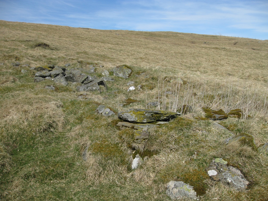
Survey maps of Brackach show the remains of buildings in four locations. This is not surprising as, by the 1760s, the Lude Estate rent book shows that Breakach was being leased out to three separate families, each having a third-part share. Although the families probably helped each other, as good neighbours should, they seemed to have farmed their own third-part.
In 1732 a case of assault between Robert Stewart's wife Elspeth and John Robertson's wife Beatrice, both in Brackach, was heard at the Lude Barony Court. The arguement started when Robert Stewart's lambs had got into John Robertson's cornfield, which suggests that each third was separated by not much more than wooden fences. The corn that was being grown, would have been oats and barley. There is no evidence of a corn-drying kiln on the Breakach site, but they may have had permission to use the one at Tomnabroilach.
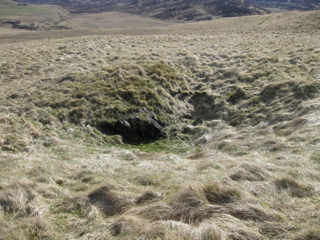
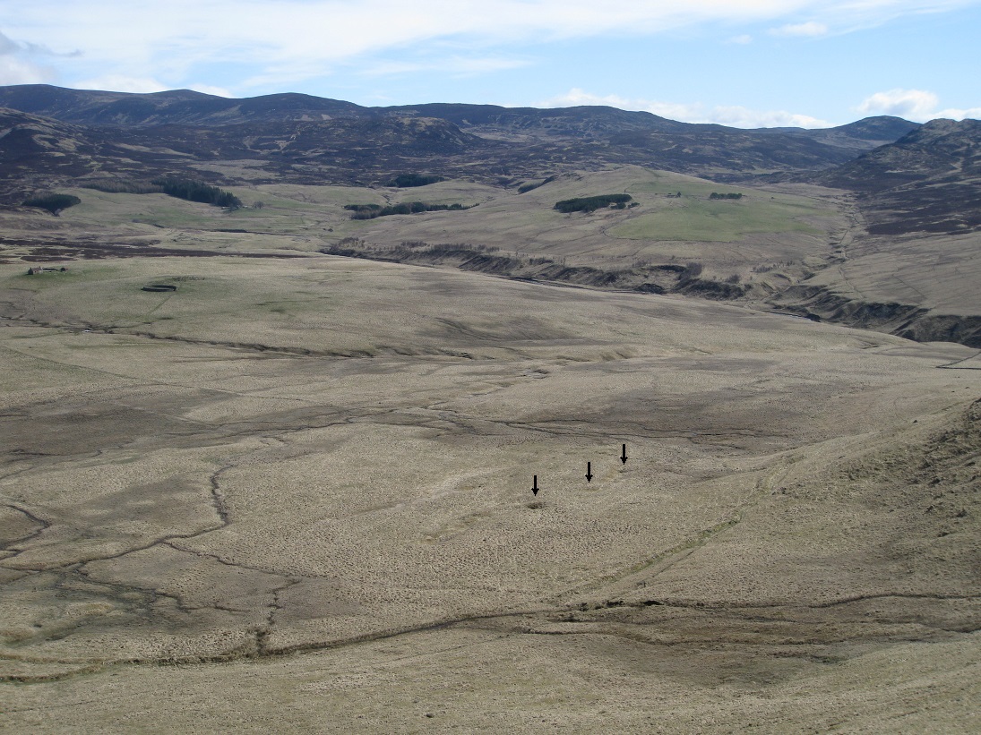
On the south side of Breakach, and within the enclosure, there is a series of small depressions which are visible with aeriel photography. They may be natural, but if so, it is surprising that they were never filled in. Alternatively, they may be man-made watering holes for the livestock on the upland plateau.
| Blair Atholl Marriages | Return to Home Page |
|---|