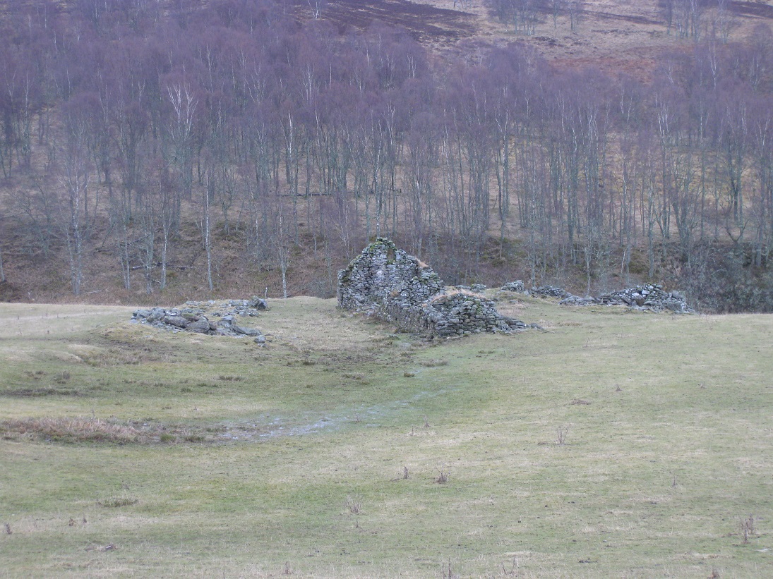
Balinloan was situated on the grassy incline below Markdou of Clune but closer to the Allt Chluain. The ruins at Balinloan are in reasonable condition, considering that the last tenant farmer left in the 1860s, but many of the features shown in the 1st edition of the Ordnance Survey map (1867), have disappeared.
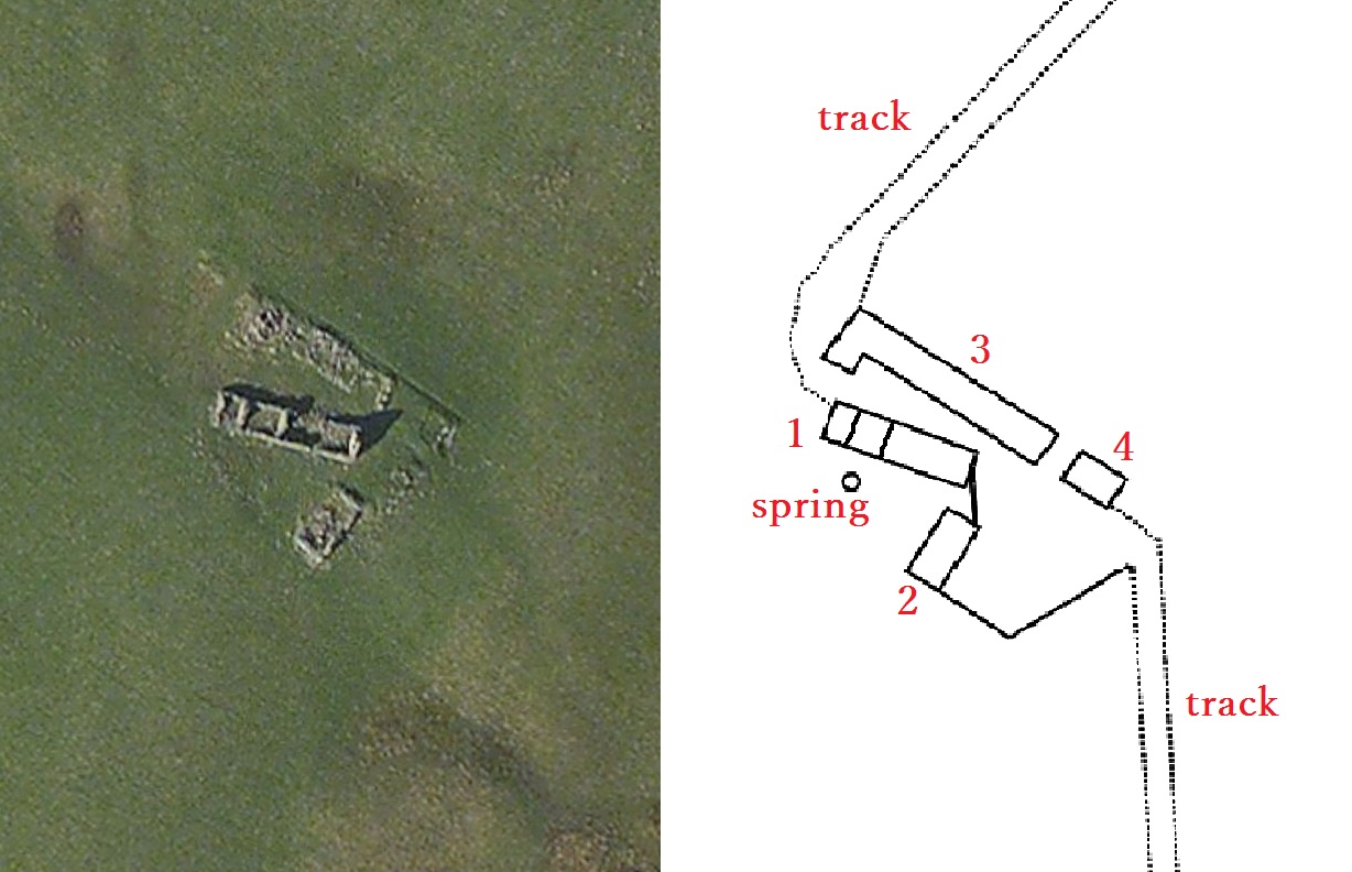
Both tracks leading from Balinloan seem to have been ploughed over at some time in the past, possibly during the Second World War, as neither are visible. Likewise there is no trace of the kail yard which was to the east of the southern outhouse (2). The most easterly building (4) has also vanished and the northern range (3) has been reduced to a jumble of stones.
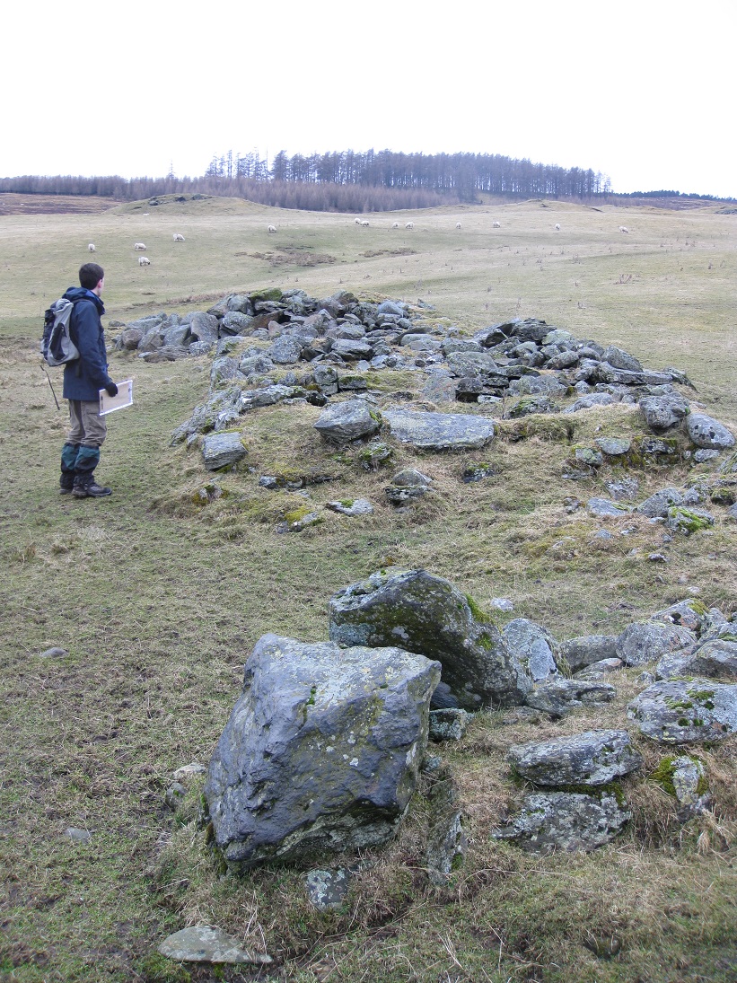
The 1st edition of the Ordnance Survey map (1867), shows that both the North Range (3) and the South Range (1) of buildings were in use at that time. The poor condition of the present ruins of the North Range suggests that this was the original settlement and that the South Range was built in the early 1800s. The protruding section at the western end may have been a separate compartment, but this is impossible to confirm as it is covered by a pile of rocks which seem to be field clearance from much later ploughing.
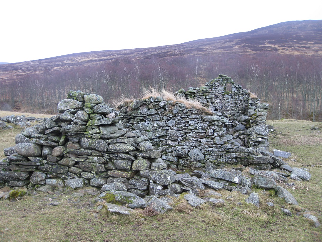
The South Range (1) was built in three stages. The first building was the eastern compartment of the range. An extension was then built onto the western gable, to form the middle compartment, and the process was repeated to build the final section. As the land slopes upwards, each gable was smaller than the last one, so that the roof remained level.

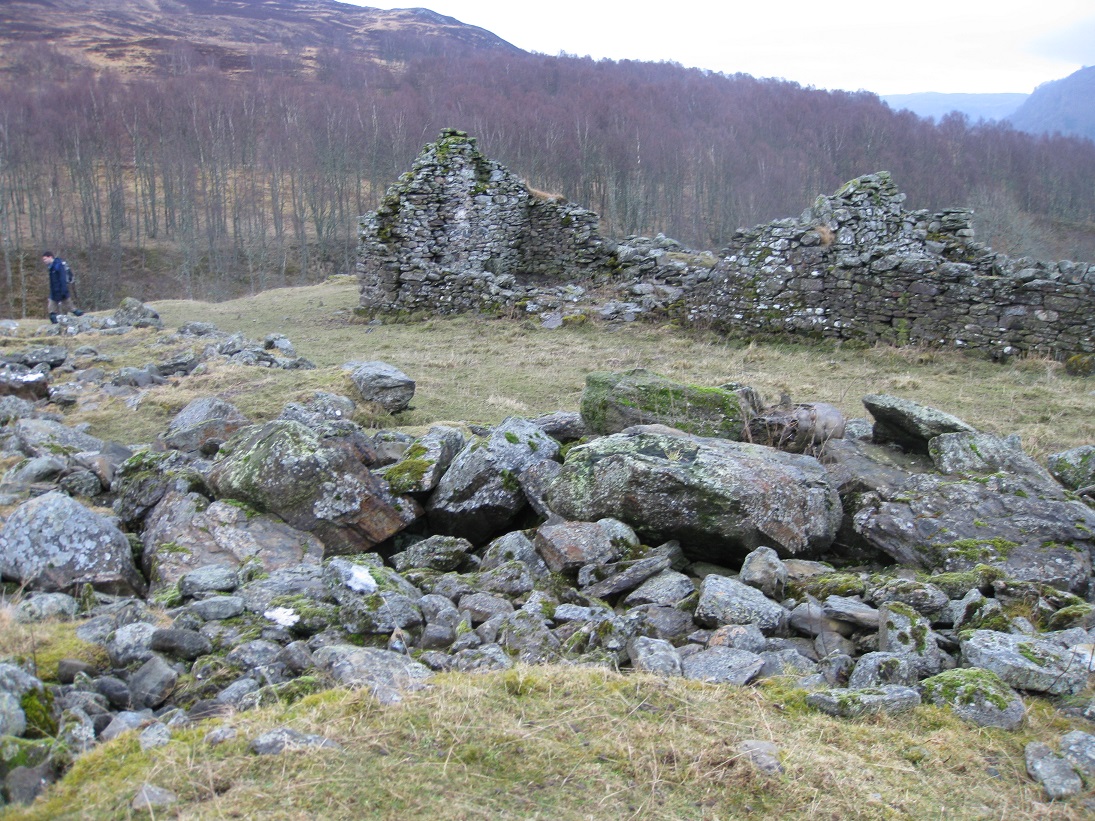
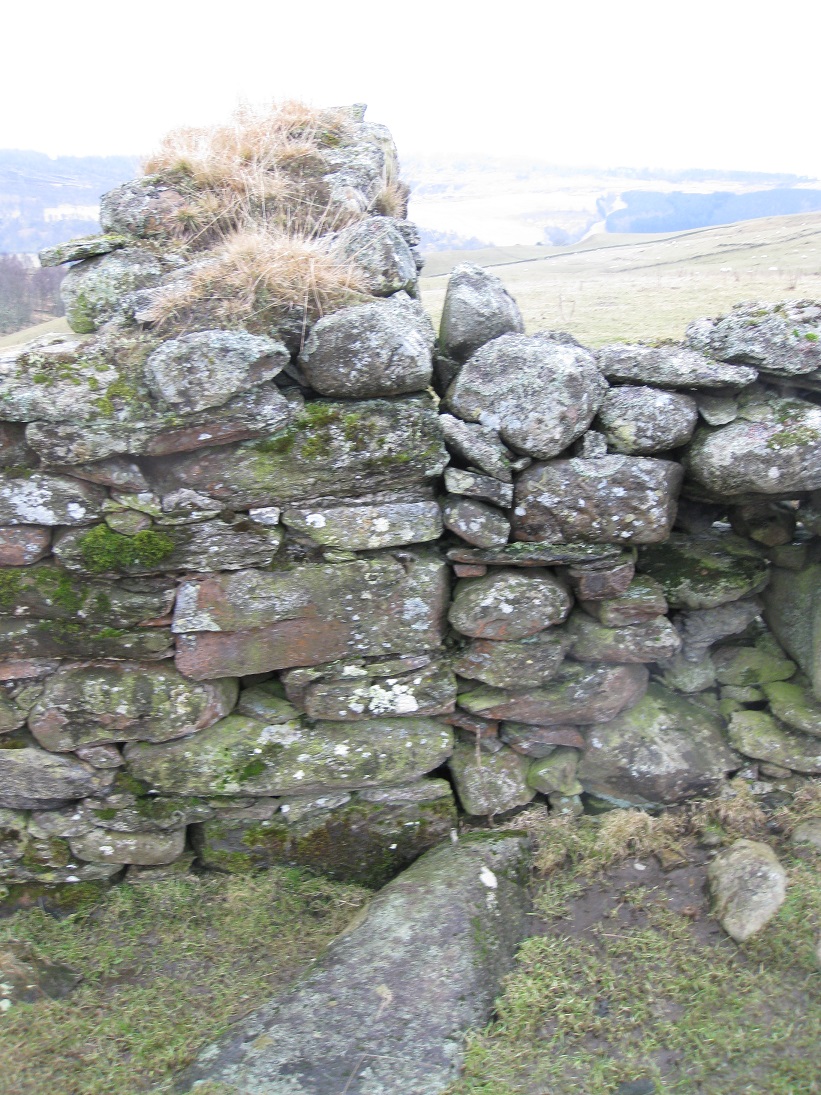
The most easterly compartment of the South Range was a dwelling house. It has the normal east to west orientation, but instead of the doorway being on the south side, it is on the north side facing the North Range. Once again this suggest a later date of construction. On the south side there was a large window, but it has been rather hurriedly filled. The reason for this in unclear, but mirrors similar activity at Markdou, nearby.
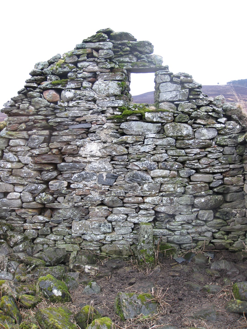
There is a small window, high up in the gable of the dwelling house, suggesting that there was an attic to the house. However, if this was the case, then a chimney must have passed though the floor of the attic and run up beside the gable window.


The stones of the hearth are at the base of the gable wall, and the wall itself has been mortared in places, probably to help support a 'hanging lum' which would remove the smoke.
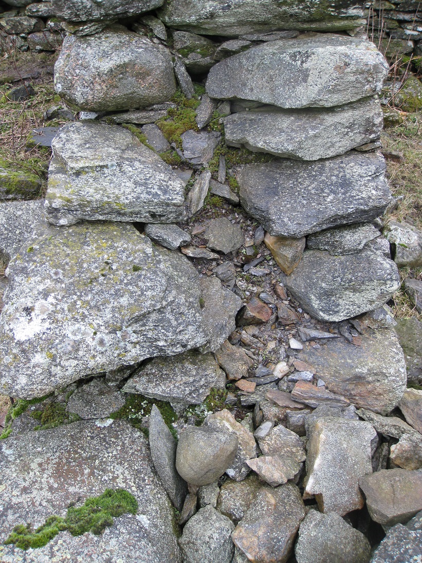
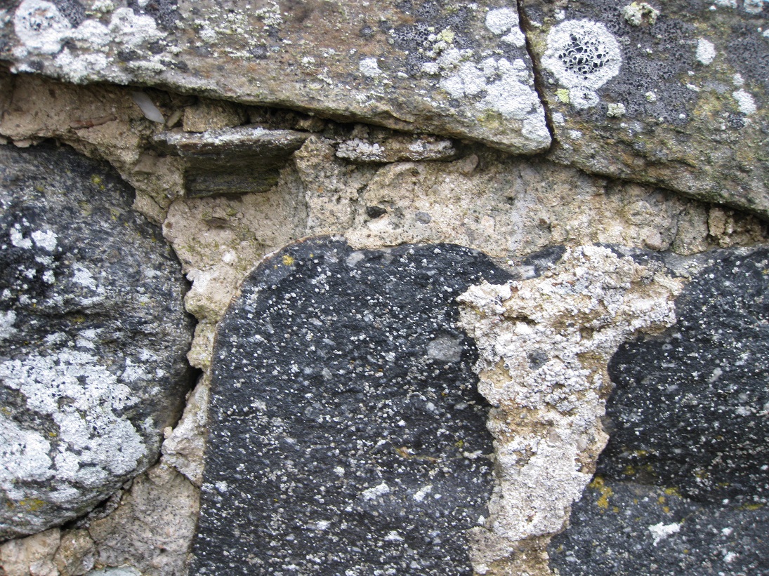
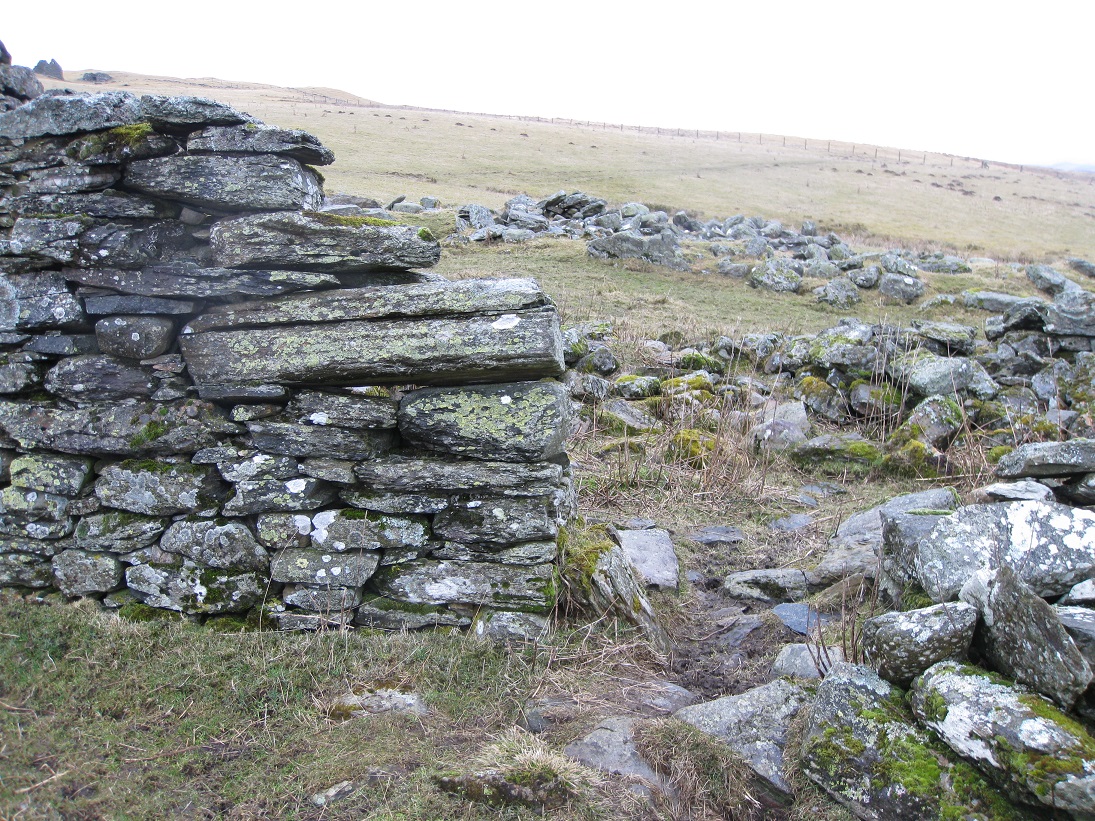
The buildings are all constructed from fairly regularly shaped, stratified rocks which may have been quarried from the nearby outcrops, or from the the river bed. Typical construction for the late 1700s and early 1800s relied upon two outer courses of rocks, tied together with a mortar made from a mixture of small stones, sand and clay. When the mixture dried it set hard and it was possible to build quite tall structures. However, when the dwelling was abandoned and the roof no longer kept the mortar dry, the rocks would have had little to hold them firmly in place. At Balinloan it is evident that more durable lime mortar was used to patch the walls later on.

A couple of the gable ends have turf growing on them and, probably, this is all that now remains of the thatch which covered the roof. All of the
supporting roof timbers have rotted away and there is no evidence that slate tiles were ever used.
The 1st edition of the Ordnance Survey map (1867) shows a spring, just behind the dwelling house. There is no evidence of it now, but the slope
leading down to this point is rather boggy and a natural spring would have been very handy.
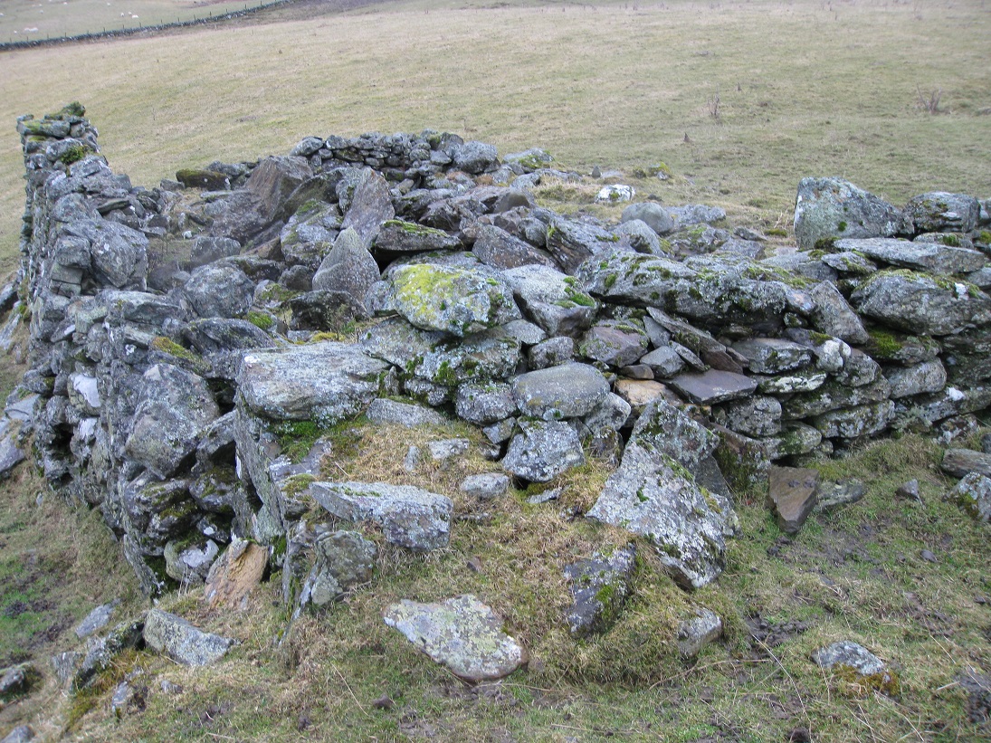
Although the kail yard and building 4 have vanished, the ruins of building 2 still remain. The building is small and orientated north to south, so
it probably was a store.
The 1861 census shows that John Stewart and his family were tenants of Balinloan and were farming 15 acres. John Stewart was about 71 years of age
and had been born in Blair Atholl parish. His wife Ann came from Moulin parish and was 72 years old. Two of their children were working on the
farm: Catherine, aged 33, and Robert the ploughman, aged 30. Both had been born in Moulin. There were also two grand-children: John Stewart, aged
7 and born in Logierait; and Alexander Stewart, aged 3 and born in Perth.
By 1871 most of the local farms were abandoned, but William Carr, a 41 year old stone mason, and his family were living in Balinloan. This census
also states that his house had two rooms with windows
| Blair Atholl Marriages | Return to Home Page |
|---|