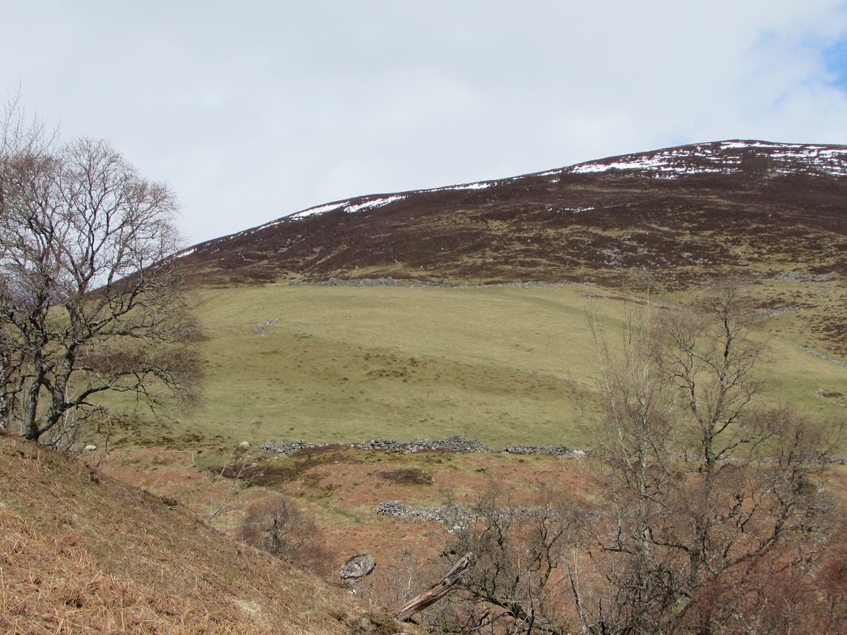
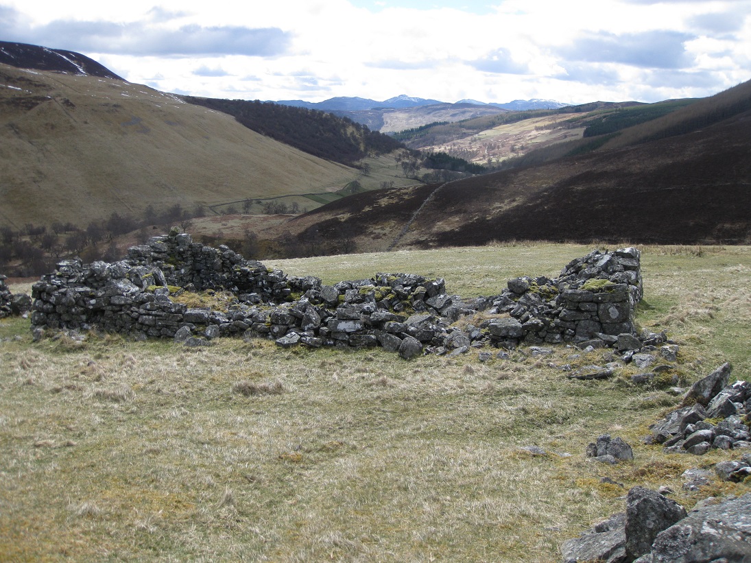
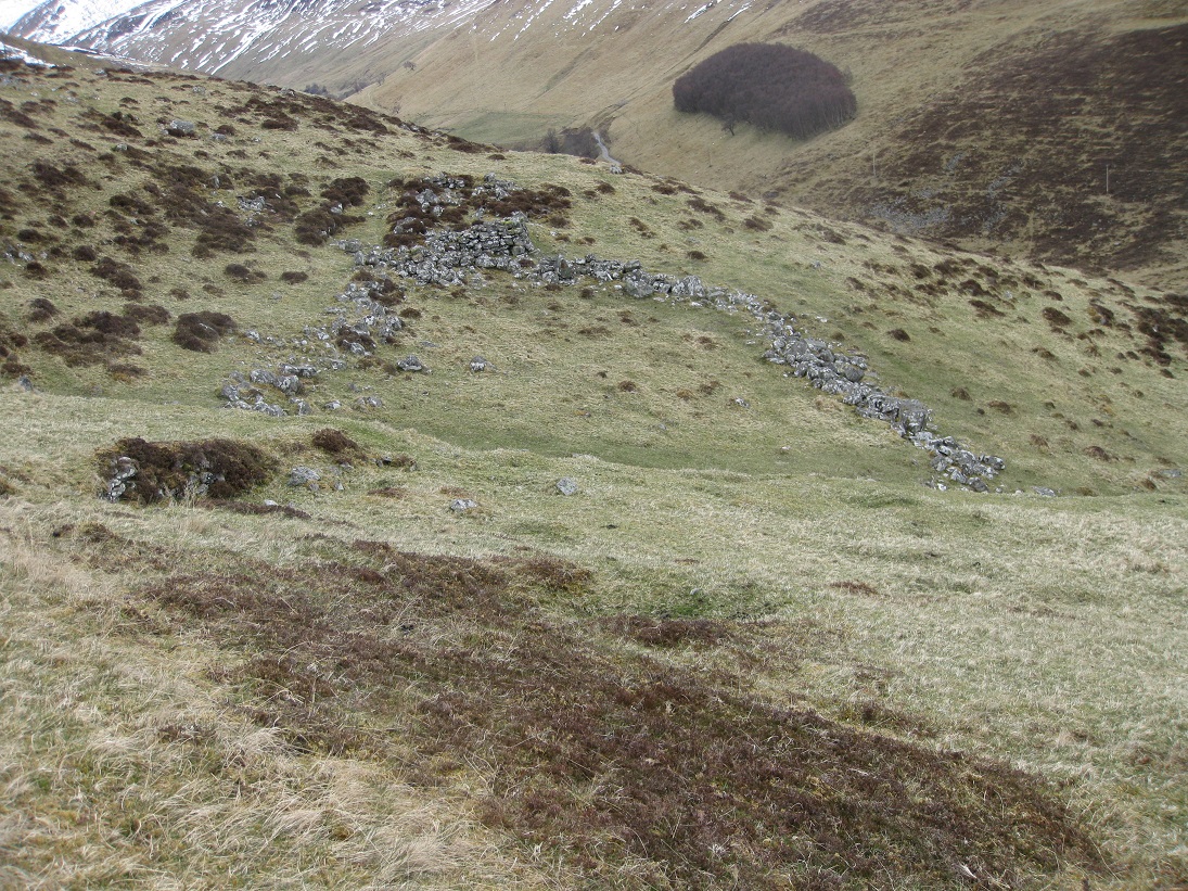
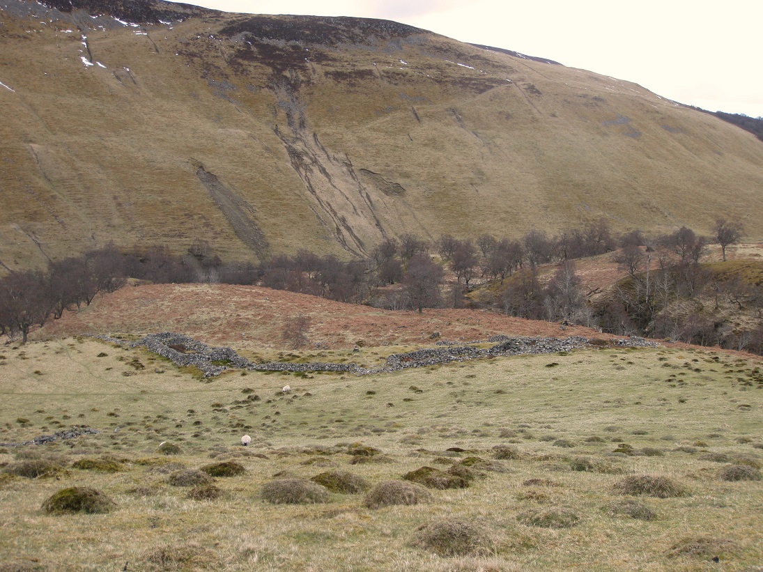
The settlement of Achmark-more occupies part of the south-facing hillside where the Allt Mhairc joins the river Tilt. In fact there are two settlements: an upper settlement between the moorland and the arable slope; and a lower, smaller, settlement below the arable land on the promontory between the converging rivers. Each settlement had its own corn-drying kiln and, for convenience, will be referred to as Upper and Lower Achmark-more.
Upper Achmark-more
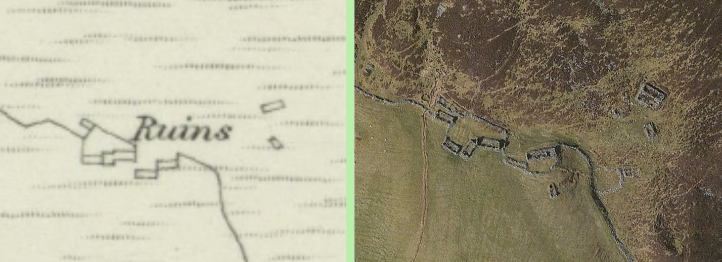
The 1st edition of the Ordnance Survey map (1867) shows a pretty poor survey of the substantial ruins which must have existed.
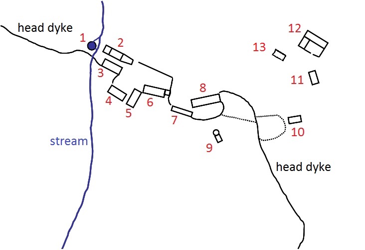
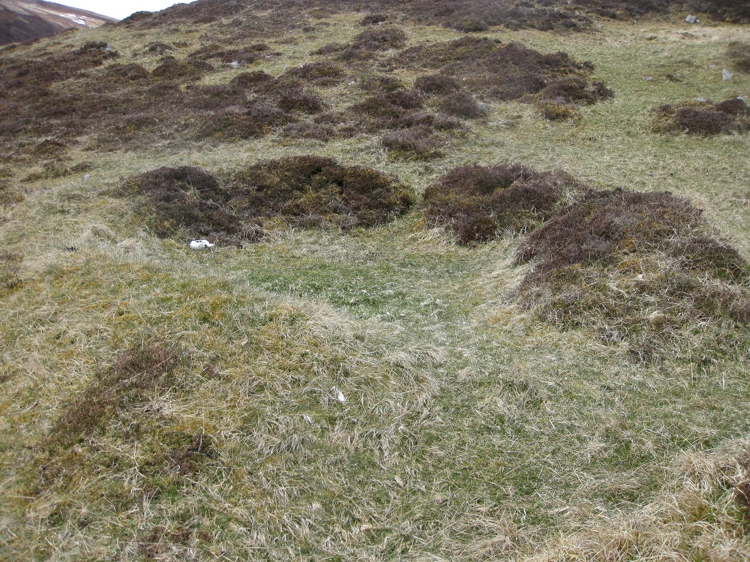
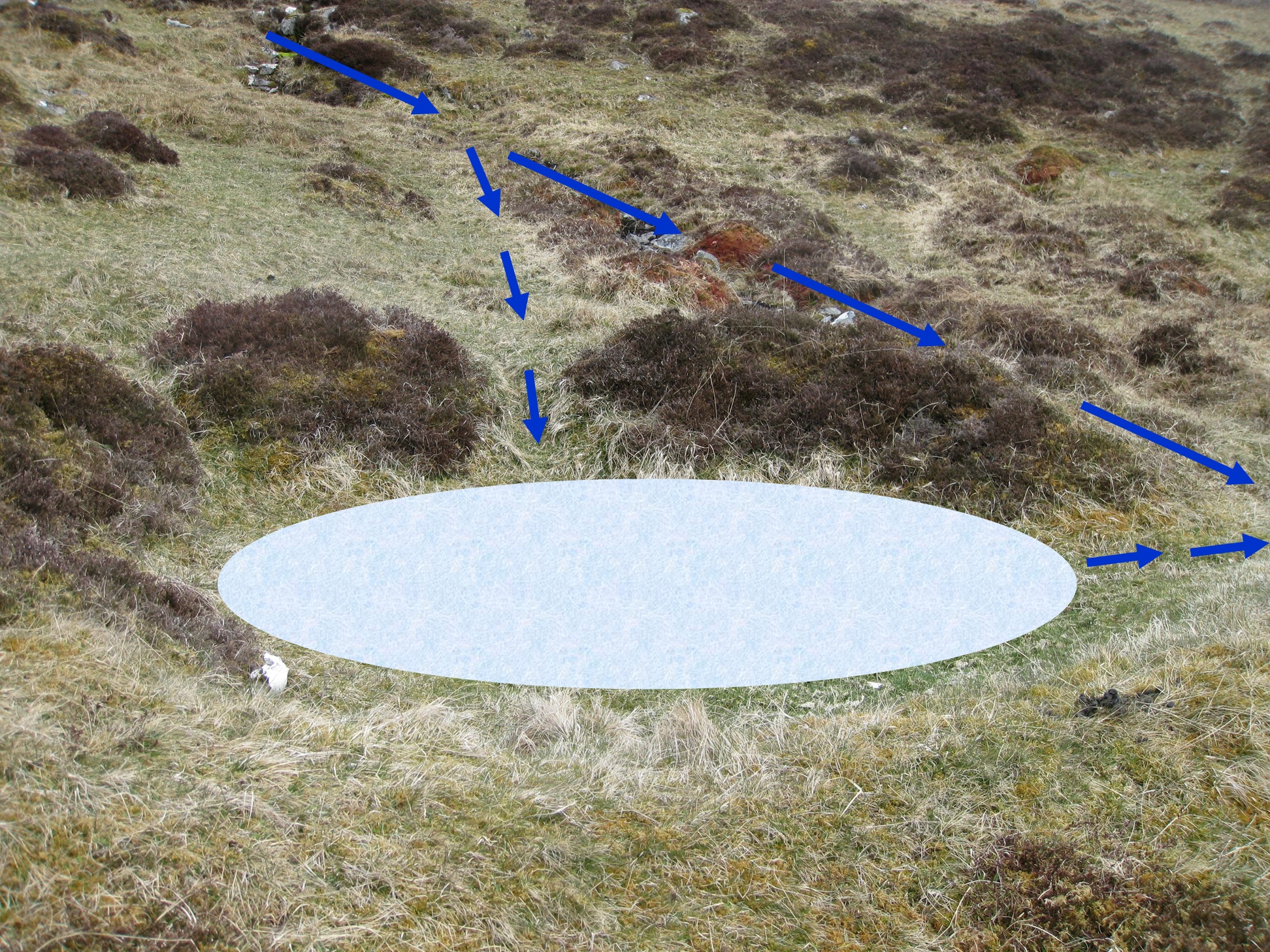
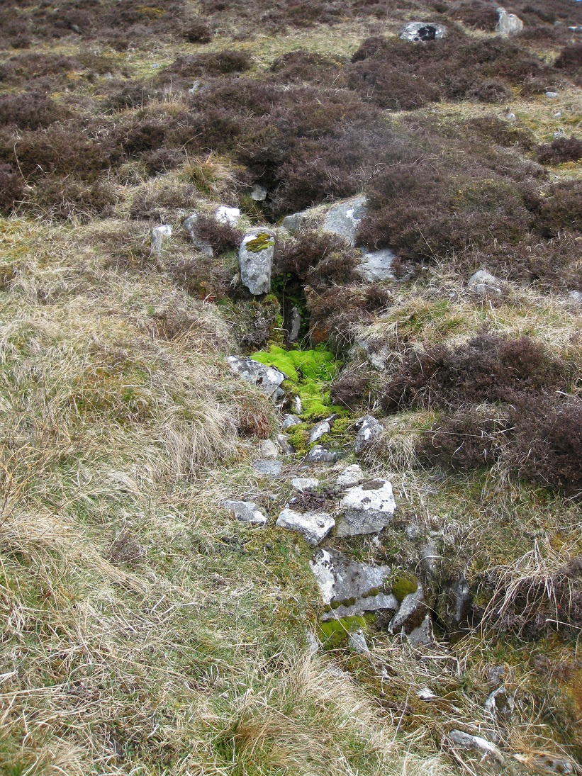
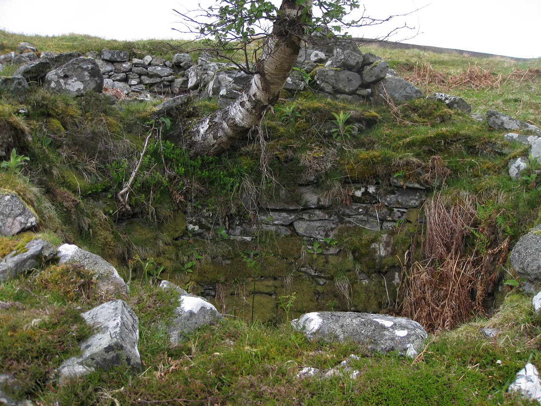
Most of the settlement is linked to the head dyke which separated the heather moorland, where animal grazed, from the arable land. A small stream flows downhill to the west of the settlement through, what appears to be, a narrow dug trench. Beside the stream, above the head dyke, there is a retting pool (1).
Flax (lint) was grown to make linen. To separate the flax fibres from the rest of the stalk it was first placed in a shallow pool of water, called a
retting pool, and left for several days until the flax bundles felt soft and slimy. Tenants were forbidden to use rivers for retting, under penalty
of a fine by their landlords, as the retting contaminated the water supply which was used for drinking. However they were allowed to construct
retting pools and, unless insufficient water circulated through the pool, the rotting stalks didn't produce obnoxious odours.
After the flax stalks had been softened they were taken to the flax mill where they were broken by being hammered. Scrutching was carried out to
remove some of the straw from the fibres. This was achieved by passing the crushed flax stalks though a set of rollers. After this the fibres would
be heckled by passing the fibres through metal combs of different sizes, firstly to remove the remaining straw and secondly to polish the fibres.
The fibres could then be spun into yarn.
It is most likely that the flax was taken to the lint mill at Kinloch of Blairuachdar. Robert Stewart built the lint mill at Kinloch in 1778.
He had a 21 year lease and, as he had built the mill at his own expense, the annual rent for the first 7 years of only 15s, after which it would be
increased. Consequently the lint mill only operated for 7 years.
The water for the settlement came from above the retting pool where there is a natural spring coming out of the hillside. Stones seem to have been arranged so that a bucket could be quickly filled from an overshoot..
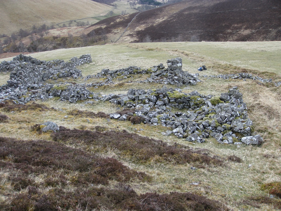
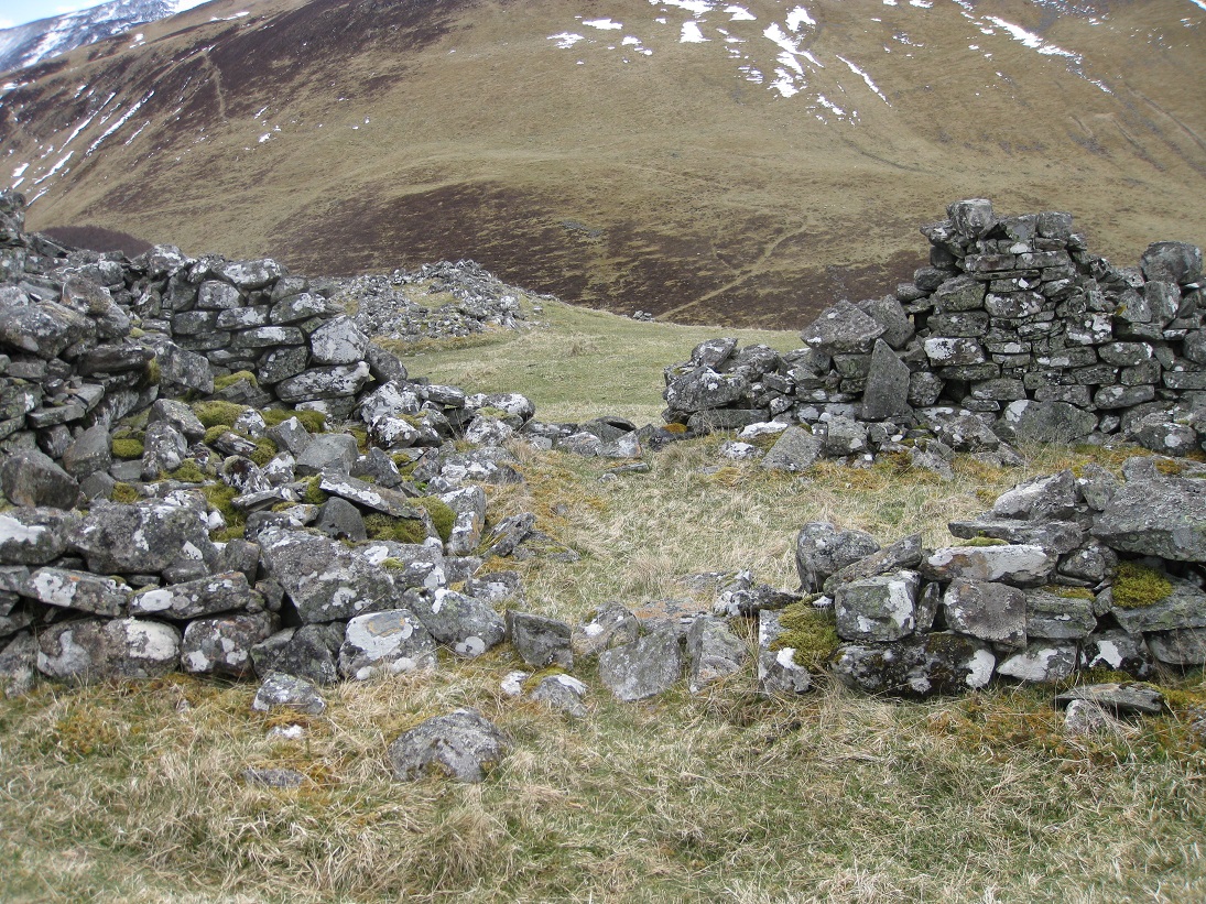
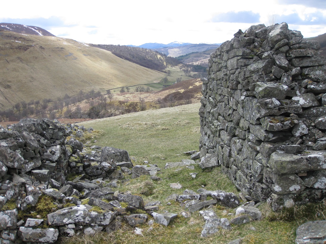
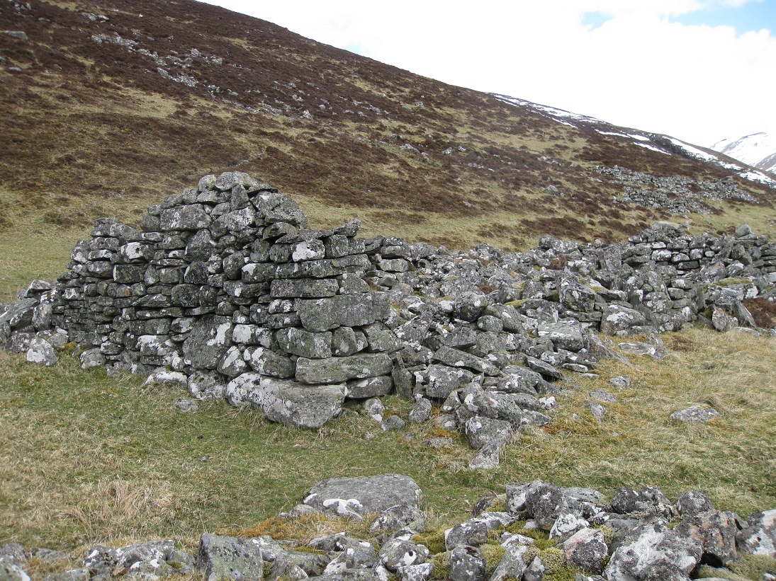
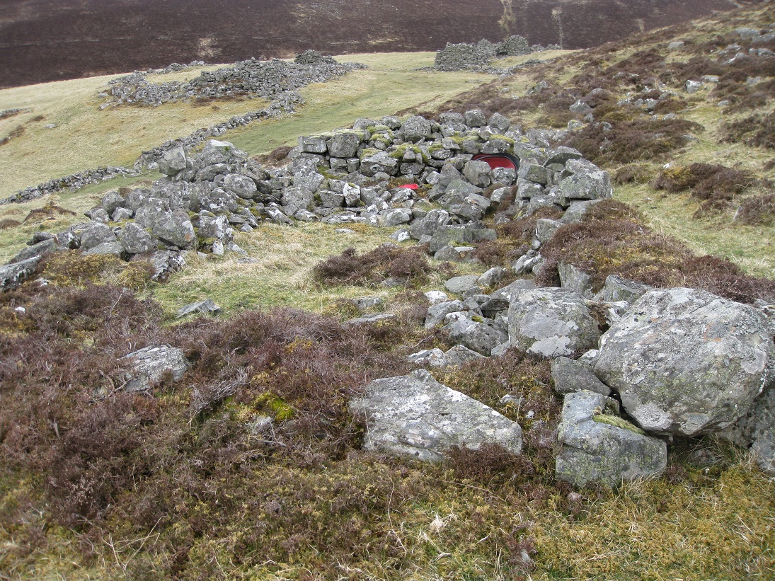
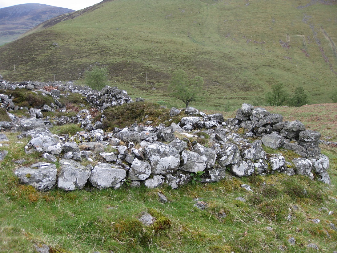
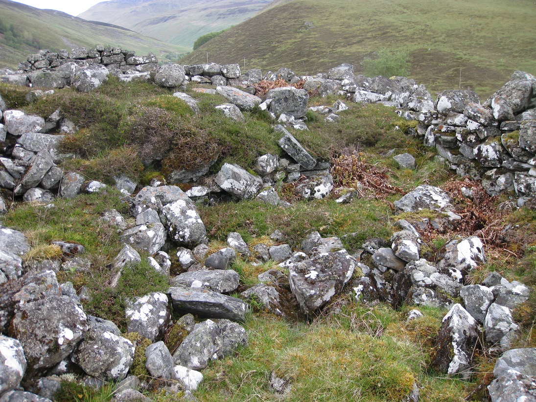
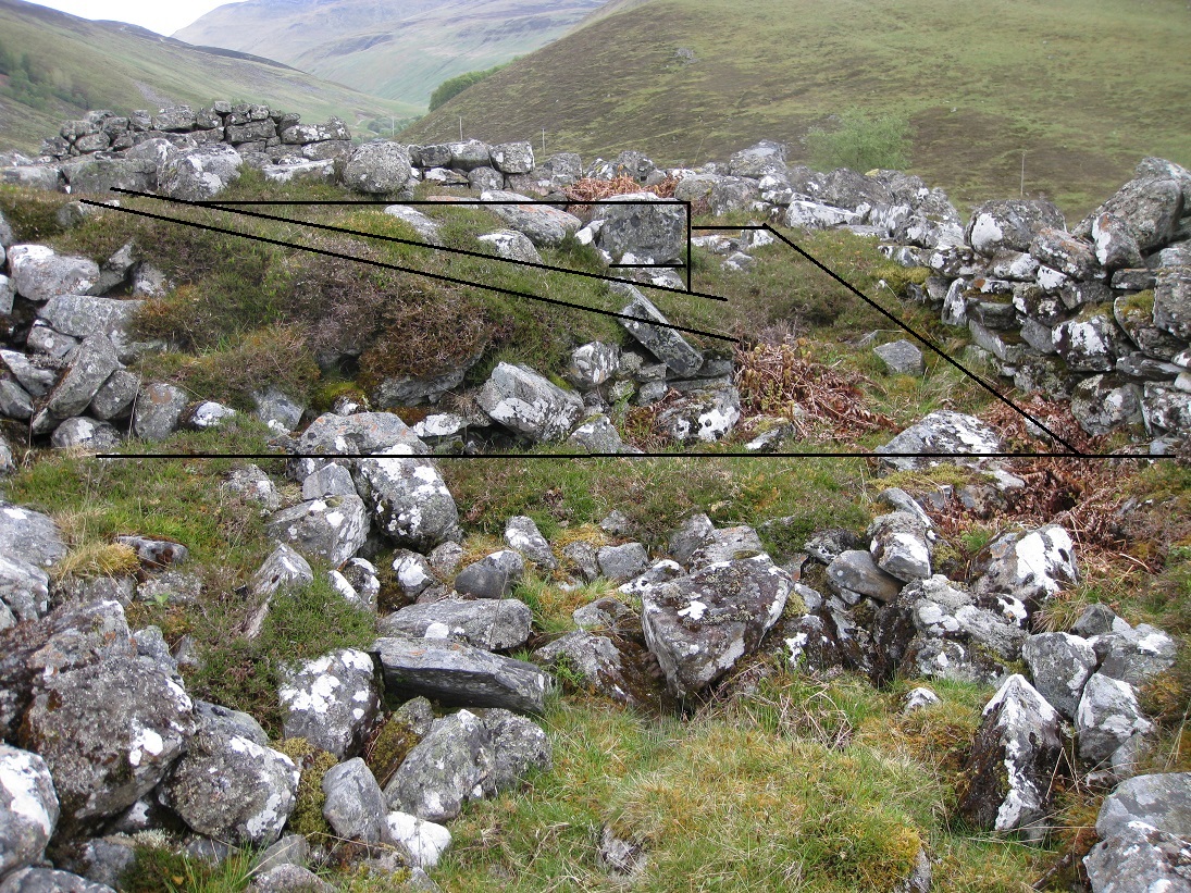
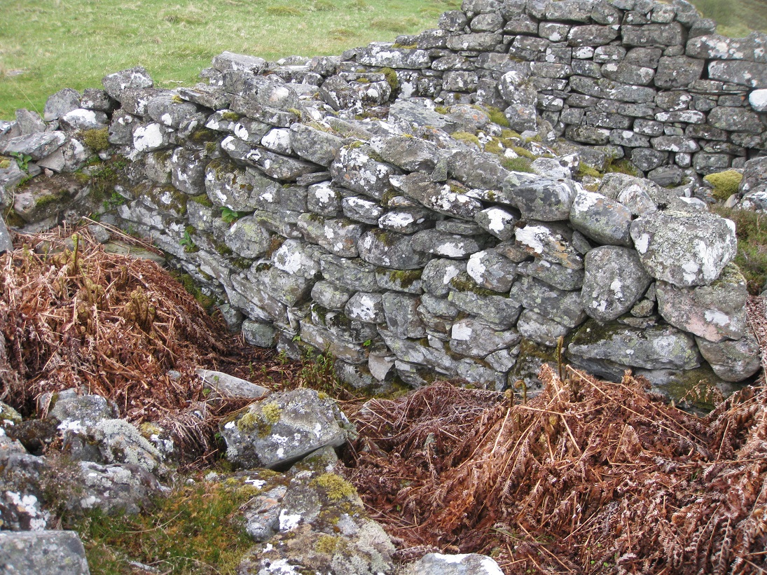
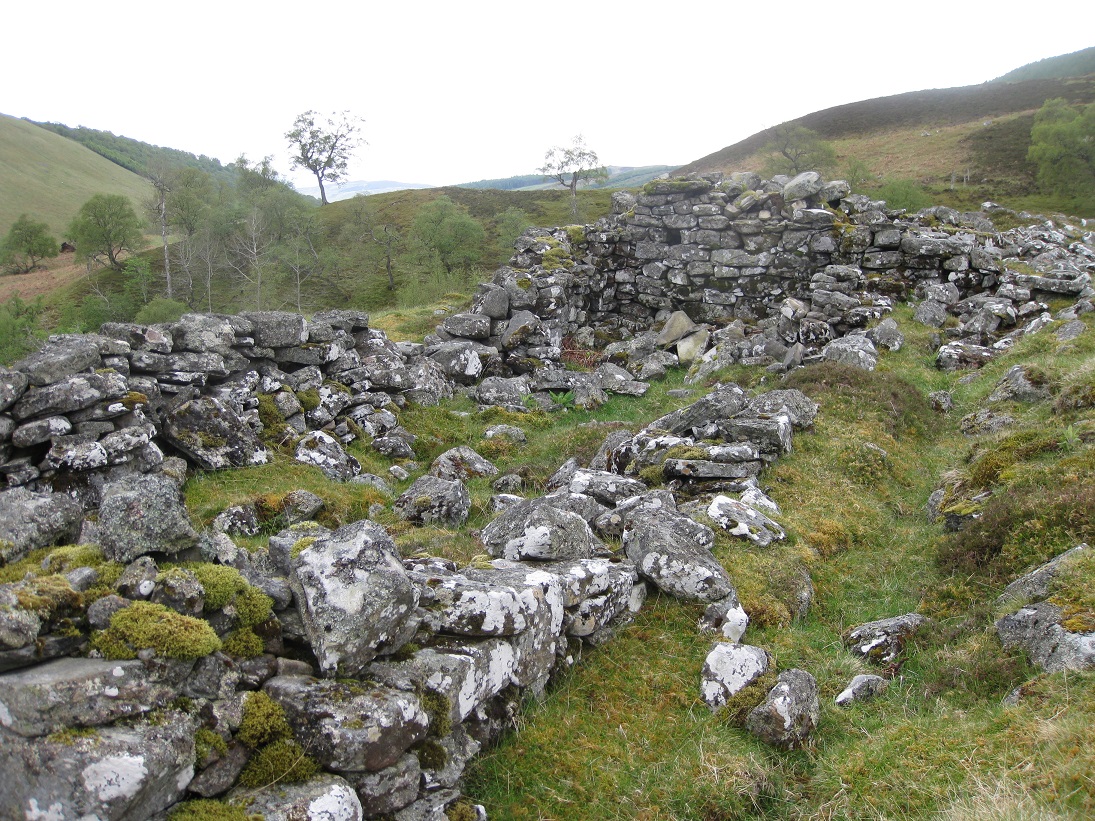
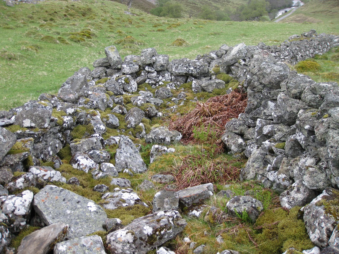
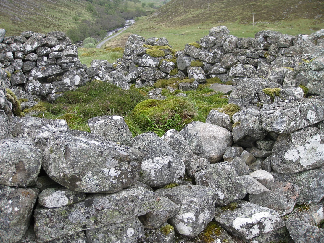
Structure 2 is orientated east-west and is built into the slope of the hill with doorways facing to the south where there is a walkway between it and the next building further down the slope. The walkway leads into an irregular shaped courtyards formed by the surrounding buildings and the head dyke.
The walls of building 2 must have been quite substantial, more than just footing, but much has collapsed. There is a stone built internal wall dividing the building into two compartments, the west compartment being half the size of the other. The far end of the structure narrows in width and, rather than being part of the building, it may have been a long enclosure.
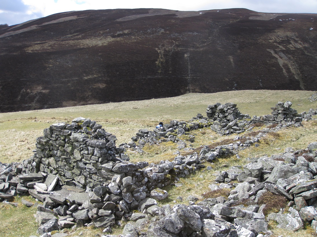
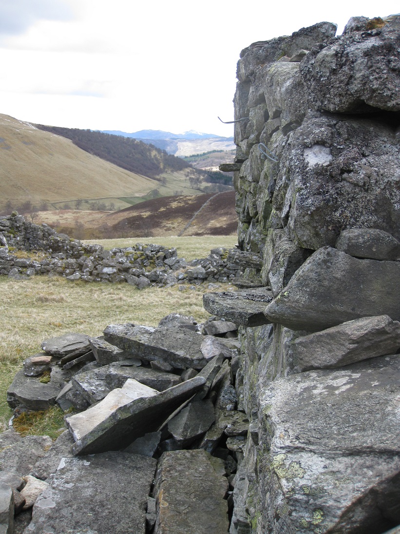
Building 3 is a house with a doorway facing southwards onto the fields. The eastern gable is still virtually intact and there are a number of stones protruding from the wall. These may have been used to secure the thatch of the roof, but may be a more recent addition. Firstly, they seem rather small for that purpose and none of the other houses have similar pegs. Secondly there are two metal wires also inserted into the gable wall, and thirdly a number of flat stones have been made into a seating area, sheltered from the wind by the gable end. A stone dyke runs from building 3 to building 4, forming the western side of the courtyard.
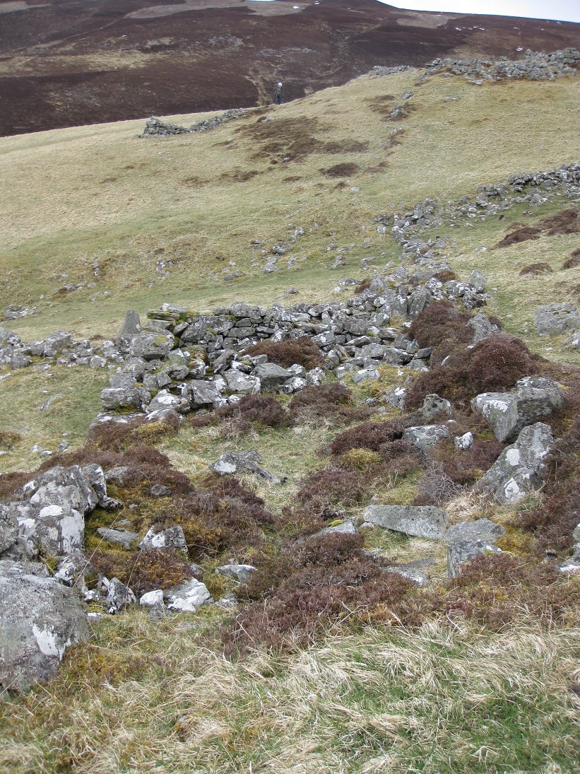
Building 4 seems to be a house as it is orientated east-west and one side of a doorway still exists on the south side. All of the houses on this
site are well built and probably date from the late 1700s. Most have high gable ends and remnants of tall side walls, which could easily have
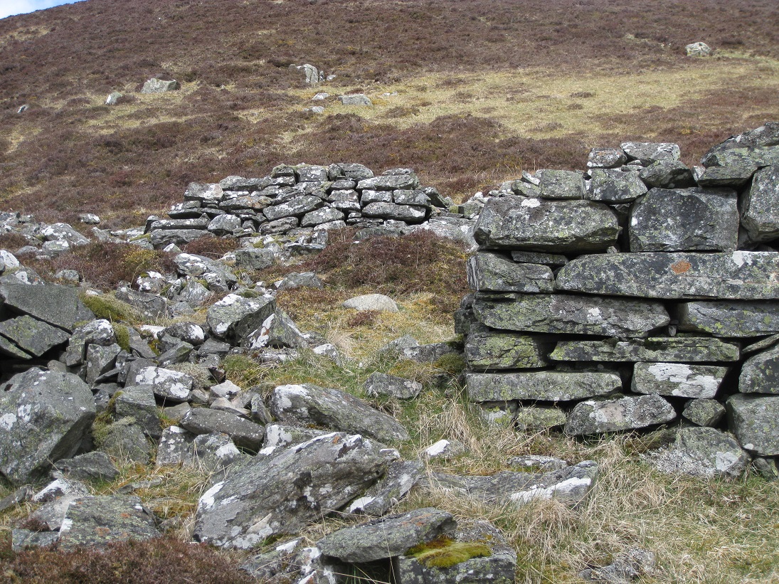
supported a thatched roof. There is no evidence of notches in the walls where a cruck frame would have been housed. Some of the walls are over a
metre thick and have been skilfully built using carefully chosen stone blocks, rather than rounded boulders from field clearance. A typical wall
consists of an inner and outer layer of large blocks, some of which bind the two side, filled with fist-sized stones. Originally this packing may
have been a lime-free mortar of stones, river slit and mud, but now only the stones remain.
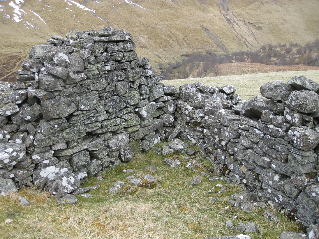
Constructing just a single building must have been a major operation. Many of the rocks must have been quarried from nearby outcrops and brought to
the site in carts. Several strong people would have been needed to lift the heavy rocks into place and pin them into position using smaller pieces.
The largest stones have been used mostly to construct inter-locking corners, but there are some very large rocks in the gable ends. Some are
positioned at such a height that scaffolding must have been used by the builders.
None of the houses have a chimney built into the gables, so either they had a central hearth, or a hanging lum at one end. Neither is there any
remaining evidence of windows, although it is almost certain that they would have existed, as slits or as square or triangular holes.
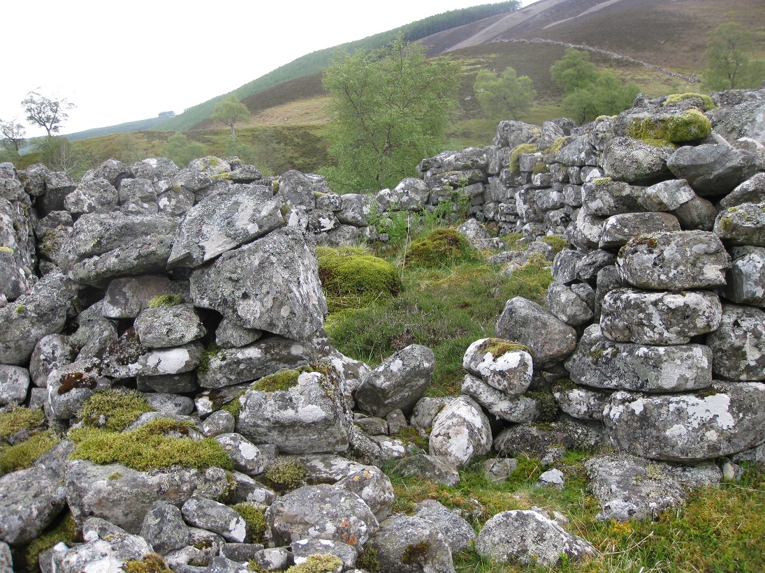
There is a small passageway between building 4 and building 5 which connect the courtyard to the open fields. Building 5 is orientated north-south and there is evidence for a doorway on the eastern side with, possibly, another doorway opposite on the western side. If this is correct, then the presence of these two doors opposite each other, to produce a through draught, suggests that this was a winnowing barn. The winnower stood between the two open doors throwing the seed which was being cleaned into the air. The breeze blew the light chaff away, while the heavier seed fell back into the winnowers pan.
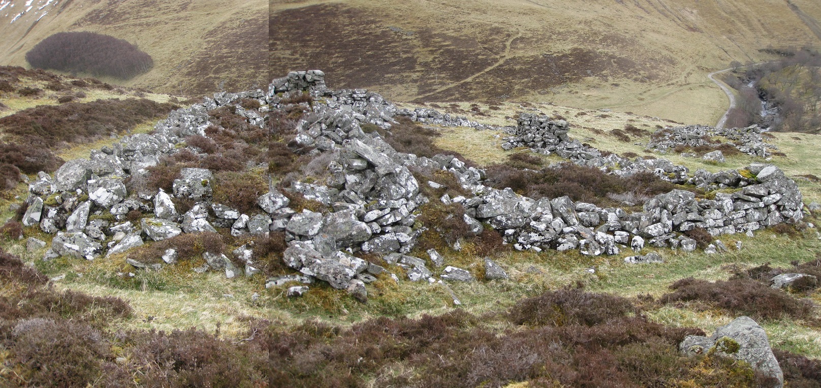
The gable end of the winnowing barn touches the gable end of building 6, which was probably the main house (the sit house), used by the most important tenant. The house has a central position on the site, and is larger and better built than any of the others. There is a line of flat stones in the ground, leading eastwards from this building, which may have been used for drying stacked sheaves of barley and oats, prior to threshing.
This houses has the thickest walls, and an aumbry (recessed wall cupboard) has been built into the west gable. Although one of the supporting blocks
has been dislodged, resulting in slippage, the smooth nature of the remaining three sides and back show that the recess is intentional. Although
similar wall recesses can be found in old churches and castles, this is highly unusual in a croft house and raises a number of questions. Was the
recess lined with wood to protect whatever was kept inside? Was the recess open to view, or did it have a door? What was kept in the recess?
None of these questions can be answered with any certainty, but some possibilities can be eliminated. The recess is too small to have been a hiding
place for illicit whisky or proscribed weapons, and in any case these would not have been hidden inside the main house. As the recess is within the
security of the house, the content must have been valued by the owner and, if so, then the recess may well have been wood-lined with a lockable,
hinged door. Possible contents could have been a family bible or money, either as silver coins or as promissory notes, or maybe documents such as
a wadsett or a tenancy agreement. Whatever it was, the 'hole in the wall' was as safe as possible, for those days.
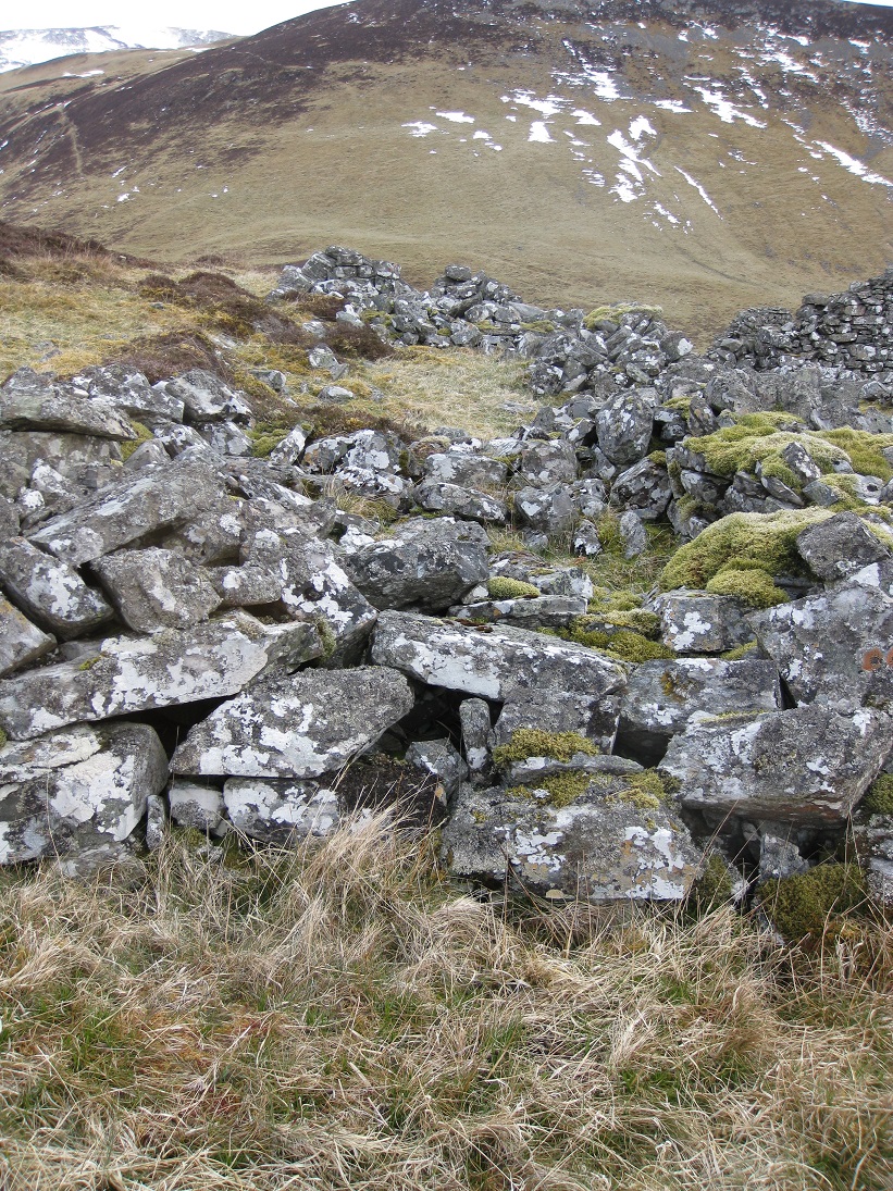
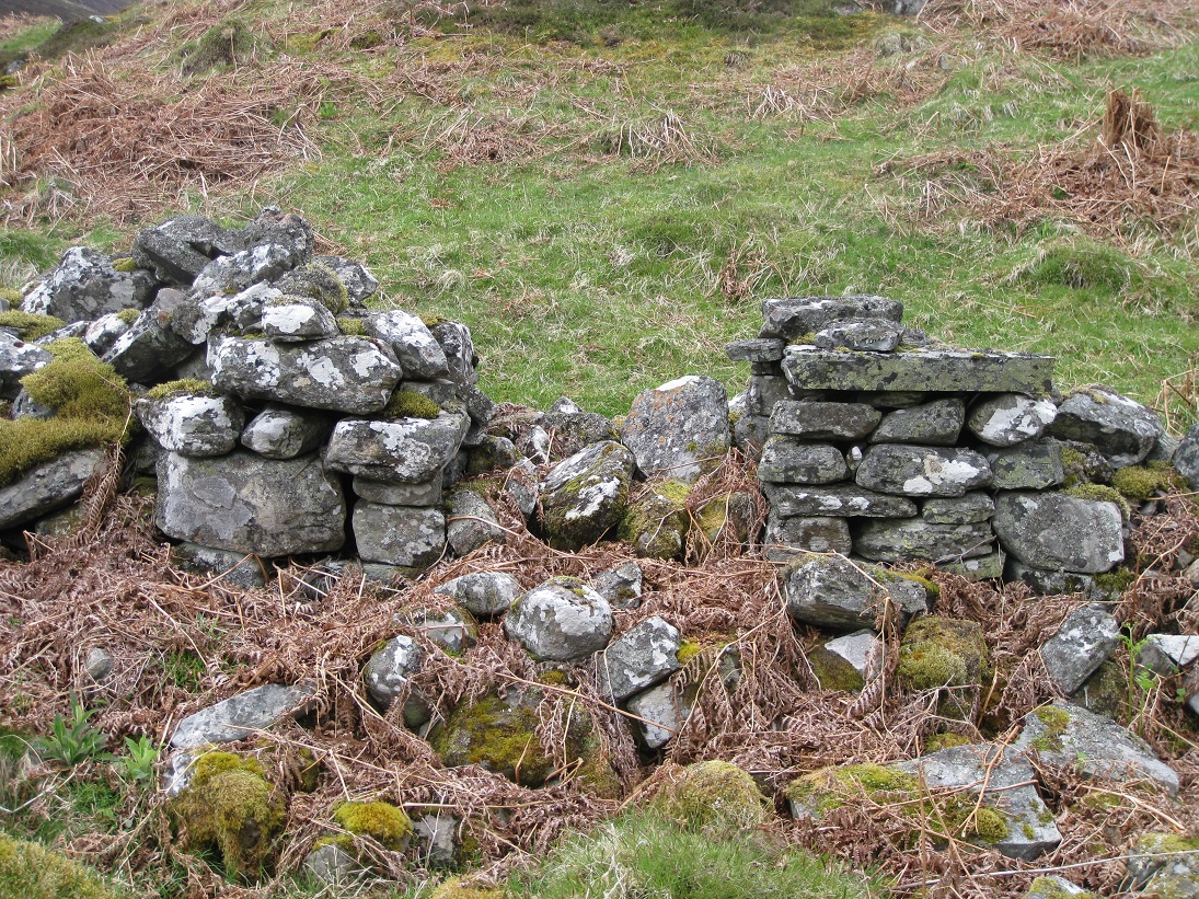
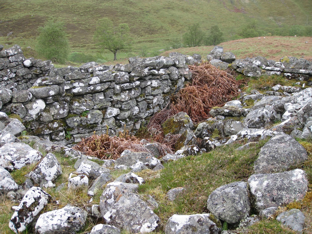
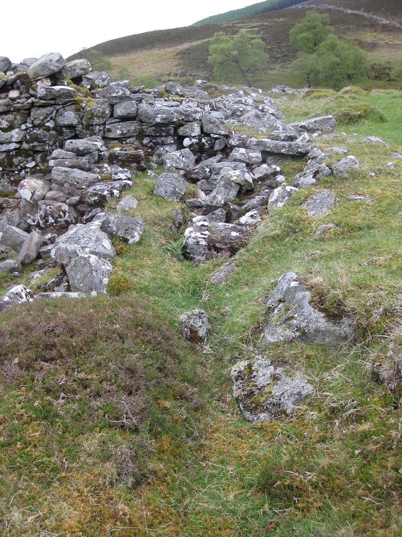
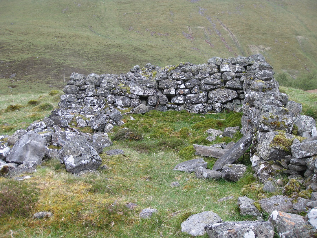
At the eastern end of building 6 there is an outhouse. As the outhouse is only half the width of the house, and the walls are not continuous, it must be assumed that the outhouse was built at a later date. The door to the outhouse should have been south-facing and as there is a slope the doorway may have had a step in front.
The outhouse has three small recesses built into the eastern gable end and, like the recess cupboard inside the house, are highly unusual. They are reminiscent of structures found in the summer sheilings, and possibly served the same purpose - a cold store for butter and cheese.
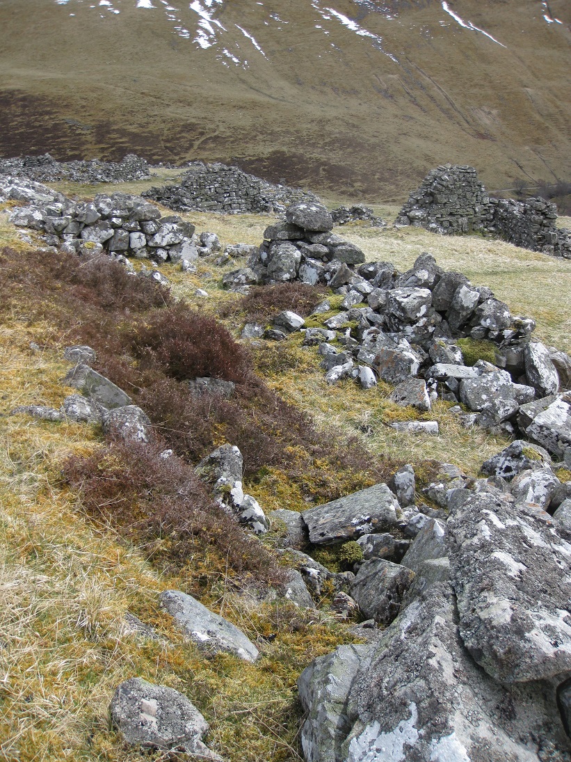
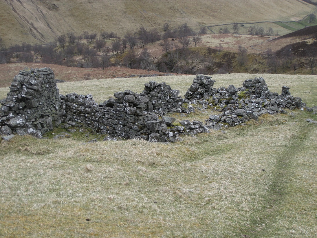
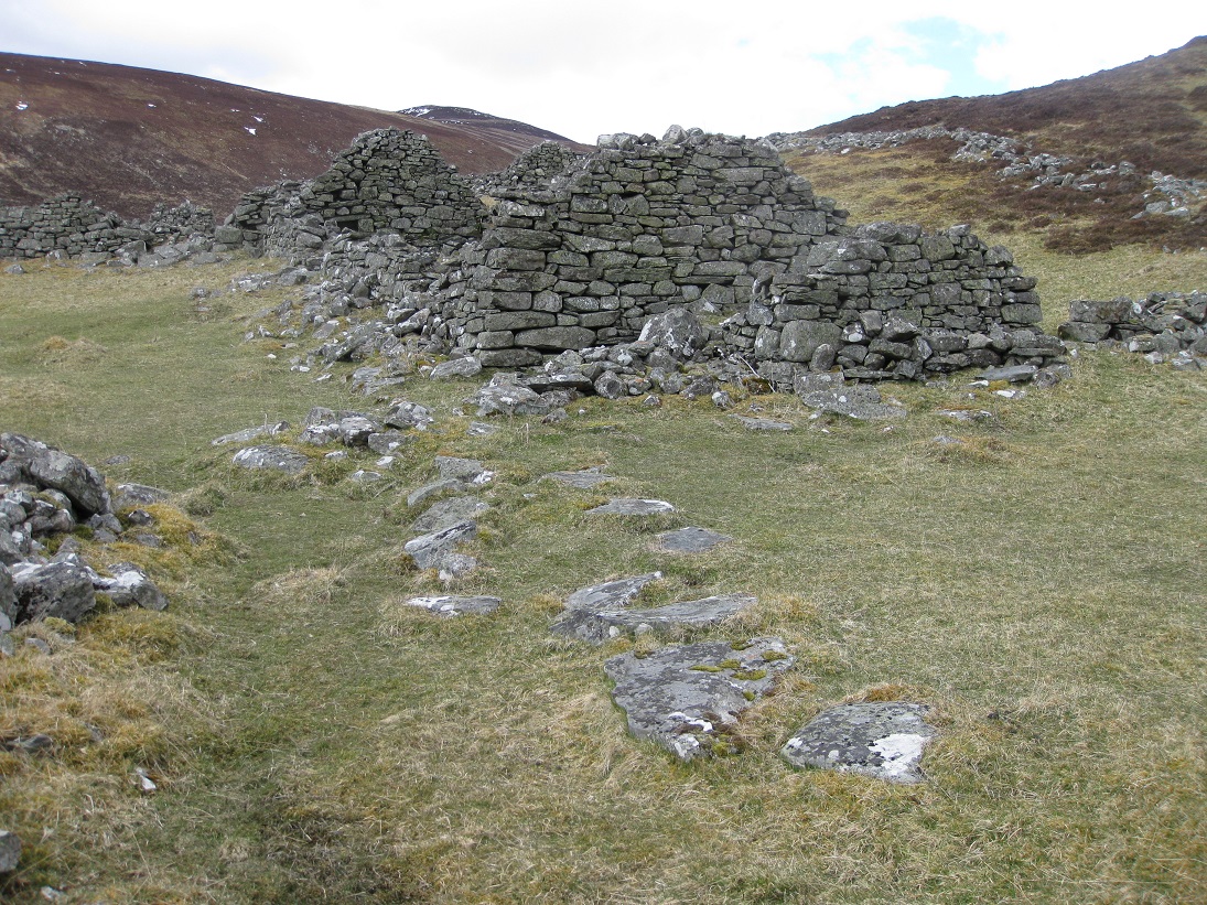
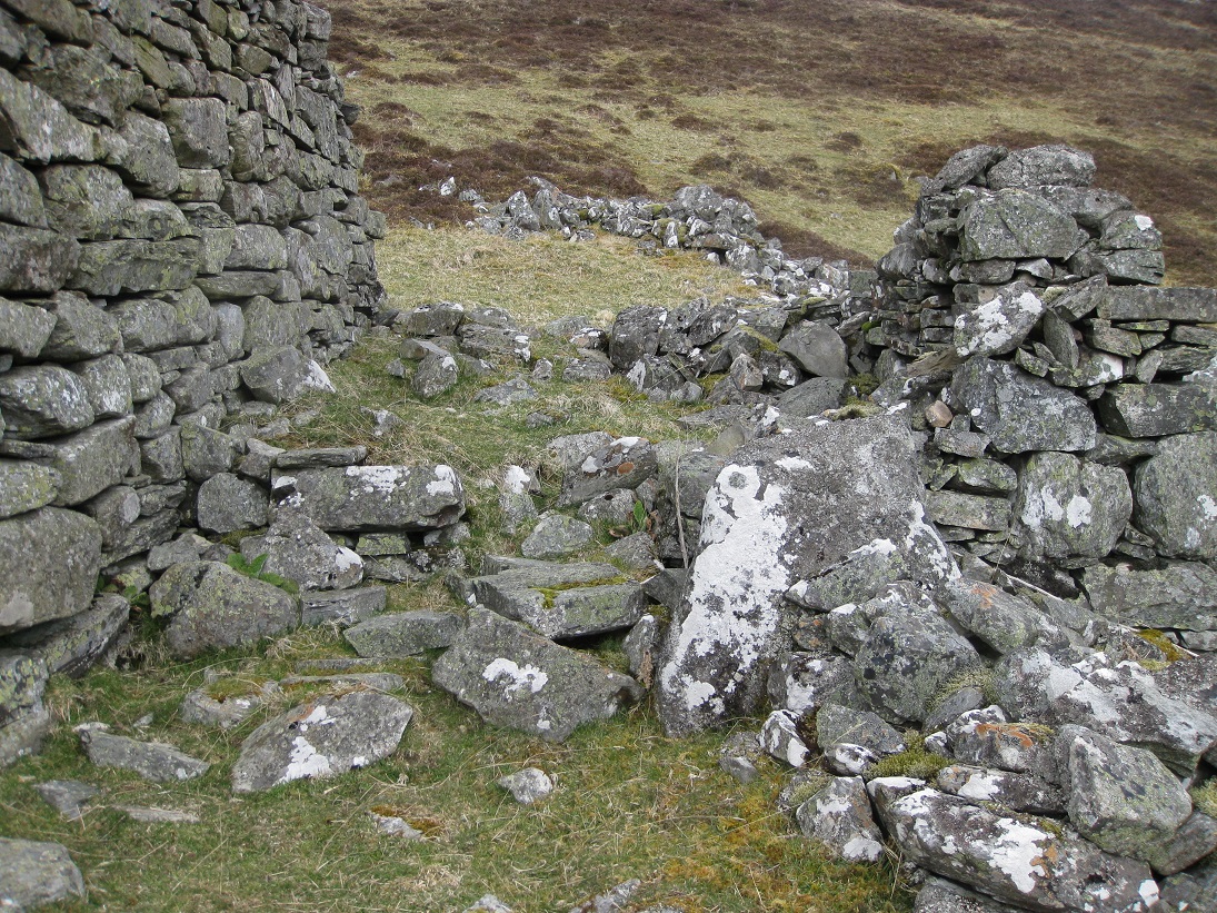
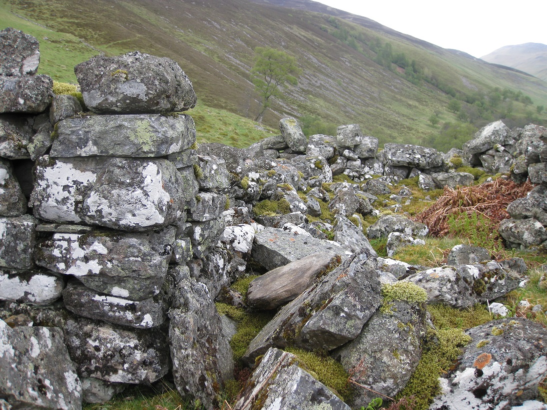
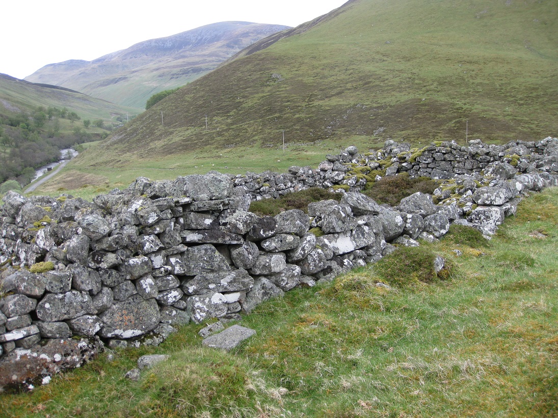
Structure 7 is built on the last strip of level ground to the south of the settlement before it slopes steeply down towards the river. The structure is about the length of a house, but the width tapers and this is probably an enclosure for livestock.
This appears to be another house with a workshop or store joined to it, however the building is in a poor state compared to the others. A stone dyke runs along the rim of the flat ground in front of the house, just as it starts to fall away, forming a curved enclosure or kail-yard which has been cleared of stones. In addition there is another enclosure to the east of the house, formed by the head dyke curving round and meeting another dyke running eastwards from the other enclosure.
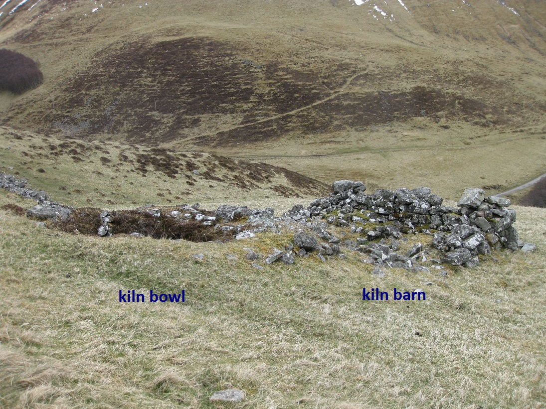
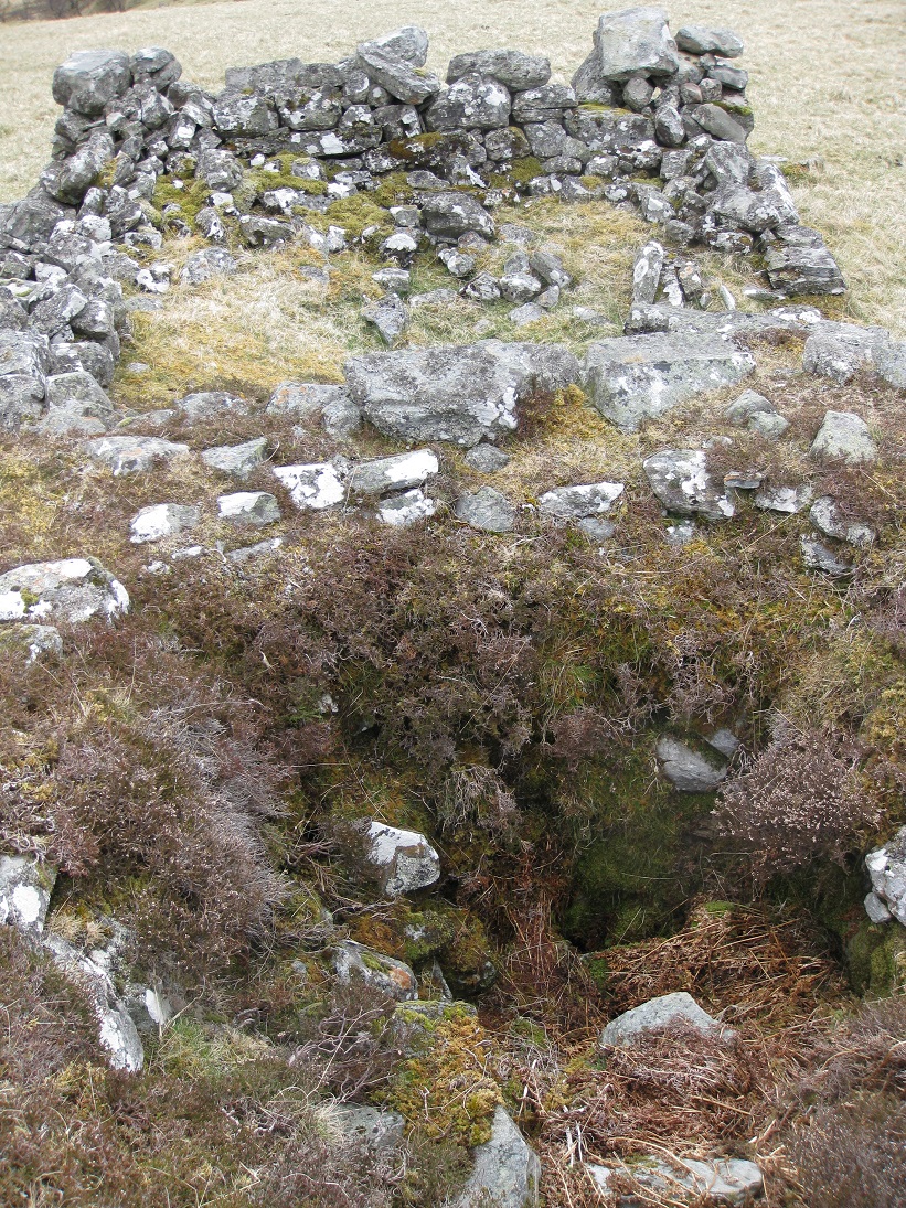
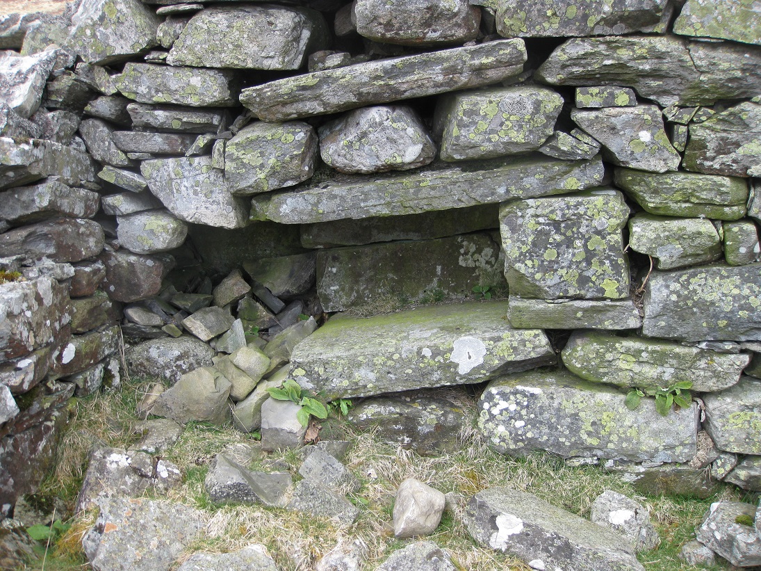
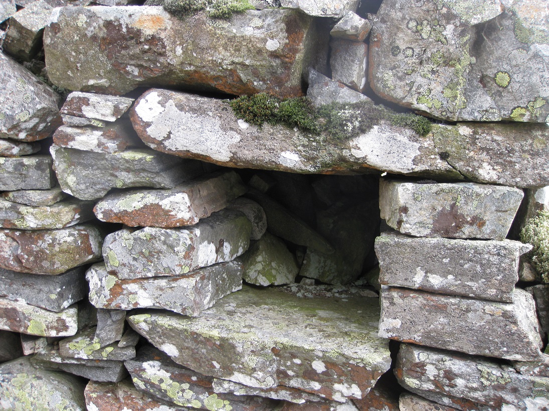
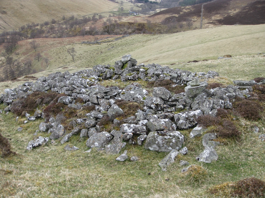
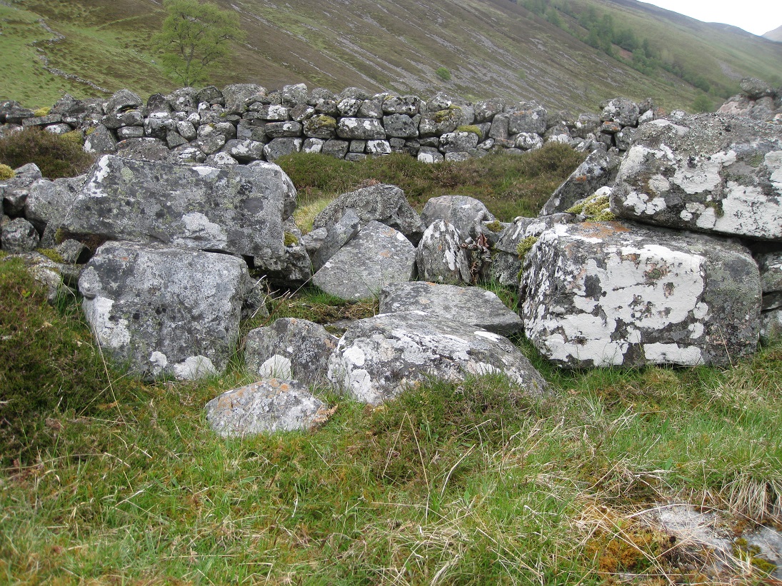
Below the enclosure, in front of house 8, there is a corn-drying kiln built into the slope of the hill. The kiln bowl is quite deep and in good condition, although there is a fair amount of vegetation growing in the sides of the bowl.
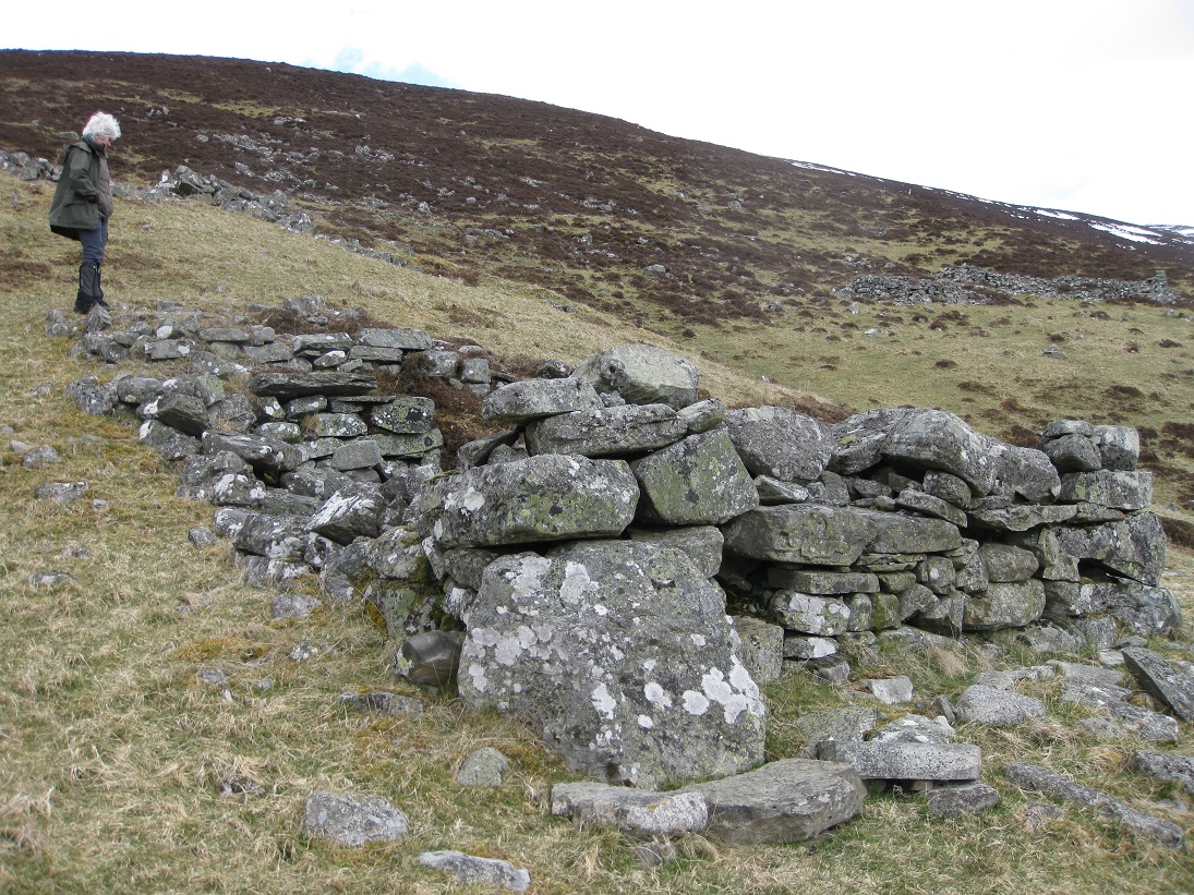
There is a substantial kiln barn built around the fire box. Most ruins of kiln barns in this area consist of little more that a short stone footing upon which the timber framed barn was perched. In this case, large stones have been used to construct a tall lower gable wall. Some of the rocks from the west wall have collapsed onto the barn floor, obscuring the firebox and entrance to the flue.
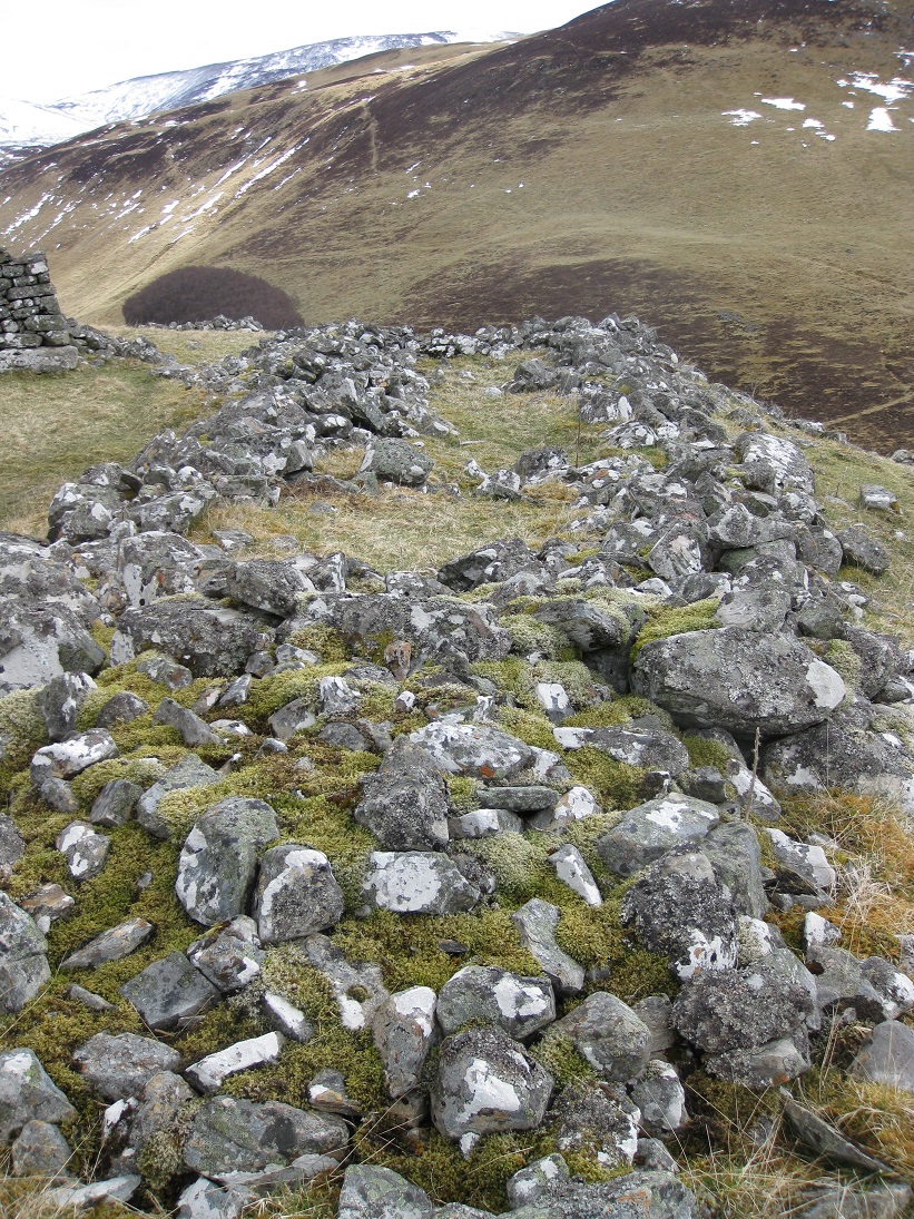
Normally settlements have few buildings beyond the head dyke, but at Achmark-more there are four. The head dyke follows the edge of a dry gully at the eastern end of the settlement, but just beyond there is a large circular enclosure which straddles the gully and the slope on the far side. Ajoining the enclosure are the remains of either a store or a byre built on the slope. Neither are shown on the O.S. map of 1867.
Building 11 is shown on the O.S. map of 1867, but is in a very ruinous state. It does not appear to be associated with any other structure and is in a grassy area, despite being above the head dyke. Its orientation and size suggests that it might have been a byre.
Both the O.S. map and the aerial photography of structure 12 give the impression that two house-sized buildings had been erected in parallel. This is a common feature in the Hebrides and Iceland, but unknown in this area. However, a closer inspection shows that the structure is composed of a large building on the north side with side entension on the west side, forming a 'L' shape, with a walled courtyard completing the rest of the rectangle. This part of the site needs further investigation.
The last structure above the head dyke is building 13. It is built across the slope but is in a tumble-down state and has been used as a dump.

Although nothing can be seen at ground level, aerial photography of the arable land between the two settlements shows that the whole area was cultivated using lazy beds (feannagan). These are a series of parallel ridges, about 2 to 3 metres wide, separated by narrow furrows which provided drainage and gave the farmer access to tend the crop. Traditionally, lazy beds were made using a foot-plough and a spade. At Achmark-more the lazy beds ran across the hill on the western side, and down the slope on the eastern side. Perhaps this shows the division of land between the two settlements.
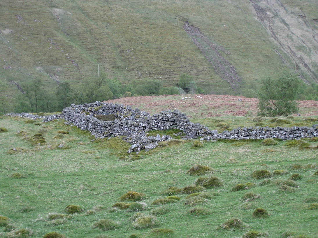
Lower Achmark-more

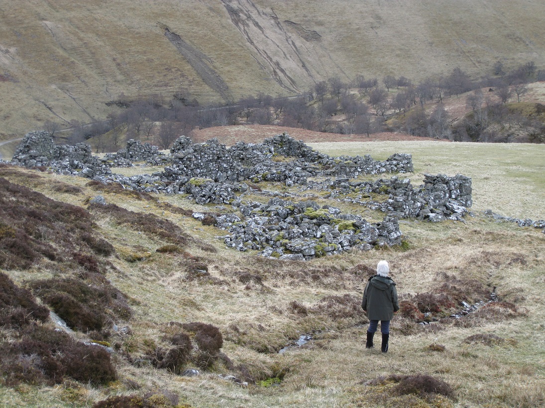
Most of the buildings at lower Achmark-more are connected by stone dykes, forming a barrier, which separates the arable land between the two settlements from the uncultivated land below the lower settlement. Normally a head dyke kept the livestock from coming down from the moorland, but in this case the livestock seem to have been kept below the settlement on the wooded peninsular between the Allt Mhairc and the River Tilt.
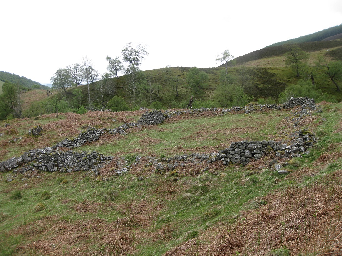
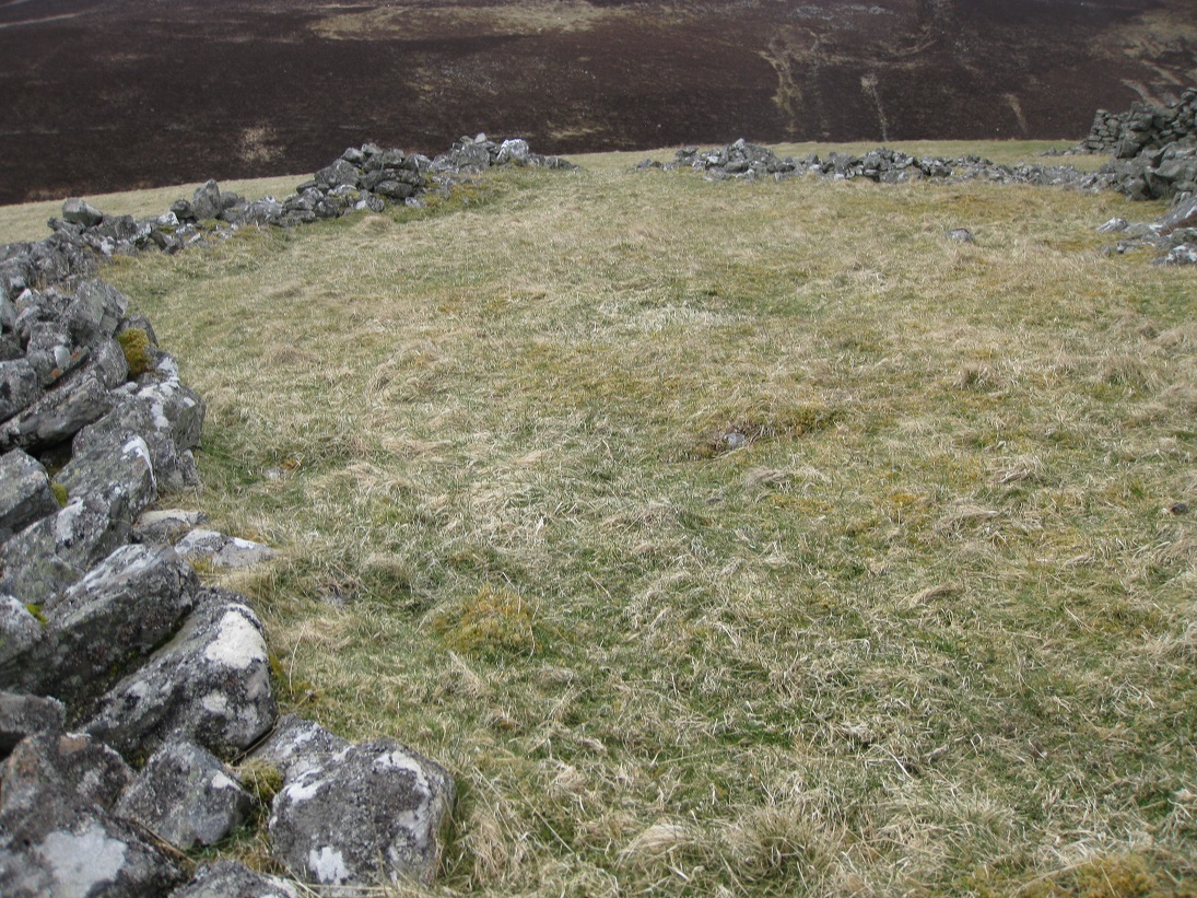
Structure 1 is a large rectangular stone-walled enclosure which has a narrow entrance on the northern side. It may have been used to house sheep during severe winter weather. As it has been cleared of large stones, it may have been a large kitchen garden. Alternatively it could have had different uses in different seasons.
Structure 2 is a substantial building, which follows the contour of the hillside, and is about 5m by 15m in size. The building has two parts:
a large section at the west end and a much small compartment at the east end. These are separated by an internal stone wall with a connecting
passageway on the south side.
The walls are of the usual drystone construction, built without the use of lime mortar. The gable ends and south wall are fairly intact, with no
trace of an entrance which indicates that this was not a house. Although the building was dug into the slope of the hill, the floor seems to be
below ground level suggesting that this might have been a byre for livestock.
The position of the entrance on the north side is not obvious as the wall on this side is in poor condition and a large number of stones have
fallen into the ruin. However, beside the internal dividing wall there appears to be the remnants of a slope, which would have allowed animals to
enter and leave the sunken byre from the higher ground on the north side.
The idea of having a slope into a sunken byre might seem strange, but the Dunkeld Commissary Testament of Alexander Stewart of Inverslanie
(7th January 1742), who farmed Achmark-more, shows that he was keeping goats which would have been well suited to the wooded peninsular down from
the lower settlement.
The small compartment, which is only about 2m by 5m, is sunken like the main section, but its purpose is unclear. Perhaps is was used to store
straw (harvesting hay was unknown), or perhaps it housed young animals.
A small curved wall on the south side connects the sunken byre to the next building. If this wall had been built on the north side it would have
taken less effort, as it would not have needed to be so high. So, perhaps, the wall was more than a head dyke barrier. It is possible that this
wall and the two gable ends contained the midden for the byre, which would be spread on the fields just above it.
Structure 3 is roughly the same size as the sunken byre but has a narrower, 7 metre, extension at the north-east end. The presence of this extension, and the absence of a well-defined entrance on the sunnier south side, suggests that this may have been a store or workshop. However, there is a gully running along the north side of the building, which would have necessitated some sort of wooden bridge. The gully appears to have stonework on both sides, and the gable wall extends beyond the building and goes across the top of the gully. This raises a number of possibilities. The gable wall is wider than expected as it was needed to house a very large midden. Alternatively, the building was wider than the normal 5m with the gully and inner gully wall being inside the building. A gully within a building might indicate its use as an animal byre, but one would expect a drainage ditch for excrement to be on the lower side, not the upper side.
The entrance to the narrow entension is marked by a buttress of very large, flat rocks on the northern side. The does not appear to be an additional doorway to the outside. The wall on the north side entends beyond the end of the building, acting as a head dyke. After a distance of 4 metres it abruptly turns in a south-easterly direction for 5 metres and stops. However at a later date a wall was constructed from this point to the next building, but the stones of the two walls do not interlock.
Structure 4 is at the north-west end of the dwelling range and appears to have been an open-ended byre or perhaps a store for peat.
Structure 5 is at the centre of the dwelling range and, as there is an obvious doorway facing southwards, this was a dwelling house. The walls and gable ends are fairly intact, but there is no sign of a fireplace. The tenants were cleared from Achmark-more in 1789 and the house probably was in use right up until this date.
Structure 6 is a separate compartment at the south-east end of the dwelling range. As its doorway is facing north, this would appear to be a small store, possibly for tools as it is right beside a small enclosure.
The ground beyond the south-east end of the dwelling range forms a small peninsular or ridge, and this was enclosed with a surrounding wall.
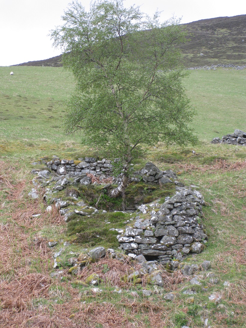

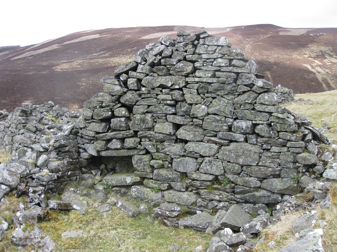
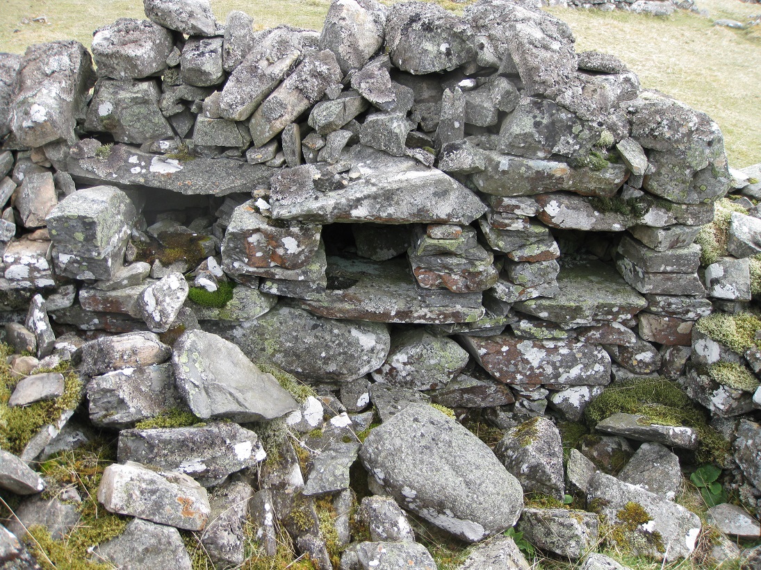
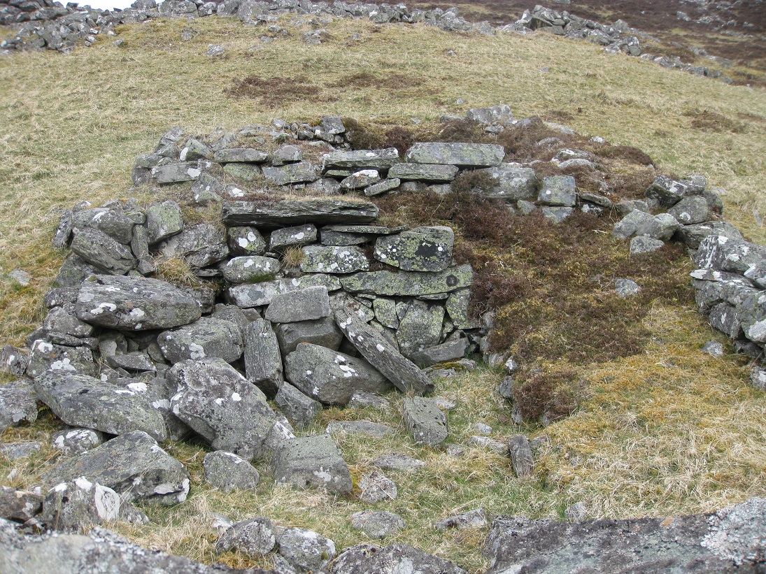
On the slope in front of the dwelling range there is a fine example of a corn-drying kiln. It is unusual to have two corn-drying kilns for a
single homestead, and it does not appear that one was a replacement for the other. One explanation might be related to the families linked to
Achmark-more.
In the early 1700s Alexander Stewart held the wadsett for Inverslanie, but farmed Achmark-more with his brother Malcolm. Both
men were involved in the Earl of Marr's 1715 Jacobite rebellion during which Malcolm Stewart was taken prisoner after the surrender of Preston,
while Alexander Stewart was captured at the battle of Sheriffmuir. Alexander was pardoned and he returned to Achmark-more, but his brother was
sent to Virginia as an indentured servant and probably didn't return. As a result, Malcolm's part of Achmark-more may have been lease to a
tenant by Alexander Stewart of Inverslanie, who decided that his family were not going to share his corn-drying facilities with any tenant.

There are a lot of fallen stones in front of the kiln which suggests that, like the other kiln, there had been a stone built kiln barn in front. The fire box and flue are quite still in good condition and, although the bottom of the kiln bowl is filled with an accumulation of earth and weeds, the bowl itself is in excellent condition except where a silver birch is growing out from the side.
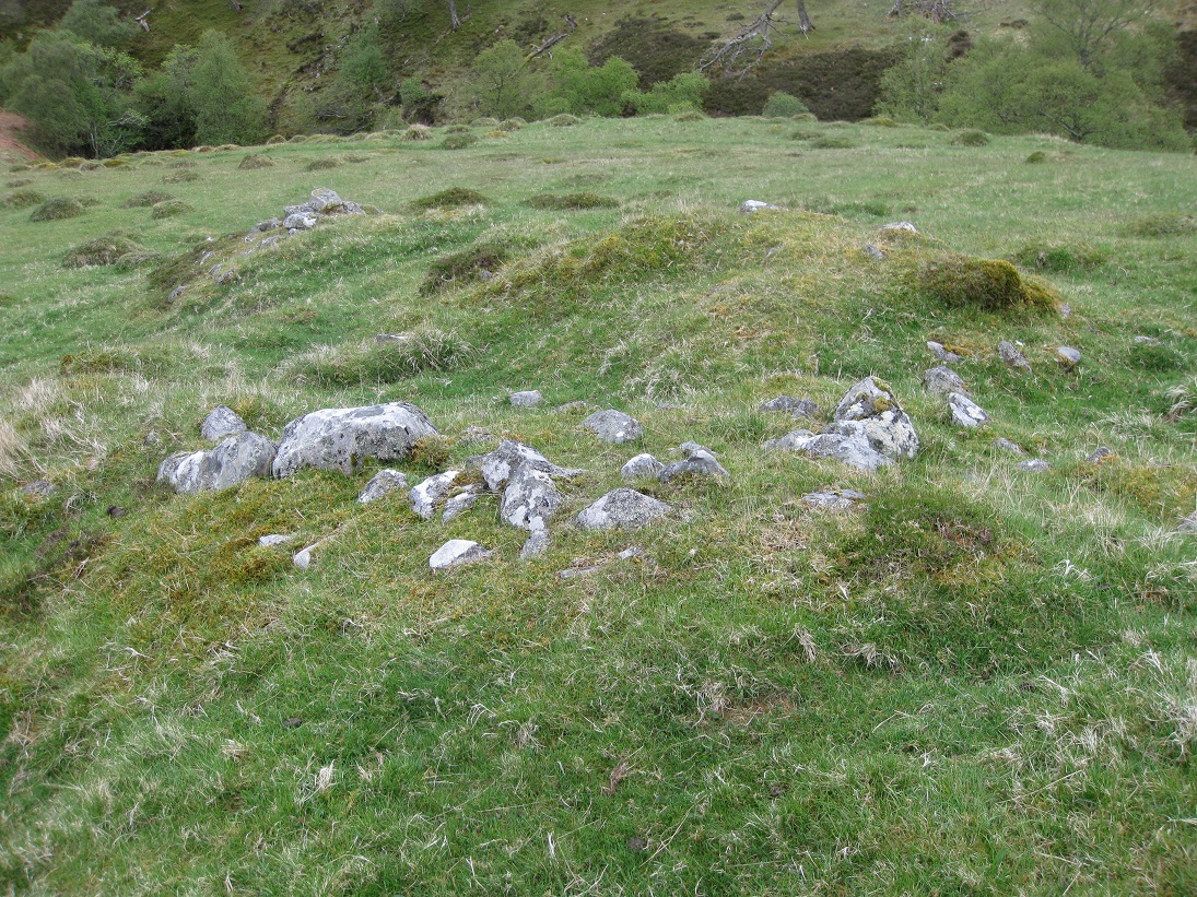
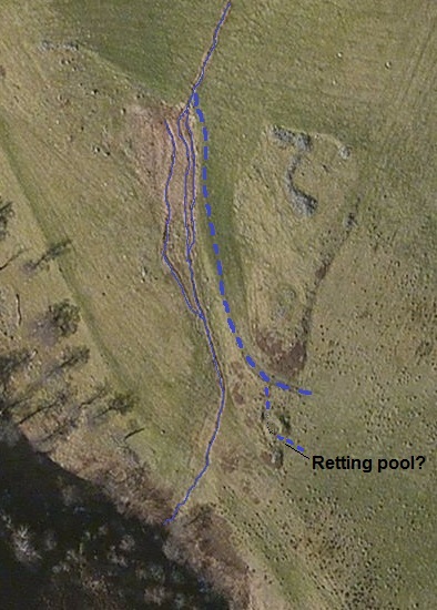
To the north-west of the lower settlement aerial photography shows a circular structure which may have been a retting pool. At the present time the water from the upper retting pool runs through the remains of the lazy beds in a dug channel and goes over an embankment before entering the Allt Mhairc. However there is a wide green channel below the lazy beds which ends in a small fan or delta. If this was the original water-course, then water could easily have been diverted into the pool.
| Blair Atholl Marriages | Return to Home Page |
|---|